Quiet ways from Morville

It’s a dry and mild afternoon, with the chance of some sunshine. The field paths continue to be worth avoiding, but there are quiet tracks and lanes north of Morville. The drive to Aldenham Park looks private, but it forms a public footpath, which leads to the unsurfaced track to the pools at Hurst Farm. From here onwards, we’re on a hard surface. We return to Morville along roads which, like so many others in these parts, are very quiet.

Fferm wynt

That’s “wind farm” in Welsh – we’re at Llandinam farm, not far south of Newtown. The well-made shale roads around the site, which is almost entirely on access land, provide an excellent surface for walking in these wet times. It wasn’t wet this afternoon though – it was fine and sunny, with enough wind for the turbines but just a gentle breeze at ground level. Whatever their pros and cons, a wander around this large site is enjoyable – the views are extensive, and the turbines make interesting graphic shapes against the sky. And there’s undoubtedly something graceful about their synchronised twirling.

On the road again

At times, it feels as though the storms have been continuous – but there have been some fine days between the deluges. This afternoon’s weather was too good for staying indoors, but if the ground’s not actually under water, it’s still too wet underfoot. So – another walk around quiet lanes, out past the farm at Harnage Grange, crossing Bullhill Brook beside the ford, then up the hill to Kenley and along the ridge. The ford was almost an impasse – the footbridge was fine, but below it, the stream was straying across the road. Not a problem – no depth – feet stayed dry. There used to be some extensive views to the west from the lane along the ridge north of Kenley – sadly, they are now only really visible from the other side of the high hedge that has been planted here. Does it need to be 8′ high?

My Sunday road walk earlier in the month was quiet – how would a weekday compare? I think we passed ten moving vehicles along the five miles, no dog walkers, no joggers, no cyclists, one Chinook…

Deeper and higher

The waters of the Severn are even higher than they were last Friday. Where the course of the river was clearly delineated by its flow, in the fields near Leighton, there now appears to be one big lake. It’s too deep now for the wading birds – they’ve gone, though I’m sure I heard an oystercatcher.

In Ironbridge, the flood is high against the barrier – it’s almost to the top of the railings beside the Wharfage footpath, and it’s not yet at its peak. (Flashback to 2012: did someone say “drought”?)

A new dimension…

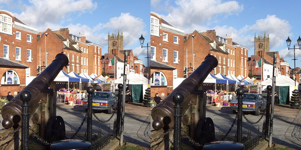
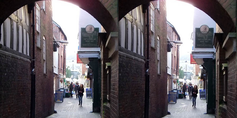
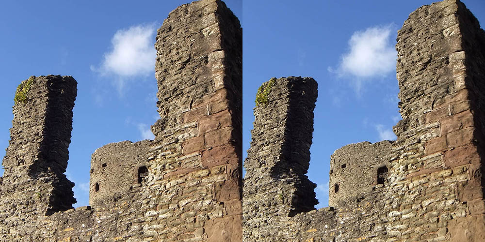
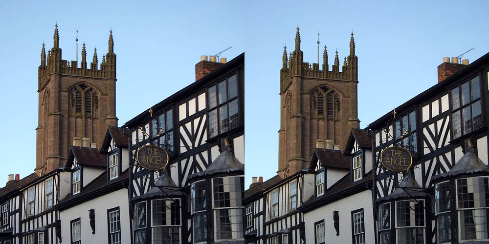
…the third one, that is. I’ve been playing with 3D (or stereoscopic) photography for a couple of days – here are some early examples. I think I’ve still got much to learn, not least how to avoid getting a finger over one of the lenses…

There is more than one way to view 3D images – I find I am able to see stereo by making myself go slightly cross-eyed while viewing the pair, but not everyone can do it. Holding a finger or a pencil about 6″/15cm from the nose, over the margin between the left and right image, may help. Move the finger back and forward until there are effectively three images behind it, then try to focus on the middle image. Don’t sit too close to the screen. If the images below are too small to be effective, click to view them full size (1000 x 500 or thereabouts). 

I’d love to hear whether blog visitors are able to see these pictures in 3D.

Ludlow Cannon 3D

Ludlow street 3D

Ludlow Castle 3D

Ludlow The Angel 3D

Rising again

The Severn, that is. It was high yesterday, when these photos were taken (Ironbridge’s Wharfage is closed – the flood barriers are up), and it’s rising – the peak is expected tonight. We took a look at the flood waters above the “big bends” near Leighton, then drove on to Atcham, where two bridges cross the river in close proximity – the 1929 A5 bridge and the 1774 bridge, now for pedestrians only.

Quiet lanes

A bright sunny afternoon – too good to stay at home, but the ground would be sodden after yesterday’s rain (this is becoming repetitive…). Would a walk entirely on surfaced ways be acceptable? There are some quiet lanes in the country west of the Wenlock Edge – let’s try it.

I’m not sure I’d want to make a habit of walking six miles on tarmac – but it was quiet. Perhaps no more than a dozen motor vehicles, half a dozen bicycles, a couple of joggers and a distant dog-walker – not too bad. Nevertheless, it nearly wasn’t the circular walk I’d intended. An impromptu ford blocked my way just beyond (appropriately) Plaish. It was deep – it would have filled my boots. Some minor gymnastics (do I mean acrobatics?) got me over the narrowest bit, but the only way forward then was along the edge of a field for a very short distance, before regaining the road. With very muddy boots.

Mogg Forest

Rhymes with “sogg”… An interesting and pleasant route for a mild and bright afternoon – but unbelievably wet underfoot. The path rises gently through the forest, though in places, it’s “forward two, slide back one”. On the crest of the ridge, the path switches to the field. There are ancient earthworks just inside Mogg Forest – impressive-looking banks and ditches (named “The Ditches” on the OS map). The footpath should now run across the field (and clearly does so in summer, if the Google satellite view is reliable), but there was no sign of it, a new crop was coming up and the earth looked very sticky. With no waymarkers to point me in the right direction, I followed the wide grassy margin of the field beside the forest instead. Foot- and horse hoof-prints told me I wasn’t the first. 

The path (waymarked again) descends to the road beside Cottage Pool, a little way up the valley from Brockton. I had intended to walk along what should have been a quiet lane to Easthope, but I think it must have been school closing time, so I took to the field path towards Lutwyche Hall (it would be slightly shorter too). Big mistake: it wasn’t too bad past the attractive little pool, but the field thence to the Hall farm was the most waterlogged part of the walk. The cows had been on it, leaving deep water-filled hoof holes in the squelchy grass. There’s a good view of the hall from the field, but navigating the morass took all my attention – by the time I was out of it, the hall was behind trees and hedges. No photos…

Note to self – a good walk for a dry summer…