A walk down to the river – a breath of fresh air on a cold grey afternoon. We’d better not dawdle – rain is forecast for later in the day.



A walk down to the river – a breath of fresh air on a cold grey afternoon. We’d better not dawdle – rain is forecast for later in the day.
Not exactly a classic outing, photographically, but nevertheless a very pleasant stroll around the lanes, in a quiet part of the Shropshire hill country below the Wenlock Edge. We were led to believe that it might be sunnier…


View OS map on Streetmap http://www.streetmap.co.uk/map.srf?X=356775&Y=301621&A=Y&Z=120
We’re out on Brown Clee, enjoying some drier weather, though it’s very wet under (and at times, in) our boots. There was a spot of light drizzle too, early on (the 0.1mm threatened by the forecast) but we coped. Once on the ridge, all (extremely minor) discomfort was forgotten as we took in the drama of the skyscape and the misty distant border hills. What a great place to be on a day like this! It’s a shame to have to come down again, but the hours of daylight are short.


View OS map on Streetmap http://www.streetmap.co.uk/map.srf?X=359990&Y=286571&A=Y&Z=120
…the sun will shine – eventually. We left home in the pouring rain, trusting in a weather forecast which proved correct. There was no point driving further up the Dhustone Lane though – Titterstone Clee was cloud-capped. We’d have to make do with the views from half-way up the lane – quite something after the last 48 hours. Happy New Year everyone!


A dry and bright day – we’re making the most of it before tomorrow’s forecast deluge. The same forecast gave us blue skies all day today – huh! The sun deigned to shine half-way through the walk, from a very low angle, putting some much-needed shape into the landscape. It was chilly, and windy – not a day for hanging around – but very pleasant, perfect for blowing away a few Christmas cobwebs.
In Welsh, the Long Mynd would be Mynydd Hir – Long Mountain – but we’re in Shropshire. About 10 miles to the north-west lies the Long Mountain. It’s in Wales. It’s interesting in the border country…


View OS map on Streetmap http://www.streetmap.co.uk/map.srf?X=342285&Y=295245&A=Y&Z=120
We needed a good leg stretch, but the field paths would be sodden – and it’s a bank holiday, so somewhere quiet would be good. And these lanes are quiet – only a few vehicles, mostly farm-related. There was a chance of some sunshine, but it passed. Grey days!


View OS map on Streetmap http://www.streetmap.co.uk/map.srf?X=353790&Y=297306&A=Y&Z=120
We’re out for a leg stretch and a breath of fresh air, on a mild but windy Boxing Day afternoon. The centre of Bridgnorth is busy, but we’re taking a quieter route away from the crowds. There’s a train due to leave the station – we’d better go and have a look…


View OS map on Streetmap http://www.streetmap.co.uk/map.srf?X=371482&Y=292741&A=Y&Z=115
An unexpected find on a grey December afternoon – ALEXANDRA, built by Andrew Barclay of Kilmarnock in 1902 (works no 929). It was working at Millom ironworks when the latter closed in the late 1960s, and then spent many years at the Lakeside and Haverthwaite Railway. More recently, it lived in Gloucestershire – and now resides, after a short spell in Oswestry, near Criggion in Powys. I’d read of its recent moves, but hadn’t given it a thought when we set off earlier in the day. Yes, that’s (appropriately) a highland cow keeping it company…


Location (zoom out!)
View OS map on Streetmap http://www.streetmap.co.uk/map.srf?X=328345&Y=314975&A=Y&Z=120
Done this one several times, usually in winter. Today the wind is rising, though there are some well-sheltered spots along the way on this mild afternoon, and apart from the wind, it’s quiet – no-one else around, apart from an angler or two at the pools.


The map is borrowed from an earlier visit – today I’m going anti-clockwise.
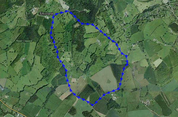
View OS map on Streetmap http://www.streetmap.co.uk/map.srf?X=366365&Y=297016&A=Y&Z=120
Weather, mothers, and plumbers – they’ve all had an impact on our outings recently. We needed a leg-stretch, and the field paths would be muddy, so we took to the quieter paths and lanes away from the wharfage for a wander on a mild November afternoon.


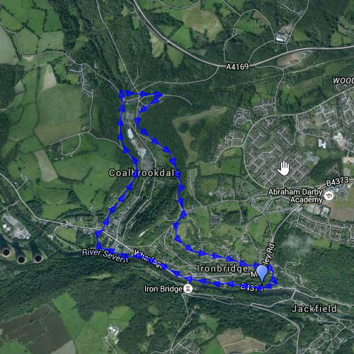
The above is last month’s map – today we walked it anticlockwise… View OS map on Streetmap http://www.streetmap.co.uk/map.srf?X=367255&Y=304041&A=Y&Z=120

