Brown Clee and Boyne Water

Perfect for a fine and sunny afternoon, with just a pleasant breeze. Taking the direct route to the summit, there are others about, but as we continue towards Boyne Water and the track down through the estate lands, we realise we’ve left the crowds (perhaps a dozen in total?) behind. We followed this route back in the spring, but today we’re doing it anticlockwise for subtly different views.

As we near the equinox, the sun is noticeably lower in the sky. Those shorter days of misty distances are getting closer.

View OS map on Streetmap http://www.streetmap.co.uk/map.srf?X=359955&Y=285891&A=Y&Z=120

Peter Pan, Dalmunzie and the Whistling Pig

Not every visitor to the Geoffspages blog will know what they have in common. Simply, they’re all narrow gauge railway locomotives – one steam, one petrol-engined, and…. Peter Pan is well-known and well-travelled; Dalmunzie much less so, in both respects, and the Whistling Pig? Who knows? PP was in action at the Alan Keef open day today, with his friend Woto. Dalmunzie, not in working order, was on display, pre-renovation. At the nearby Lea Bailey railway, a couple of diesels coughed and chugged up and down the short-but-interesting track to the mine entrance, but the star turn was undoubtedly an EIMCO compressed air-powered mines loco, which scuttled back and forth in fine fashion, its exhaust making a curious whistling sound. Given its basic shape, the name is entirely appropriate.

A “Geoff’s Rail Diaries” page will appear in due course (but not before I’ve done the Statfold page), including video (with sound, of course) of the remarkable yellow pig.

Alan Keef Ltd
Lea Bailey Light Railway

Edale to Glossop – a day to remember

Tuesday: The Greater Manchester “Wayfarer” is excellent value, especially to those of us who qualify for the “concession” fare of £6. A day return from Shrewsbury to Wilmslow isn’t too expensive – from there, the Wayfarer takes over – and we don’t even need to change trains to get to Piccadilly. We’ll have a little while to wait before we join a Sheffield-bound “stopper” for the ride to Edale. Soon we’re heading for the hills, and already the day is very warm in the bright sunshine – it will turn out to be the hottest September day for many years (though it’s not going to be the temperature that makes it memorable). By early afternoon, we’re on the edge of the summit plateau of Kinder Scout, where there’s no shortage of comfortable boulders for a lunch break.

By the time we’re moving again (only minutes), there’s cloud in the west, and the day has changed by the time we reach Kinder downfall. The landscape is murky (and the temperature has dropped) as we head, via Mill Hill and the curiously-named Harry Hut, towards Glossop. A glint of metal catches the eye in the increasingly-drab heather – the remains of a WW2 bomber. (Later research tells an unexpectedly-happy tale – the two-man crew, on delivery duties, were able to walk down to the main road, suffering just cuts, bruises and one broken jaw. The web site doesn’t tell how the latter was sustained)

As our train from Glossop approaches Manchester, the sky over the city looks threatening. We hear the rain – and the thunder – begin while we take refreshments, before boarding the 6.30pm for Shrewsbury. The sky is now so dark (apart from the near-constant lightning) that it could be midnight. “Look at that staircase – it’s a waterfall!”. Our prompt departure is misleading – we crawl from signal to signal most of the way to Wilmslow. Then, with (at last) a glimmer of light in the western sky, we pick up speed and run to Shrewsbury without further delay.

We arrive home perhaps half-an-hour late. Checking the news sites, we realise that we got off lightly – Manchester’s tram network had come to a complete standstill, an international football match had been called off, and chaos reigned (rained?) in the city’s sodden streets. It was a most enjoyable walk and a great day out, but that might not be why we’ll remember this trip.

Greater Manchester Wayfarer
B-24J Liberator 42-52003

View OS map on Streetmap http://www.streetmap.co.uk/map.srf?X=407500&Y=388620&A=Y&Z=120

Later that day

28 August ctd: Taking it easy, at Uig pier, and later at Camas Mor.

There would have been more photos of this year’s trip. On our last day, the wind was blowing strongly from the south-west, and the west side of Trotternish was misty and grey. Perhaps we can get out of the wind down the east side, at Rubha nam Braithairean? Yes, we could – not only was it sheltered, but bright and sunny too – a perfect spot for a brief exploration. But I’d forgotten to put the camera in the car…

Alone on Rubha Hunish

28 August: Last time I was here, there were others about. This time, I paid my visit to Skye’s northernmost tip before lunch, and had the little rock-rimmed peninsula to myself – and the gulls, and the cormorants. Wonderful! I’m on my own because my usual companion on these little outings would be quite unable to manage the very steep rocky path down the cliff between Meall Tuath and Meall Deas – it needs a good head for heights. After a most enjoyable hour or so, I’m on my way back, and now there are others on their way down. They’ll enjoy their visit, I’m sure, but being alone on Rubha Hunish feels a little bit special…


View OS map on Streetmap http://www.streetmap.co.uk/map.srf?X=141425&Y=875535&A=Y&Z=120

Staffin shore: Orcas

27th August ctd: After our visit to the Loch Shianta, we drive on to Staffin slip, park the car and wander across the saltings to the rocks. Rather than remain at our usual spot, we continue along the grassy upper shore below the cliffs. Soon, we can go no further – the jumble of huge boulders makes the shore virtually impassable. We stop for a while, and gaze out so sea – what’s that? Large fins break the surface… Glimpses of white patches identify them as orcas, also known as killer whales. There are no acrobatics, but they’re there for the best part of 20 minutes (the YouTube video below contains the edited highlights…).

Later that day, we’re back on the west side of Trotternish, watching the sun setting behind Harris, in an almost-perfect demonstration of the curvature of the earth.

Catholic tastes

Towards the end of the afternoon, it occurred to me that, over the weekend, I’d seen a quite amazing range of railway activity. Yesterday we started with the Statfold open day – rather a soggy one, sadly,  though the weather had changed completely by the time we saw Princess Elizabeth hurrying southward from Church Stretton, shortly before 6pm. This afternoon we were at Nantmawr where we had a ride on an ancient DMU, barely half-a-mile down the last remaining section of the former “Potts”. The main reason for our visit however was to see the incredible collection of industrial monorail equipment, which until very recently was in storage at Blaenau Ffestiniog.

More on the above will appear on “Geoff’s Rail Diaries” in due course, though I’m acutely conscious of a growing backlog. So far as this blog’s concerned, we were still on Skye until this entry. I hardly dare say it, but I could do with a few more rainy days…


The enchanted loch

27th August: The sign at the little parking place describes Loch Shianta as “The Enchanted, Holy or Magical Loch”. There’s certainly something magical about the water in this well-hidden pool – it’s the clearest water I’ve ever seen, with a curious turquoise tint. Is it something in the water, or just its rocky bed? Sadly, neither the depth nor the clarity come through in the photos – it has to be seen to be believed.

The path down to the loch is short and well-made, with little plaques every few yards, mostly in Gaelic. “Gabh seo, a ghaoil” seems to translate (Google) as “take this, love”. Is that perhaps too literal? Though it’s late in the season, this is a colourful walk, with plenty of knapweed and scabious, not to mention a patch or two of ragwort. Just off the path. there’s a super small colony of fly agaric (“flying Eric”, as my nephew once misheard), and as ever, there are great views of islands and the highlands.

Staffin Ecomuseum

View OS map on Streetmap http://www.streetmap.co.uk/map.srf?X=147067&Y=869865&A=Y&Z=115

Sròn Vourlinn

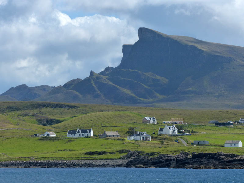
Sron Vourlinn25th August: yesterday, as we walked back from Rubha na h-Aiseig, the shapely peak of Sròn Vourlinn was prominent and dramatic on the skyline ahead. Today, we’ll walk to that peak and look back to Ferry Point…

There’s a fairly straight, level and most enjoyable route to Sròn Vourlinn from the top of the road from Staffin to Uig – unfortunately, everyone else agrees with me, as the first part of the walk is also the route to the much better-known Quiraing. We’ll try to avoid the crowds, and begin the walk on the path from Loch Langaig, down on the main road near Flodigarry (see also “Quiraing – the other way“). The path ascends steadily until it reaches a cairn marking a sharp right turn, in a hollow below black cliffs and startling pinnacles. There are other walkers around – one or two have used our path from Loch Langaig – but when we continue along the ridge to the north, we’ve got the hills to ourselves. The views are tremendous and extensive, from the mainland mountains to the east, through a far-reaching seascape to the hills of the Western Isles. In the middle distance, with Lewis on the horizon, is Rubha na h-Aiseig. To the south, down the Trotternish ridge, the landscape is a tangled confusion of crags, cliffs and pinnacles. Just don’t get too close to that vertical cliff edge!

View OS map on Streetmap http://www.streetmap.co.uk/map.srf?X=145733&Y=870841&A=Y&Z=120