After Doris Day

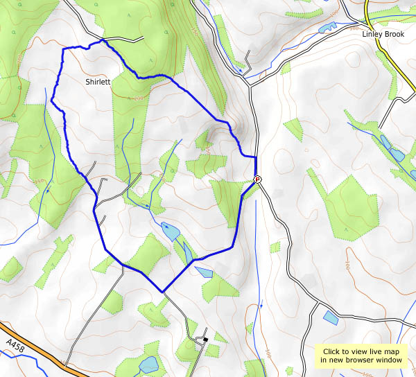
Friday – the sun’s shining, and we’re taking a walk down to the Severn, on the day following storm Doris. Others were worse affected, I think, though there were one or two trees down (fairly rotten specimens, it has to be said), and one or two houses lost a ridge tile. It’s more sheltered in the valley, and the weather’s mild enough for us to sit outside the youth hostel at Coalport for our tea and cake. We’ll head for home the shortest way – up the dingle with its wonderful hanging gardens, and not-so-wonderful mud. Can’t have everything!

Brown Clee skyscapes

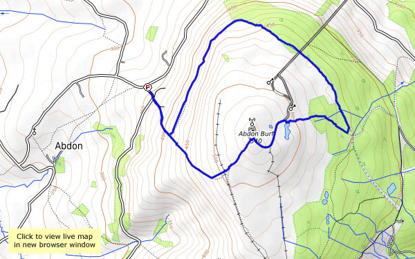
The sky’s blue today, with photogenic clouds (best kind) – let’s have a walk on Brown Clee! We’ll walk up from the telephone box (it’s a free library these days) and take the terrace path around the hill to the far side. At first on the open hillside, it later skirts the forest, where there’s some attractive deciduous woodland beside the conifers. When we meet the path up the east side, from the picnic place, we make a gentle and cautious (it’s a bit sticky underfoot) ascent to the summit where, for a few minutes, we’re the highest people in Shropshire. It’s downhill from here, of course, but no-one has told the water – the moor is rather squelchy. But who cares? It’s great up here on a day like this.

Soon we’re back at the car – better change the library books before we head for home…

map

View OS map on Streetmap http://www.streetmap.co.uk/map.srf?X=359115&Y=286916&A=Y&Z=115

Fog’s gone: the edge in January

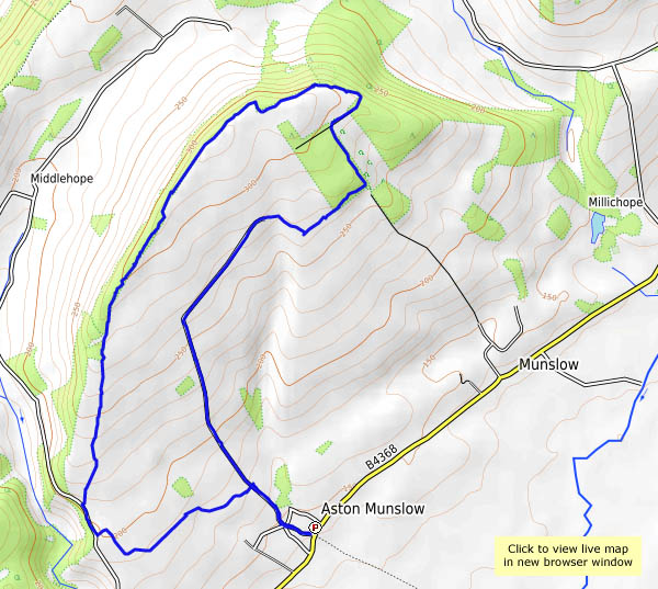
The morning’s fog dispersed, as instructed by the Met Office, to leave a clear blue sky – perhaps the last we’ll get for a week or so? Better get out there and enjoy it – Aston Munslow and the Wenlock Edge could be good. It’s not especially elevated ground here, just over 1000′ at the highest point, but it feels like the top of the world. Must be the rarefied atmosphere!

map

View OS map on Streetmap http://www.streetmap.co.uk/map.srf?X=350930&Y=287731&A=Y&Z=120

On Breidden Hill

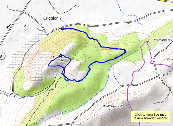
A short walk to a landmark summit, just across the Welsh border. It’s no great height, nor the greatest height of this little clump of shapely hills which is a significant feature of views from further east. The top is marked by Rodney’s Pillar, memorial to the 18th century Admiral, and provides splendid views of the border hills – or would have done, that is, had it not been for the lingering mist. The sun tried hard, but only really succeeded, inevitably, when we’d come back down again.

map

View OS map on Streetmap http://www.streetmap.co.uk/map.srf?X=329515&Y=314401&A=Y&Z=115

A cold afternoon

Murky too! Not a day for the hills, and it’s wet underfoot. The paths at Attingham Park are well-maintained – we can get a leg-stretch there. Many others have had a similar idea, though they’ve thinned out considerably by the time we reach the far perimeter. There are some attractive reflections in the Tern, and there’s some wonderful bracket fungus on a tree near the entrance. It’s still there when we return…

Attingham Park NT

map

View OS map on Streetmap http://www.streetmap.co.uk/map.srf?X=355090&Y=310136&A=Y&Z=120