Silver birches

Thursday 5 Jan: We have to be in Wolverhampton briefly, late morning. It’s a perfect January morning – quite the wrong kind for being in Wolverhampton, so we’ll continue on to Cannock Chase, for a snack lunch in the visitor centre, followed by a walk to make the most of the weather. To do that, we’ll need to drive away again (it’s fairly densely forested there), to a more open part of the Chase, where scattered silver birches predominate, their trunks really catching the light. It’s pleasant by the Sher Brook too – in places, the water is mirror-like, the reflections perfect. We could have walked further, but that would take us into the forest, so we’ll head back to the car as the shadows lengthen.

map

View OS map in Streetmap http://www.streetmap.co.uk/map.srf?X=398430&Y=317641&A=Y&Z=120&ax=367365&ay=301641

The Mynd in January

Wednesday 4 Jan: “We’ll be out most of the day – you’ll have to amuse yourself…” No problem – it’s fine, bright and intermittently sunny. I’ll start from the Carding Mill Valley and work my round to Little Stretton, then up to the top beside Small Batch, and come back down Mott’s Road. There are one or two tricky bits on the path through the woods – soft and slippery – otherwise it’s a very pleasant route. The sun’s trying hard, and though it doesn’t always succeed, it provides me with some fine sunbeams to the south-west.

map

View OS map in Streetmap http://www.streetmap.co.uk/map.srf?X=343115&Y=293621&A=Y&Z=120&ax=367365&ay=301641

.

Foggy day

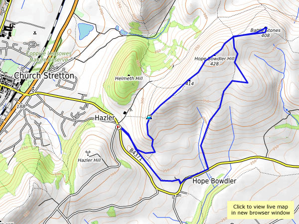
At home, we’re just on the edge of it; along the Wenlock Edge, we’re well above it. It’s pretty thick down in Apedale, but we can see the Hope Bowdler hills poking out through the fog. We’ll keep going! The forecast says the clear blue above the fog will be replaced by cloud later in the day, so we’ll set off in the morning (after scraping a very hard frost from the car) and find somewhere on the hill to eat our sandwiches (the Battlestones). As we head slowly back towards the car, the day is changing. We’ve had the best of it!


map

View OS map on Streetmap http://www.streetmap.co.uk/map.srf?X=347860&Y=293626&A=Y&Z=120

Shirlett: a Christmas leg-stretch

25 December: a day when we get out, weather permitting, for a walk and a breath of fresh air. On this Christmas Day, there’s no shortage of the latter – quite a stiff breeze, though the route we’re following will be sheltered. It’s certainly not cold – 13C according to the Met Office. It’ll soon be dark though – better get back to the car, and head for home and Christmas tea (featuring, among other things, a rather fine locally hand-built pork pie). Merry Christmas everyone!

We were here (Streetmap):  http://www.streetmap.co.uk/map.srf?X=365980&Y=298106&A=Y&Z=120


Longer days ahead

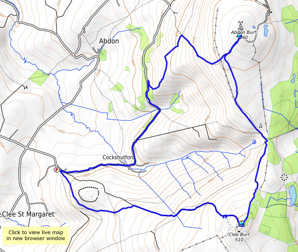
22 December: We’re past the shortest day now, though it will be weeks before the evenings become noticeably lighter. It’s a fine and breezy afternoon – a last chance for a good leg stretch before the weather deteriorates and the Christmas fun begins. Brown Clee beckons!

As ever, it’s quiet up here. Just as I leave the car, two families arrive, but I’m away, and won’t see them again. Other than a solitary photographer at the highest point, I’ve got the hills to myself (and the sheep, and a couple of small groups of wild horses). The breeze stiffens at Clee Burf, the secondary summit, but it’s quiet enough at the seat above the five springs for a lunch break.

I’m off again, following a soggy path to the summit at Abdon Burf, and for a few seconds (the wind is cold here) I’m the highest person in Shropshire. I’ll return to Cockshutford down the track towards the telephone box, before taking the contouring path back to the lane. There’s a glimpse of a red kite for a few moments, but try as I might, I won’t see him again. Until the next time, perhaps…

map

View OS map on Streetmap http://www.streetmap.co.uk/map.srf?X=358625&Y=285576&A=Y&Z=120

Back to Bannister’s

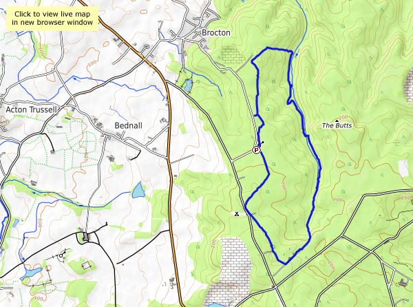
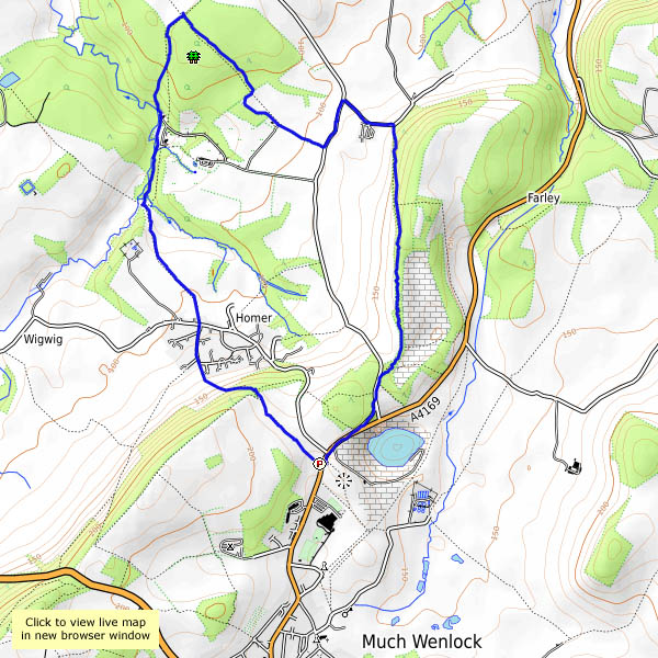
We walked to Bannister’s Coppice in the autumn, on a beautiful golden day; today’s dull and colourless, but I need a leg-stretch. Perhaps, like last time, I’ll see deer? Perhaps not. If nothing else, I can check the existence of a footpath, not shown on the OS map, which will avoid muddy fields on the return leg. Yes, it’s there, winding through the trees – the views are better too, looking back along the Wenlock Edge, with the village of Homer prominent in the middle distance. By now the afternoon is getting late – the light’s gone. Time for home.

map

View OS map on Streetmap http://www.streetmap.co.uk/map.srf?X=362505&Y=302021&A=Y&Z=120