 Ironbridge? Coalbrookdale? Will there really be no more? Who knows? In the meantime, have a look at “Last steam from Coalbrookdale” on Geoff’s Rail Diaries – more pictures of yesterday’s two trips down – and up – the former power station line from Madeley Junction.
Author: geoffspages
A Castle in Coalbrookdale
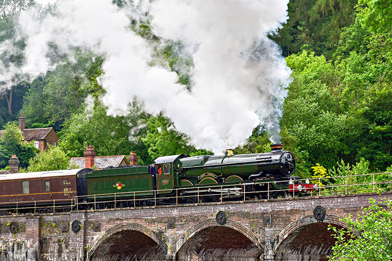
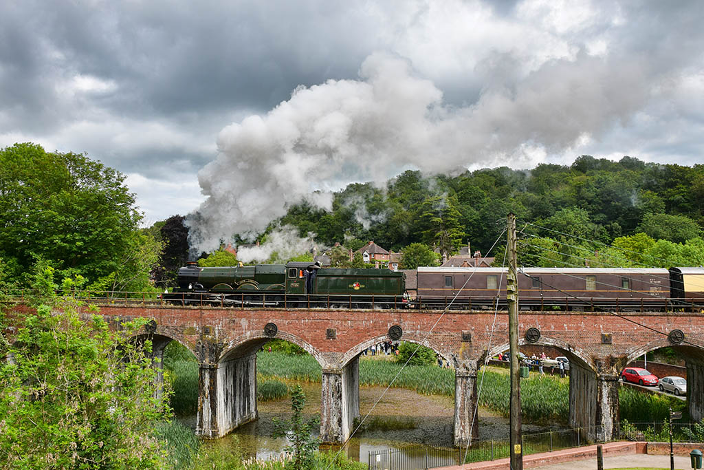 No. 7029 “Clun Castle” was in action today, on a couple of shuttles between Wellington and Coalbrookdale. It was advertised as the last steam to (or was it “from”?) Ironbridge – but that was over 50 years ago. We’re not complaining – it’s good to see a train of any kind on the line which used to serve the now-defunct power station. It was very dull for the first run, but the sun did its best for the second. Here’s a sample – more to come on “Geoff’s Rail Diaries“…
Bears and the Mynd
If you go down to the woods today, you’re sure of a big surprise…
That may be true, for the unsuspecting, but I must admit that I’d hoped we might find them… They’re in the trees beside the Long Mynd Hotel, and rather fine they are too. We’re taking a walk on the Mynd, from a different starting point – the little car park at the top of Cunnery Road, and making a small ursine detour before tackling the steep path up the Ashlet hillside. We’ll walk towards the Boiling Well, before cutting across to the top of the Light Spout valley, to return to the start past the waterfall, down the Carding Mill valley and through Rectory Woods. A very pleasant outing, perfect for this cold (is this really June?), windy but dry afternoon.


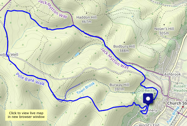
View OS map on Streetmap http://www.streetmap.co.uk/map.srf?X=343480&Y=294411&A=Y&Z=120
Day trip to Hull
It’s just two hours from Manchester – but we’ve got to get to Manchester first. With an early start, we’ll have the best part of five hours in Hull – and fascinating hours they are! After saying hello to Philip Larkin, who’s hurrying to catch a train (but he’s late), we find lunch near the old docks (now a marina). Later, we visit Corporation Pier station (which had ferries but no trains) and the walkway above Albert Dock, then walk alongside the river Hull as far as Drypool Bridge. Heading back through the old town, we find ourselves at the Streetlife Museum, a distraction which means we’ll have to walk briskly back to Paragon station. A great day out – must do it again!
For more rail-related photos from the trip, visit By TPE to Hull on Geoff’s Rail Diaries


Wenlock to Perkley
An easy wander to the south-west of Wenlock, on the last day of (meteorological) spring. There are wild flower meadows, fields of wheat, barley, oats and potatoes (and oilseed rape, almost completely faded), and hidden ways between lines of trees. Other than the power station chimney and cooling towers (not for much longer) it’s a rural and unspoiled landscape.


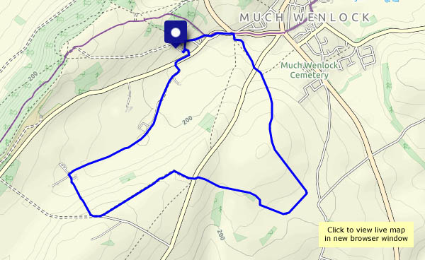
View OD map on Streetmap http://www.streetmap.co.uk/map.srf?X=361430&Y=298891&A=Y&Z=120
The deer park and the walled garden
A short wander around Attingham Park, on an afternoon which improved. The deer – lots of young ones – are taking it easy. The walled garden is full of colour – and the scarecrows seem to be working as intended.


The Bannister’s Round
It’s become a favourite – a very enjoyable circular route from Much Wenlock, down through Traps Coppice and into Bannister’s Coppice, then beside Sheinton Brook and back up through Homer. There was a chance of rain earlier in the afternoon – this route is mostly in attractive woodland, but in the event we didn’t need shelter. By the time we’d topped the edge above Homer, the day had changed for the better.


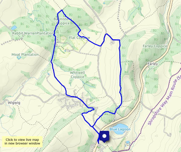
View OS map on Streetmap http://streetmap.co.uk/map.srf?X=362175&Y=301916&A=Y&Z=120
Topley and The Speller
Another afternoon that’s too good to waste… We’re starting at the top of the Rushbury to Beambridge road, where it crests the Wenlock Edge, and walking around the rotund hill at Topley, along quiet farm lanes and tracks. Our return takes us through Upper Millichope and intriguingly-named “The Speller”, just one part of more extensive woodlands hereabout. It’s attractive country too – walking uphill, back towards the edge, we’re in deciduous territory, where the sunshine dapples the undergrowth. Lastly, buttercup meadows lead us to the track along the edge, back to the start.


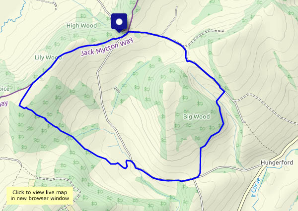
View OS map on Streetmap http://www.streetmap.co.uk/map.srf?X=352060&Y=289946&A=Y&Z=120
Comer in May
A perfect afternoon for a short wander in the woods – the sunshine’s warm but the air’s cool. There’s lots of colour in the woodland – spring-green leaves, wild (and feral) flowers everywhere – and a comma butterfly which thought it might hitch a lift on my boot…


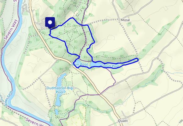
View OS map on Streetmap http://www.streetmap.co.uk/map.srf?X=374745&Y=289631&A=Y&Z=120
Looks like rain…
There could be one or two showers this afternoon, the forecast suggested. The clouds were dropping unsubtle hints too. We’d better not stray too far, and preferably somewhere where there might be shelter. We’ll walk down to Coalport – if it rains, we can enjoy our tea and cakes indoors. A few drops began to fall as we approached the old railway bridge at the bottom of the lane – ten minutes later, it had cleared and we were on our way again. Fed and watered at the YHA cafe, we’re heading back up the dingle, where the wild garlic is still flowering, and to those with a sense of smell, making its presence known…


