They’re just big thistles really… An Attingham amble, out around the deer park and back through the walled garden


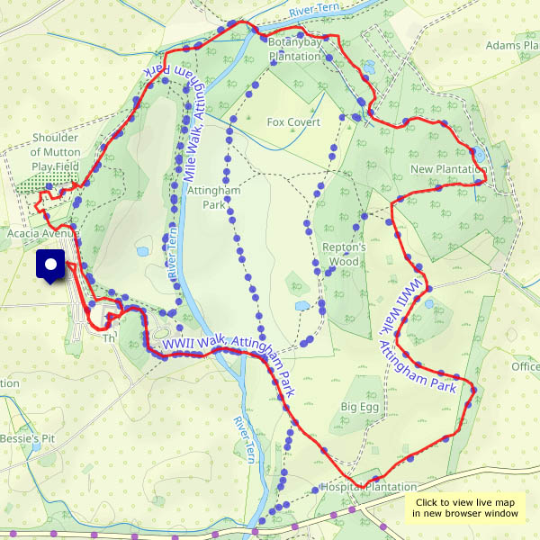
View OS map on Streetmap http://www.streetmap.co.uk/map?X=355310&Y=310110&A=Y&Z=120

They’re just big thistles really… An Attingham amble, out around the deer park and back through the walled garden
View OS map on Streetmap http://www.streetmap.co.uk/map?X=355310&Y=310110&A=Y&Z=120
Beautiful lighting at the end of the day, for our walk (a regular!) around Colemore Green and Boldings Pools.


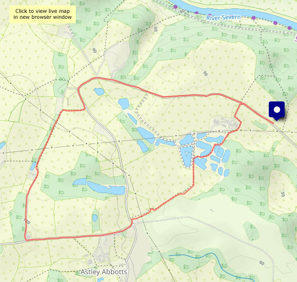
View OS map on Streetmap http://www.streetmap.co.uk/map?X=370965&Y=296815&A=Y&Z=120
It should be dry this morning – it could be wet this afternoon… A short wander on the Wenlock Edge, immediately to the west of Wenlock, should provide some interest. The changed colour of the world, over the last week or so, is very noticeable. Few flowers, autumnal shades – berries and fruits, and leaves starting to turn


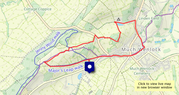
View OS map on Streetmap http://www.streetmap.co.uk/map?X=361750&Y=299815&A=Y&Z=120
Shrewsbury’s Onslow Park, 26 August – yes, bank holiday Monday, and the crowds are horrendous, but the traction engines, steam rollers and other (very) assorted steam-powered machines are in fine fettle – a splendid display!


It’ll soon be here! The hedgerows are certainly anticipating the coming change of season – the hops are really plentiful, and there will be a great crop of damsons… This was an evening walk – it’s quite dark under the trees – only a few photos today.


View OS map on Streetmap http://www.streetmap.co.uk/map?X=367085&Y=297470&A=Y&Z=120
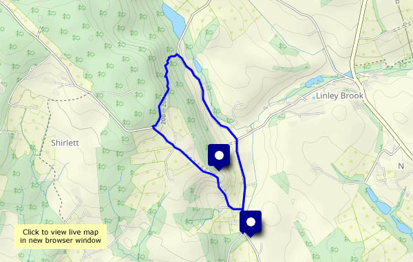
It’ll soon be autumn – the nights are already drawing in. We need to get out promptly if we want a walk in the evening. Shirlett Lane perhaps – it’s only a mile or two up the road.


View OS map on Streetmap http://www.streetmap.co.uk/map?X=365840&Y=298200&A=Y&Z=120
Perhaps not entirely appropriate – the light has gone from the lanes around Willey, but in the hedgerow there are lots of wild hops. Rub one of those flowers between your fingers, and sniff! Wonderful!


Tuesday 20 August: It’s harvest time – some of the fields have already been cut, with lines of straw or towers of bales in evidence. Not all – in other fields, the wheat and especially the barley look beautifully ripe and golden. We’re walking from Tigger’s Ickle Shop in Rowe Lane – we’ve stocked up with some plum tomatoes, an aubergine that resembles a black boxing glove and some pieces of cake… (There’s a second Tigger’s Ickle Shop at the other end of the lane, but we’re spent up!) Soon we’re approaching Holdgate, where there’s a chocolate seat with great views to Brown Clee; beyond, the lane is well-edged with ripe blackberries. It’s been a great walk, despite our sticky fingers…


")


View OS map on Streetmap http://www.streetmap.co.uk/map?X=356005&Y=289605&A=Y&Z=120
 …with Austin 1. Just published to Geoff’s Rail Diaries, an illustrated account of our visit and short train ride yesterday afternoon. Visit ‘Austin 1 at Oswestry‘ – now!
We’ve been to Oz (should that be Os?), better known outside the area as Oswestry. 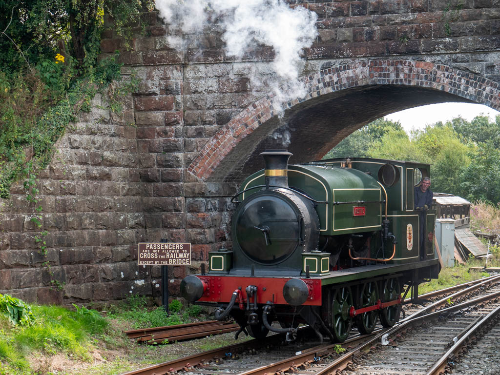 The Cambrian Railways Society has, most appropriately, had a base there for many years, but has struggled against the odds to operate trains much further than up and down a siding. A couple of years ago, it began running trains about 2.3km (sounds much further than 1.4 miles) down the old main line, to Weston Wharf. Here there are refreshments, in a static buffet car, and next door at the brewery tap. The train ride has a purpose at last! Today, we took a ride down the line, steam hauled by Austin 1 visiting from Llangollen (and just for the pleasure of it, we walked back). There will be a Rail Diaries entry in the next day or so, meanwhile, here’s a taster.
