Hopesay Hill and Wart Hill

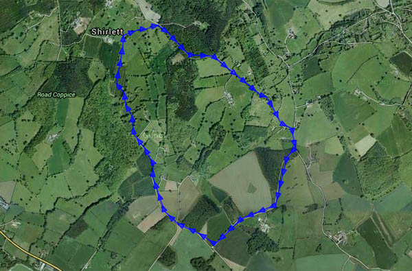
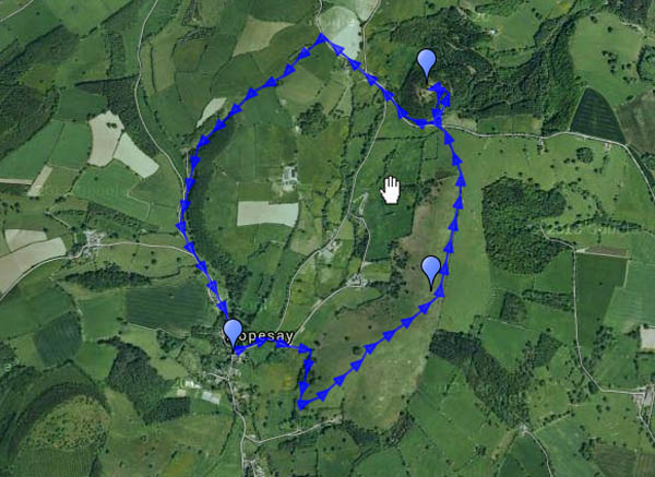
Hopesay lies in a side valley off the Clun valley – so quiet that it should have been listed with the latter’s “quietest places under the sun”. Its hill, owned by the National Trust, is an airy grassy ridge, adorned by a well-placed clump of trees. Wart Hill, immediately to the north of Hopesay Hill, is clad in forestry pines, which thin towards its top sufficiently to appreciate how good the view would be if they were all cut down… It’s Easter Sunday, but there are few others about – one or two walkers, a farmer tending his sheep. And, of course, the buzzards – and red kites (or possibly one red kite three times). One landed in a tree close by, a brief glimpse of colour before he was away again, too quick for the camera (or its operator…)

Map
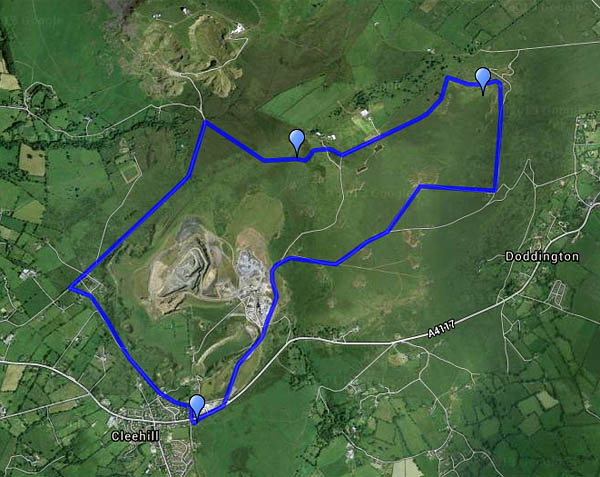
View OS map on Streetmap http://www.streetmap.co.uk/map.srf?X=339460&Y=284065&A=Y&Z=120

Better weather

It’s grey and damp today – but Friday and Saturday afternoons were positively springlike. There are few signs of spring, but the air is warmer, the breeze less biting. Friday’s wander was around Coalbrookdale, up and down through the woodlands. Yesterday was Wenlock’s turn, heading through the town, up past the windmill and along the edge.

Coalbrookdale:

Much Wenlock and the edge:

Barrow, Willey and Shirlett

It’s dry and bright, a good afternoon for exploring. It would have been sunnier too, if we’d not been tied up earlier in the day. There are three stretches of road walking en route – the first, the Wenlock to Broseley road, is fairly busy, but there’s ample verge to hop onto when needs must, and it’s downhill… The other roads are very quiet, and quieter still, respectively. And away from the lanes, there’s just the birds, twittering and rustling in the undergrowth. It may be half-term, but there’s no-one else about.

MapView OS map on Streetmap http://www.streetmap.co.uk/map.srf?X=365975&Y=298916&A=Y&Z=120

A hazy day on Wenlock Edge

The views wouldn’t be great today. It was very hazy, and there was little chance of sunshine. A walk in woodland might be good – how about Wenlock Edge? There’s a little NT car park where the Hughley road leaves the Wenlock – Stretton road. We could walk along the edge path above the quarries, then back along the track through the woods, a little lower down. We could walk, that is, where the path was fit for walking. No farmers’ tractors this time, just the popularity of the path to blame for the mud, in places barely passable. There may not have been any distant views – a clearing in the trees provides a viewpoint for the Wrekin, way beyond the limit of visibility this afternoon – but it was pleasantly atmospheric, and was it a touch warmer than recently?

MapView OS map on Streetmap http://www.streetmap.co.uk/map.srf?X=359285&Y=298596&A=Y&Z=120

Sunspots and Thresholds

Thresholds is a farm, at the northern end of Betchcott hill, between Picklescott and Ratlinghope (yes, really – this is Shropshire); sunspots are sunspots. The morning’s mist cleared to a blue sky; we chose a route which should make the most of the sunshine. There’s no wind to speak of, it’s a beautiful afternoon to be out on the hills. There’s still some snow too – it’s melting, but there’s plenty of white in the landscape. As we drove to the start of the walk, we could see banks of mist away to the north, with the Wrekin behind. As we turned back towards the car at Thresholds, the view to the north opened up again – in the place of the mist, there was a sea of murk. Before we knew it, the murk had engulfed us – not thick fog, but an eerie mist through which a pale sun was barely visible.

Sunspots: I took a couple of pictures of the aforementioned pale sun with the lens at full zoom; when I studied them 1:1 on the computer screen, I could see darker spots on the sun. First thought: dust spots on the camera sensor. Then I realised they were in the same place on the sun in both pictures, though the sun was in a different part of the picture. A quick check on the web – see http://sohowww.nascom.nasa.gov/data/synoptic/sunspots_earth/sunspots_512_20150208.jpg – confirmed my guess. Sunspots! Haven’t seen sunspots before…

Map

View OS map on Streetmap http://www.streetmap.co.uk/map.srf?X=342310&Y=297956&A=Y&Z=120

Snow on the Wrekin

It’s not a very high peak, but snow on top made the Wrekin look most inviting. I accepted! It’s cold today –  lower down, on the northern slopes, the mud on the path was frozen hard. Higher up, the snow had been well trodden and polished, and the path was treacherous. The antics of descending walkers persuaded me to continue over the top and down through the trees towards Little Hill, to return through the woodland. The sun, which had sneaked behind a patch of cloud, came back out and shone brightly again once I was well into the forest. There’s no snow down here, and the air has been warmed a little – there’s serious mud…

MapView OS map on Streetmap http://www.streetmap.co.uk/map.srf?X=362970&Y=308206&A=Y&Z=120

January on the Mynd

We’ve done it many times, always with subtle variations. The afternoon was too good to waste – leaving the car in the Carding Mill Valley, we walked up Townbrook Valley onto the ridge and on to Pole Bank. The air was growing cold as we headed back towards Mott’s Road; if we’d done this a month ago, it would have been dark by the time we got back to the car.

Map

View OS map on Streetmap http://www.streetmap.co.uk/map.srf?X=343320&Y=294676&A=Y&Z=120

Clee Murk

Thursday: there was a chance that the sun might break through later in the afternoon – it was trying when we left home. It failed – though sunbeams to the south showed success elsewhere. It was cold on Clee Hill, with patches of snow, and the views weren’t great – the hills beyond Ludlow more sensed than seen. It’s not pretty up here – a bleak landscape, with much evidence of past industrial activity. But it’s atmospheric today, and the old workings are interesting. We started out from Clee Hill village, past the noisy working quarry, and headed north-eastwards to Magpie Hill. Our return was by Random Farm and the three-forked pole (see http://www.geograph.org.uk/photo/607144), descending from Hoar Edge (and its frost…) to the Titterstone road. From the top of the old incline, we followed the route of the railway (more industrial evidence) back towards the car. An enjoyable afternoon.

MapView OS map on Streetmap http://www.streetmap.co.uk/map.srf?X=360005&Y=276536&A=Y&Z=120