Gogbatch

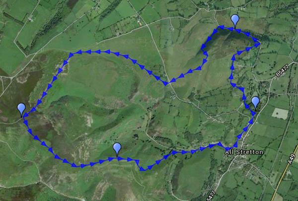
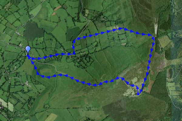
Last gasp of the Long Mynd, before it fades into the fields and pastures of the plain to the north, is Gogbatch. It’s a pleasant – and quiet – spot for a picnic, despite having a (very minor) road running its entire (very short) length. It’s a good spot to begin a walk, too, on this comfortably warm August afternoon. There’s just enough breeze to maintain the comfort as we ascend gradually past Jinlye and Jonathan’s Rock to the main plateau. Our return route skirts the golf course, before descending through deep bracken into the Batch Valley. There’s an inviting but evidently little-used path from All Stretton back towards the slopes of the Mynd. The Himalayan balsam is invading, but brambles and more deep bracken nearly force us to retrace our steps (note to self – bring secateurs next time. And a billhook? And a flame-thrower? Perhaps not).

Map

View OS map on Streetmap http://www.streetmap.co.uk/map.srf?X=345305&Y=296096&A=Y&Z=120

Norton Camp

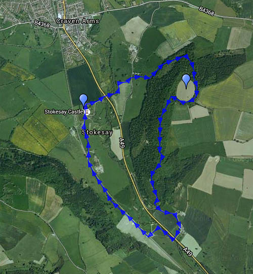
It’s a hill fort, near Craven Arms. Today we’re walking up to Norton Camp from Stokesay Castle, where, on our return, there will be refreshments. It’s warmer than of late, which isn’t saying much. 21C feels warm this summer. Much of this walk is in woodland, but it’s mostly deciduous and quite varied, and contains some interesting things – and occasionally, there are unexpected views. The hill fort isn’t over-exciting (to a lay observer) – the earthworks appear to be substantial but they’re covered in trees and shrubs. We follow the ridge of the hill southwards, to descend by Rotting Lane, crossing the A49 (again, and it’s not easy) and the Onny, to follow tracks close by the railway line back to Stokesay.

MapView OS map on Streetmap http://www.streetmap.co.uk/map.srf?X=344000&Y=280936&A=Y&Z=120
Colourful Coalport

Everything’s in flower, or so it seems, and the butterflies are beginning to cooperate… We’re making the most of a dry and sunny afternoon after a day of rain, with another to come tomorrow, if the forecast is right. The youth hostel at Coalport (beside the china museum) is open for tea and cakes all summer, and the walk’s long enough to feel we’ve earned it (as if we needed an excuse…)

Hope Dale

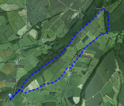
We’re out on the Wenlock Edge, on a beautiful July afternoon. The air is fresh after overnight rain, there’s a pleasant breeze, and plenty of sunshine. We start from the small car park at Harton Hollow, and follow the lane via Middlehope to Wetmore Farm. There are hundreds of butterflies, of several varieties, but none of them are willing to pose for the camera. And there’s a peacock! It’s not the most scenic of walks to Wetmore – the hedges are ten or twelve feet high, though there are views from the occasional field gate. From Wetmore, we head on up to the edge path – at first, it skirts the woodland, and there’s a good view down into the dale and beyond. Then we’re amongst the trees – very pleasant open deciduous woodland, with a good path along the crest of the Wenlock Edge to take us back to the car.

Map

View OS map on Streetmap http://www.streetmap.co.uk/map.srf?X=349460&Y=288786&A=Y&Z=120

Stiperstones – foxgloves, bilberries and kites

July on the Stiperstones: we were up here around this time last year, and nearly melted. Today the sky was blue, with some white fluffy cloud – and it was pleasantly cool, a great afternoon for a walk. The bilberries need a little longer, though they’re ripening nicely. The foxgloves – great clumps of them in places – are in their prime. A red kite crossed the sky, high up, with never a flap – and returned a few minutes later, performing one large circle and then away. Too far away for the camera, but good to see.

Map

View OS map on Streetmap http://www.streetmap.co.uk/map.srf?X=336400&Y=297876&A=Y&Z=120

Pyramids

Orchids – little conical-topped ones – dozens and dozens of them. And one solitary (greater?) butterfly orchid (they’re not common). We’re walking on Wenlock Edge, the same route we followed on a misty day in February (see “A hazy day on Wenlock Edge“). It’s virtually midsummer now – no mist today, instead there’s warm sunshine, and it’s pleasant in the cool shade under the trees.

The map below is the one used in February:
today we walked clockwise – out below the edge, back along it.

MapView OS map on Streetmap http://www.streetmap.co.uk/map.srf?X=359285&Y=298596&A=Y&Z=120

Sheinton to Harley, Wigwig and Homer

Life under the edge

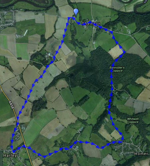
There’s many a double-take by passing motorists on the Shrewsbury – Wenlock road – “Did that sign really point the way to Wigwig and Homer?”. Yes, a hamlet and a small village well-hidden, despite the sign, beneath the northern end of the Wenlock Edge. This was a very pleasant circuit, starting from Sheinton, following farm lanes and tracks past Belswardyne Hall to Harley. “Look at that – the sun’s got a halo”. There’s no need to enter quiet Harley village, and it means crossing the busy A458 twice – but it saves walking beside the noisy road. The lane to Wigwig crosses what was once a ford, and probably still is in very wet weather. In Homer, we leave the road and take to fields of sheep, followed by attractive woodland beside Sheinton brook, then more fields of sheep – and we’re back in Sheinton.

Map

View OS map on Streetmap http://www.streetmap.co.uk/map.srf?X=361005&Y=302661&A=Y&Z=120

Two sunny afternoons

They’re too good to waste! Bright sunshine, fluffy clouds, not too warm – ideal for wandering.

Wednesday: To Benthall Edge and Hall (tea and cake)

Thursday: Long Mynd. A route we’ve done many times, starting from the Cardingmill valley and ascending via the Lightspout (hoardes of schoolchildren – it’s peak field trip season). Beyond the waterfall it’s quiet – just the sheep and the hill ponies to accompany us to Pole Bank. We return along the ridge to Townbrook Valley, a pleasant path to take us back to the start.

Map

View OS map on Streetmap http://www.streetmap.co.uk/map.srf?X=343005&Y=294546&A=Y&Z=120

Brown Clee from the phone box

We’ve done this one before (the phone box in question no longer contains a phone – instead, it’s now the “Little Red Book Stop”) – see “A clear day on Clee Hill” . It was clear this afternoon, warm when the sun shone – which wasn’t often, nor was it for long –  nevertheless, it’s a good place to be.

Map

View OS map on Streetmap http://www.streetmap.co.uk/map.srf?X=359005&Y=286906&A=Y&Z=120