The view from Haughmond Hill

…is tremendous – a wide panorama taking in the Wrekin and Wenlock Edge, the Clee and Stretton hills, the Stiperstones and Breidden, the Berwyns and, in the far distance, mid-Wales peaks. Is that Cader Idris on the horizon? It’s far too good for a hill that needs no climbing – it must be very gently uphill from the car park, but we’re not going to have to stop to get our breath back…

There’s a little snack bar back at the car park, which closes about 5 minutes before we arrive back at the car. Next time perhaps?

Haughmond Hill (Forestry Commission)

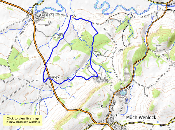
View OS map on Streetmap http://www.streetmap.co.uk/map.srf?X=354250&Y=314018&A=Y&Z=120

To Ironbridge

We’re walking down to Ironbridge this afternoon, past some of the sculptures which once stood at the power station (now closed). If we follow the paths through Workhouse Coppice we can then descend through the woods to the bridge. The busy Wharfage takes us to the antiques centre (one of us is looking for a gift – the purpose of this little outing), then we’ll head back to Broseley up the steep Bridge Road. We’ll have to shelter from the rain first – there are one or two showers about…

Shropshire was once noted for its damsons – they seem to grow everywhere. One of the saddest sights is the windfalls rotting in the gutters. Few people seem to want them today – what a shame!

Wenlock to Benthall…

…and home for tea. It was a last-minute decision – let’s go to Wenlock on the bus (the no. 18 double-decker – top deck, front seats) and walk back – via Benthall Hall for refreshments, of course. It’s not the most encouraging weather photographically – there’s some sunshine, but also some grey skies and a shower or two (which we weren’t expecting). It’s a pleasant outing anyway, calm before the storm perhaps (Aileen is coming tonight, apparently)

Benthall Hall NT

View OS map on Streetmap http://www.streetmap.co.uk/map.srf?X=365070&Y=301486&A=Y&Z=120

Murky Mynd

It didn’t actually rain, but the air did seem rather wet at times. The morning’s drizzle didn’t clear quite as soon as we’d hoped, and there was little point in using the toposcope on Pole Bank, even if we could see at least 10 yards in all directions. Minutes later, the air began to feel much drier. Did we feel a touch of warmth too? The tea and cakes / ice cream, back at the Cardingmill, were of course excellent, though our indulgence was punished by a last defiant little shower as we walked back to the car…

View OS map on Streetmap http://www.streetmap.co.uk/map.srf?X=344105&Y=295146&A=Y&Z=120

Belswardyne blackberries

A walk from Sheinton to Harley and back – out by Homer and Wigwig, back past Belswardyne. The blackberries weren’t the object of the exercise, but when we saw them beside the hedge (well away from the roads) – big, juicy and ripe – we had to stop and pick a few (still had the bags with us from Tuesday’s abortive sortie). They seem to be ready early this year – as will be the bramble jelly!

View OS map on Streetmap http://www.streetmap.co.uk/map.srf?X=360605&Y=302751&A=Y&Z=120

Perkley

A short wander at the northern end of the Wenlock Edge, on a grey but warm and humid afternoon. The blackberries are ripening nicely at present – perhaps we’ll pick a few. That hedge near the end of the walk was well-covered last September… Yes, and it probably will be this September – today there are banks of very unripe berries. Earlier on the walk, we’d passed by some nicely ripe ones (checked, of course, by sampling), but we’d have to carry them with us, so we’ll keep going… It was inevitable, wasn’t it?

View OS map on Streetmap http://www.streetmap.co.uk/map.srf?X=361420&Y=298936&A=Y&Z=120

Catherton Common

Sunday 6 August: we’ve parked here before, but always headed upwards onto Magpie Hill and beyond. Today, we’ll walk in the other direction, to explore the common lands of Silvington and Catherton. At the lowest point (but certainly not the nadir) of our wander, we cross the stream at Cramer Gutter, before heading back past colourful heather and ling. It’s a very absorbing little bit of countryside – scattered cottages, patches of heather and bracken, small stands of birch, clumps of gorse and one particularly fine blackberry bush, which delayed our onward progress for a minute or two…

View OS map on Streetmap http://www.streetmap.co.uk/map.srf?X=363110&Y=278621&A=Y&Z=120

Oats and beans and barley…

…grow near the Munslows in August. A familiar route starting from Aston Munslow – across the sheepy field, up the lane to the edge and along to Munslow Common, then down the lane to Munslow and back across the fields (battling, in the last half mile, with 7′ tall maize) to the start. Very pleasant, even though the undergrowth makes some stretches almost impassable, where the sun can get through the trees.

View OS map on Streetmap http://www.streetmap.co.uk/map.srf?X=351115&Y=287836&A=Y&Z=120

Coalporting

A much-needed leg-stretch down to Coalport (for well-earned tea and cake…), on a grey Saturday afternoon. We may not be past July, but there are signs of seasonal change – the wheat looks ready for harvest, there are some hefty (but undoubtedly sour) apples by the farm, and ripe (but rather blobby) blackberries, with many better-looking specimens to come. Could be an excellent crop in a few weeks time… And at last the butterflies are playing to the camera!

Church Stretton to Craven Arms

We’d thought of doing this by using the train, leaving the car at Craven Arms – then realised we could make the same journey free of charge using our bus passes… An interesting trip too – not entirely along the A49, the Minsterley Motors 435 service uses some very narrow lanes through Wistanstow and Bushmoor. Who’d be a bus driver in south-west Shropshire?

Starting out from the bus stop in Church Stretton, we aim for the top of Ragleth Hill for lunch. We’d have got there quicker if we’d spotted the waymark roundels at the foot of Poplar Drive. Later, after lunch, we find ourselves taking another little detour at Hatton Wood, where the correct path isn’t the obvious one. Soon mended. After the Apedale prairies, we’ve another short climb ahead of us, onto the Wenlock Edge beyond Wolverton. It’s a very enjoyable walk through the trees along here, before we drop down to Strefford and follow the Quinny brook, and later the Onny, back to Craven Arms. On the sound principle that these things come in threes, we take yet another wrong turning where, once again, the obvious route is the wrong one. By the time we arrive in Craven Arms, we’ve earned those ice creams. But what an enjoyable walk! Plenty of variety, and a perfect day for it.

View OS map on Streetmap http://www.streetmap.co.uk/map.srf?X=344805&Y=288161&A=Y&Z=126