…the bluebells, that is. We’re wandering on a sunny afternoon, with the bluebell wood as an objective – probably this year’s last visit.


…the bluebells, that is. We’re wandering on a sunny afternoon, with the bluebell wood as an objective – probably this year’s last visit.
A short wander around Bridgnorth – down to the Severn, where the geese and their goslings are basking in the sun, then up to High Town. A short sharp shower found us under the bridge near the top of Stoneway Steps – perfect timing! Bridgnorth is busy on a sunny Sunday – after a quick walk around the castle grounds and up the High Street, we’re back to the car and home, away from the bustle.


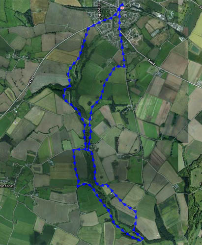
Thursday: a waterside walk from Shifnal to Grindleforge bridge, near Ryton, following the Wesley Brook as it makes its way toward the Worfe – down the west side, and back up the east. It’s all very gentle country – we’re not in the Shropshire hills today. That may be a good thing – there’s only the lightest of breezes, and it feels warm in the fields – the shady wooded stretches come as a relief. Spring is really getting going now – lots of colour beside the path.


")


View OS map on Streetmap http://www.streetmap.co.uk/map.srf?X=374345&Y=305606&A=Y&Z=120
Not walking today – just enjoying the warm sunshine at Stokesay Castle. The swallows are building their nests in the ceilings of the ancient building, and over by the main road, a red kite is wheeling, almost at rooftop level.
Stokesay Castle (English Heritage)


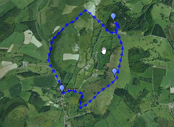
Hopesay lies in a side valley off the Clun valley – so quiet that it should have been listed with the latter’s “quietest places under the sun”. Its hill, owned by the National Trust, is an airy grassy ridge, adorned by a well-placed clump of trees. Wart Hill, immediately to the north of Hopesay Hill, is clad in forestry pines, which thin towards its top sufficiently to appreciate how good the view would be if they were all cut down… It’s Easter Sunday, but there are few others about – one or two walkers, a farmer tending his sheep. And, of course, the buzzards – and red kites (or possibly one red kite three times). One landed in a tree close by, a brief glimpse of colour before he was away again, too quick for the camera (or its operator…)


 View OS map on Streetmap http://www.streetmap.co.uk/map.srf?X=339460&Y=284065&A=Y&Z=120
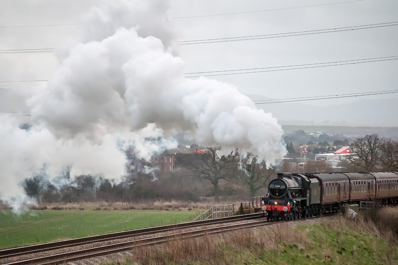 Jubilee “Leander” could be mistaken for a Black 5 – now in BR black livery as 45690, after years of LMS maroon – though the lines of a 5XP are perhaps just that bit finer than the slightly stockier 5MT. Whatever the colour or shape, and despite the dull weather, Leander made a fine sight and sound on Shrewsbury’s Battlefield bank this afternoon. (See also “Leander in black” on Geoff’s Rail Diaries)
There weren’t many, it has to be said. There are a few primroses out on this fine afternoon, and one or two celandines – and in the last few yards, some lambs enjoying the sunshine. It was good to be out despite the cold air, though spring isn’t quite here yet, I think.


View OS map on Streetmap http://www.streetmap.co.uk/map.srf?X=366365&Y=297016&A=Y&Z=120
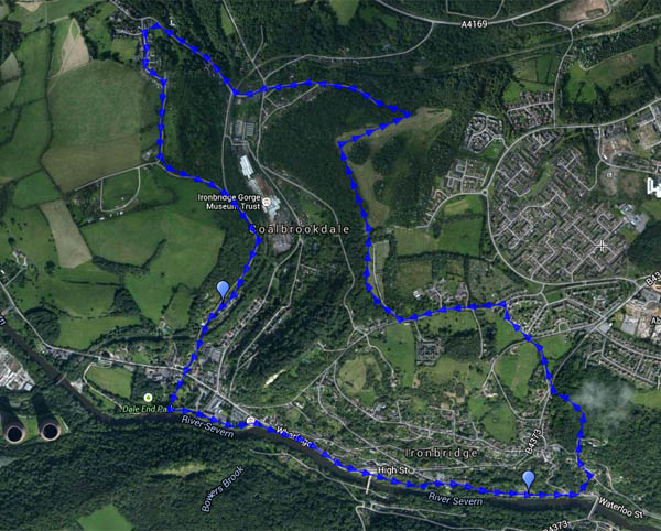
It’s been cold and showery recently, but today the temperature made double figures, and the Met Office reckoned it wouldn’t rain before four o’clock. We’d better get out and stretch our legs. Considering that the walk began at Bedlam (the old furnaces beside the Severn), it was quiet in south Telford. We crossed the hill west of Woodside and descended (a little) to the coke hearth, before heading up to Sunniside, returning to the dale past the assorted livestock at the farm – donkeys, llamas, ostriches and geese (and possibly more). We’re heading for the tea room beside the old railway station (excellent cakes – worth hurrying to get there before they close at 3pm). Suitably refreshed, we follow the riverbank back to the car.


View OS map on Streetmap http://www.streetmap.co.uk/map.srf?X=367415&Y=304216&A=Y&Z=120
It’s not a very high peak, but snow on top made the Wrekin look most inviting. I accepted! It’s cold today – lower down, on the northern slopes, the mud on the path was frozen hard. Higher up, the snow had been well trodden and polished, and the path was treacherous. The antics of descending walkers persuaded me to continue over the top and down through the trees towards Little Hill, to return through the woodland. The sun, which had sneaked behind a patch of cloud, came back out and shone brightly again once I was well into the forest. There’s no snow down here, and the air has been warmed a little – there’s serious mud…


 View OS map on Streetmap http://www.streetmap.co.uk/map.srf?X=362970&Y=308206&A=Y&Z=120
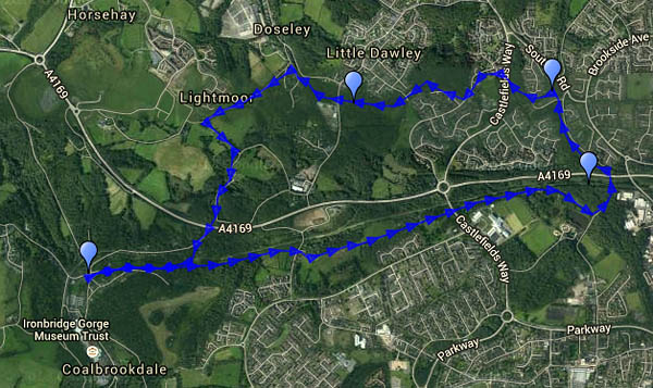
A district of Telford is named after the c1792 sandstone bridge built to carry the western branch of the Shropshire Canal over the turnpike road. Both are long redundant, but their courses remain. Though we’d driven through the area very many times, we’d never sought out the structure – perhaps we ought to go and have a look? Sadly, it’s in need of renovation, and much of it is hidden behind corrugated steel sheets. We walked there from the “coke hearth” at the top of Coalbrookdale, along the trackbed of a pre-railway age tramway, with beside us the railway which still carries fuel to the power station. We left this route where it was once crossed by the Coalport branch line, following the latter a short way to the aqueduct. Now our route would follow, on and off, the canal – to a point where it was crossed by a wagonway – another ancient bridge with a plaque to confirm the fact, though its construction date seems to be unknown. Whatever its age, it made an excellent spot to shelter from a sudden sharp flurry of snow… We returned to the car along rough lanes before descending once again to the wagonway beside the railway. Most of our walk had been on, or beside, ancient transport routes, mostly unseen and unknown by today’s road users.


View OS map on Streetmap http://www.streetmap.co.uk/map.srf?X=367995&Y=305276&A=Y&Z=120
