A wander with the camera around Blists Hill Victorian Town – a pleasant way to spend an afternoon.
Here for the view
That’s not the only reason – it’s a great place for an enjoyable walk, especially on a fine afternoon like this. The forecast said the clouds would clear – and they did, on schedule too.
View OS map on Streetmap http://www.streetmap.co.uk/map?X=347500&Y=293335&A=Y&Z=120
Darley and Willey
The sun’s there somewhere – it’s trying! There are a few patches of blue in the sky, but they never quite coincide with the sun’s position. Not to worry – it’s not raining, and it’s drier underfoot than it’s been for a while. I’m taking to the fields and unsurfaced tracks, down to Dean Brook and Darley, then past the Honeypot (yes, really!) to Willey. I’m on my way home now, heading over the hill to Deancorner and along the farm lane back towards the start. A pleasant afternoon – it’s good to be out.
View OS map on Streetmap http://www.streetmap.co.uk/map.srf?X=367695&Y=300145&A=Y&Z=120
Barmouth Bridge
Friday 26 January: we’re off to the Welsh coast, to see the rebuilt Barmouth Bridge – a remarkable bit of engineering and planning. We’re going by rail, a journey which suffers half-an-hour delay on the way back – leading to unanticipated bonuses at Machynlleth. Silver linings? This little cloud proved to have a golden lining!
There are more photos of the rail-related aspects of this outing and a couple of interesting video links on Geoff’s Rail Pages – visit The new Barmouth Bridge for the full story
View OS map on Streetmap http://www.streetmap.co.uk/map?X=261750&Y=314630&A=Y&Z=120
Heading south
![]()
Just published to Geoff’s Rail Diaries – photos and an account of my journey from Kyle of Lochalsh to Dunbar on 13 January. Travel “South from Kyle” – now!
Bedlam to Coalbrookdale
A regular good leg-stretch – up and over from Bedlam furnaces to Coalbrookdale, down Coach Road to the riverside, and back to the start through Ironbridge. If I time it right, I’ll stay dry…
View OS map on Streetmap http://www.streetmap.co.uk/map?X=367300&Y=303980&A=Y&Z=120
Skye: day 6 – to the bothy
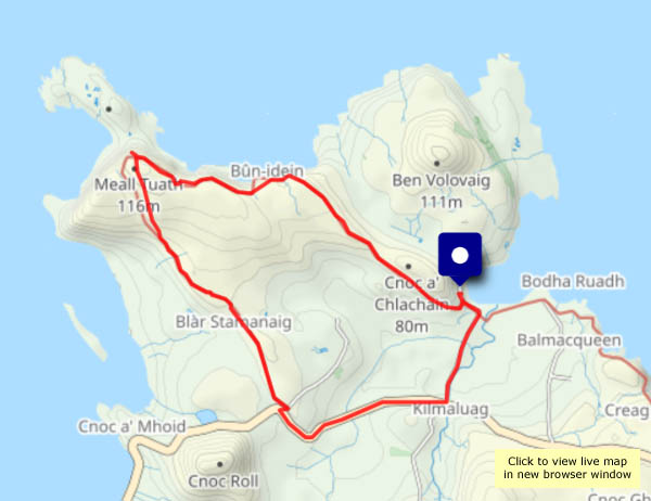
Thursday 11 January: my last day of wandering, and the weather’s beginning to change. It remains calm and dry, but there’s more cloud about. Tomorrow there are domestic duties to attend to, and on Saturday, I begin my journey home. Today I’m walking the first stretch of the Skye Trail, to the bothy high above Rubha Hunish, the most northerly point of the island. In better times, I’d be down the very steep path to the spit of land below, where lies that northern tip, but it could be icy, and if I did go down there, it would be dark before I got back to the start. I’ll content myself with wonderful sea views, and some beautiful light as the sun sinks on this exceptional week on Skye.
View OS map on Streetmap http://www.streetmap.co.uk/map?X=141525&Y=875598&A=Y&Z=120
Skye: day 5 – Glen Conon
Wednesday 10 January: The south side of Glen Uig is home to the Fairy Glen. It’s in deep shade – and blue with frost reflecting, yet again, a cloudless blue sky on another windless day. To the north side is Glen Conon, which seems to be the name of the settlement of scattered houses beside the road, which climbs from opposite Rankin’s shop by some remarkable zig-zags (the river in Glen Uig is the Conon). Beyond the bends, the very quiet road provides a panoramic view of the glen and, at its head, Beinn Edra, a summit on the Trotternish Ridge. It’s an ‘out-and-back’ walk, most enjoyable on this wonderful January day.
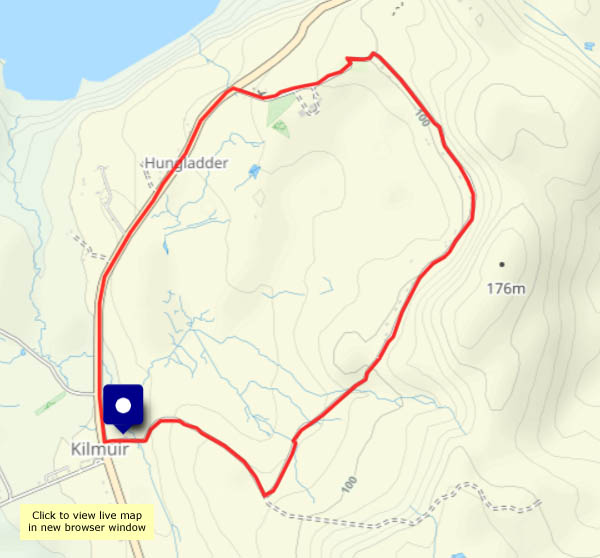
View OS map on Streetmap http://www.streetmap.co.uk/map?X=140395&Y=863878&A=Y&Z=120
Skye: day 4 – north from Flodigarry – twice!
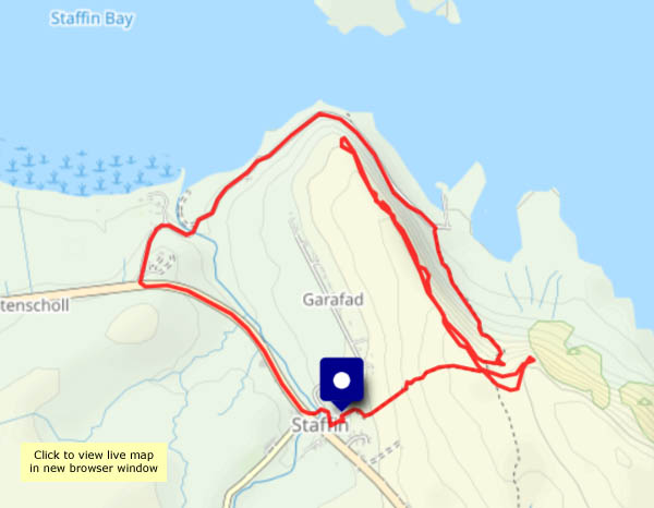
Tuesday 9 January: a walk along part of the Skye Trail, with an unintended double back… I started down the road to Flodigarry, from where I followed the trail. The route was pretty clear on OpenStreetMap, but it’s not shown on the OS map… There was a way up a cleft in the low line of crags, but I thought I’d seen a better way up. I hadn’t – I ended up back at Flodigarry, where happily I found an easy scramble up onto the hilltop and eventually regained the route. Another fine, still, blue-sky frosty day – mud would have made things difficult, but it was mostly frozen hard. The views to Lewis and to the north-west Highlands are wonderful!
View OS map on Streetmap http://www.streetmap.co.uk/map?X=145720&Y=872765&A=Y&Z=120
Skye: day 3 – the Rha Glen road
Monday 8 January: almost certainly, this road is thought of by thousands of summer visitors as the Quiraing road. But it’s early January, so the road is quiet – and we’re not heading for the Quiraing. Instead, we’re enjoying the bright sunshine under a clear blue sky. It may be frosty, but there’s not a breath of wind, and apart from one or two cars which pass, it’s completely silent.
About a mile and a half up the road, a clearly-defined path rises to our left – let’s see how far we can get. There’s an interesting little rocky outcrop, and we can now see beyond the crest of the ridge to Loch Snizort and the outer isles. We could perhaps get a little closer to the edge and look down on Kilmuir? Perhaps not – after a couple of false starts, we realise we’re going to get wet feet, and the sun is getting lower. We’ll head back to the car, parked in the space high above Uig Bay.
View OS map on Streetmap http://www.streetmap.co.uk/map?X=139090&Y=865098&A=Y&Z=120