
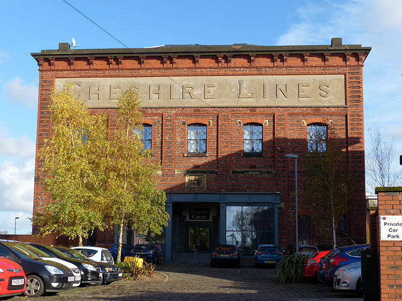
 Just published to Geoff’s Rail Diaries, an illustrated account of a great day out, using a “Cheshire Day Ranger” ticket. Visit “Cheshire Lines Revisited” – now!
Ice-cold in Coalport
I exaggerate – but a friend said there had been snow in Wellington this morning. We certainly wouldn’t have wanted to be caught in one of the morning’s sharp showers, but the afternoon would be bright and sunny (and cold, and it will be good to stay out of the wind…). Yes, the weather forecast was right. The colours are so much better at this time of year, aren’t they? There’s only one problem – the tea shop in the youth hostel is closed during the winter months. We’ll have to make do with chocolate (it’s what camera bags are for, isn’t it?)


Mucklewick mud
Friday 10 Nov: One of us felt we should visit the Christmas fair at the Bog Centre – it would be quieter, perhaps, than the Saturday and Sunday. While we’re out there, a walk would be in order – it’s bright and breezy, with plenty of sunshine and just the odd spot of rain in the wind every now and then. We set off with no firm route in mind, and ended up with a route that was decidedly unfirm. The last few fields were seriously soggy – it was “pick your way very carefully” territory. If the Christmas fair was relatively quiet, the walk was even quieter – we saw no-one from leaving the Bog until we returned a couple of hours later. I don’t think I’ve ever seen anyone else on Mucklewick Hill. I’m not complaining…


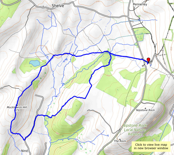
View OS map on Streetmap http://www.streetmap.co.uk/map.srf?X=334345&Y=297286&A=Y&Z=120
Beech and birch…
…on Cannock Chase. It’s a perfect late-autumn morning, ideal for a walk over the Chase, to the visitor centre for lunch. We’ve earned bacon baps today, though the real reward is the colour in the remaining leaves, especially when seen against that clear blue sky. There are few left on the silver birch, but those on the many beech trees which line the edge of the coniferous forest are glowing in the sunshine.


 View OS map on Streetmap http://www.streetmap.co.uk/map.srf?X=398845&Y=316371&A=Y&Z=120
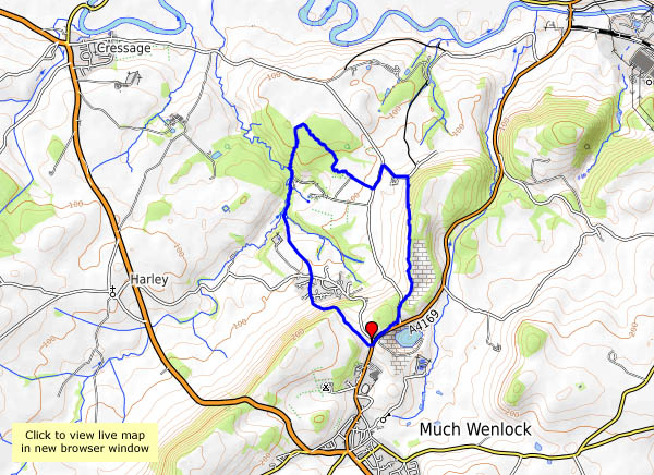
A short Wenlock wander
The afternoon is wearing late – there’s only time for a short walk. We’ll have a wander around Wenlock…


 View OS map on Streetmap http://www.streetmap.co.uk/map.srf?X=361440&Y=300141&A=Y&Z=120
On Dinmore Hill …
… lies Queenswood, an area of managed woodland with, at its heart, an arboretum – just the place for an outing on a cold but sunny day. It’s a popular spot – there’s a party of very small schoolchildren gathering leaves, numerous young mums and offspring, and the inevitable dog-walkers, but away from the autumnal specimens and the viewpoint (too hazy today for really good views) it’s quiet, and very pleasant too.


View OS map on Streetmap http://www.streetmap.co.uk/map.srf?X=350460&Y=251080&A=Y&Z=120
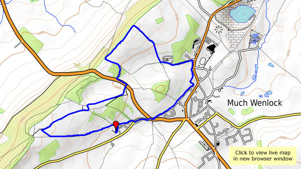
An unseen kite
The clocks have gone back – it’ll be dark early, and we’re making the most of a fine sunny afternoon. Wenlock to Bannister’s Coppice will be a pleasant stroll – perhaps we’ll see some deer? We did – a sizeable herd, in the depths of the wood, just distant shapes moving quickly but quietly between the trees. No chance of a photograph. What we did achieve was a photographic record of a red kite, quite accidentally. I only saw it when checking through the photographs later – that speck in the sky has a pretty distinctive shape…


View OS map on Streetmap http://www.streetmap.co.uk/map.srf?X=362135&Y=302151&A=Y&Z=120
Late October on the Mynd
Friday 27 October – a bright sunny day, far too good for staying at home, so we’ve packed a picnic… It’s very busy in Church Stretton, but we soon lose the crowds – the Pike provides a quick way up onto the hill, at the top corner of the golf course. At this point, we attempted to follow the path clearly shown on the OS map, which is a mistake, as it doesn’t exist. The clear, easy-to-walk path is 100 yards to our left, higher up the hill. At least its quiet along here…
We take our lunch break by the pond, near the top of Mott’s Road, before heading to the summit, then returning to the car by Townbrook Valley. It’s a bit quieter down here – and finally, we time the tea room to perfection… A good day out!


View OS map on Streetmap http://www.streetmap.co.uk/map.srf?X=343320&Y=295091&A=Y&Z=120
Kites and alpacas…
It’s busy on the Stiperstones this afternoon – lots of black sheep, at least two red kites, a grouse, a good number of alpacas and several llamas. There were quite a few people too, in the more popular parts – something to do with it being half-term, and the weather fine, clear and sunny? Young parents and children, a largish party armed with pointy sticks and a large group of – were they schoolteachers? Our greatest fear was that they might arrive at the Bog before we did, and that it might be packed anyway. Our fears were unfounded – just a medium-sized group around one of the tables, and it seems one of us knew them all anyway, so that was OK. The tea and cakes were, as ever, excellent (and well-earned, of course).


View OS map on Streetmap http://www.streetmap.co.uk/map.srf?X=336375&Y=297956&A=Y&Z=120&ax=335475&ay=299701
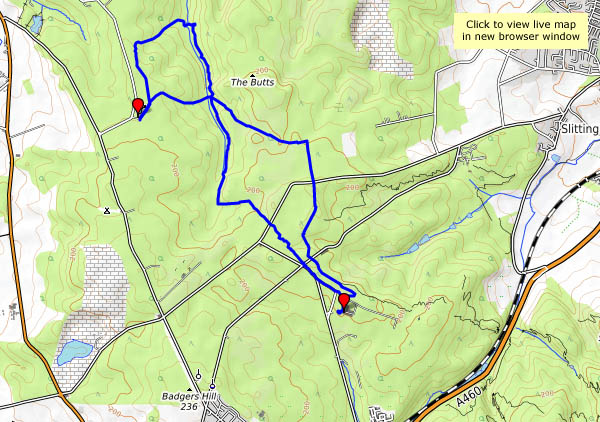
Bedlam to Coalbrookdale
The remains of the ancient iron furnaces at Bedlam were open to the elements until very recently – now they have a cover – a canopy with substantial steel supports. We’d better take a look. Afterwards, we’ll wander over the hill, and down Church Road, viewing the closed power station through the trees (there’s a common theme to this little walk…). At the top end of Coalbrookdale the viaduct no longer serves its purpose. The woodland path to the old railway station, now in the care of the Green Wood Centre, overlooks the iron works, soon to cease production. It’s been a quiet walk so far, but now we’re dodging the many visitors to Ironbridge as we walk beside the river back to the car. At least one thing is still thriving here.


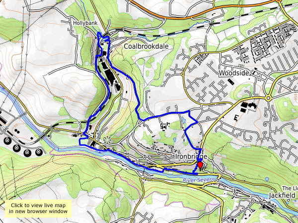
View OS map on Streetmap http://www.streetmap.co.uk/map.srf?X=367367&Y=304093&A=Y&Z=120
