A soft green day in border country

Friday 11 June: a walk from Llangunllo to Knighton, in weather that makes the landscape feel very soft and green. There’s dampness in the air, and for a time we have our waterproof tops on, but they’re hardly necessary. “We ought to see a red kite or two” – yes, we did! One landed on the fence, just about within camera range, and perched for a while (looking soggy and grumpy) before, with little more than a flap, gliding away, making the most of the lightest of breezes.

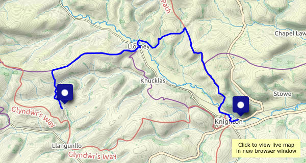
This is a walk of two halves – Wales and England (Shropshire). Knighton is a Welsh town, but its railway station is in England (just, a matter of yards). We leave the train at Llangunllo (Wales), and walk to the crest of the ridge of Wernygeufron, which descends very gently to the hamlet of Lloyney. There, we cross the river Teme to find ourselves in England again (at Llanfair Waterdine). A steady pull, steep in places, takes us up to Offa’s Dyke and another enjoyable ridge. Finally, a steep descent leads us down to the river once more. Walking downstream and eastwards, we find a sign: Croeso i Gymru – Welcome to Wales. Fifteen minutes later, a pint (of Shropshire beer, from Bishops Castle) is well-earned refreshment – croeso i gwrw! – welcome to ales…

View OS map on Streetmap http://www.streetmap.co.uk/map?X=325225&Y=273636&A=Y&Z=126

The sun goes down…

… Behind the isles – at this time of year, South Harris. There have been times when, during our stays on Skye, we haven’t seen what we would call a sunset (there have been times when we haven’t even seen the Western Isles), but this time we’ve had some clear skies and a nightly spectacle in the west. The sun sets around 10pm in these parts in late May…

Going out on a high!

Wednesday 2 June: ‘High’ is relative – at no point am I more than 1,200ft above the sea, but the top of Sròn Vourlinn is isolated and exposed – and quiet.  For every 1,000 visitors who park at the Quiraing car park* and head this way, I suspect fewer than one comes this far. As I approach the airy overhanging ridge, there are a couple of other people, but they’ve gone within minutes, and soon I’m sitting on the springy turf surveying the scene. Once again, I’ve got a fine viewpoint entirely to myself. Tomorrow we’re heading home, by a roundabout route – this is a great way to close the Skye chapter

* I started out from the small parking area near Flodigarry, ascending past Lochs Langaig and Hasco, joining the main path amongst the spectacular pinnacles beyond the Quiraing.

View OS map on Streetmap http://www.streetmap.co.uk/map?X=145548&Y=870651&A=Y&Z=120

Uig and the Fairy Glen

Monday 31 May: It’s firmly (and deservedly) on the tourist trail – it’s also a pleasant walk from Uig, which solves the problem faced by most visitors – where to park the car? Since our last visit, a couple of years ago, lots of new parking space has been created by the local authorities – but I think we’ll stick with the walk. The views from the road are pretty good, especially when the ferry arrives, doing an impressive hand-brake turn to tie-up and unload at the end of the pier.

View OS map on Streetmap http://www.streetmap.co.uk/map?X=140735&Y=863557&A=Y&Z=120

The far north

Sunday 30 May: Rubha Hunish, Skye’s northernmost point – a great place to be, especially if I get there before the others… I’m walking by 9.30, and there’s hardly anyone else about. I pass three, then two more people – they’ve been staying overnight in the bothy, the former coastguard lookout on Meall Tuath, which overlooks the little Hunish peninsula. Am I alone now? No – as I descend the precipitous path down the cliff face, I hear voices. Four people appear to have just reached the foot of the cliff path – I can only just see them, but one particularly strident voices carries clearly. (Why do people so carelessly destroy what they, and others, have come for?).

The noisy people look as though they’ll walk clockwise around Hunish, though for now they’re lingering on the shore. I’ll walk anticlockwise – that way, they won’t be in earshot just ahead or behind me, apart from when we pass. Much later, I realise I never saw – or heard – them again! Did they just go back up and miss out on all the interest down here?.

There are cliffs on the eastern side, and three fine stacks – then the northern tip, where I sit a while and watch the world go by. There’s a dolphin, or similar, out there, and a seal pops up for a moment. Then HMS Lancaster sails by…

All too soon I’m back at the top of the cliff path, looking back. One other person has just descended – now they have Hunish to themselves. Crossing the moor on the way back, a few others pass, heading for the clifftop. I’ve timed it right today!

View OS map on Streetmap http://www.streetmap.co.uk/map?X=141565&Y=875652&A=Y&Z=120