Midwinter meandering

Circumstances (not least the weather) have conspired to keep the camera indoors for a couple of weeks – it was suffering from lack of exercise (so was its owner). Today it’s bright and dry – time for a local leg stretch. Our last outing was to see the cooling towers meet sudden destruction – I’ll look down on the site, and see how it compares with our last view from this position, high up in the woods on Benthall Edge.

To the Wrekin!

For complex (and mildly embarrassing*) reasons, a walk on the Long Mynd became a walk up the Wrekin. The hill is lower and the walk shorter, but it’s not an inferior substitute – it provides us with a very enjoyable leg stretch and a good place to sit and enjoy our sandwiches. Afterwards, tea and cake in Much Wenlock replace the intended refreshments in the Carding Mill pavilion – similarly, not at all inferior. A most enjoyable little outing!

*I forgot my boots!

View OS map on Streetmap https://www.streetmap.co.uk/map.srf?X=363280&Y=308451&A=Y&Z=120

December days

First day of December – and first day of (meteorological) winter. They’re short, but when they’re dry and sunny, it’s good to be out. It’s a familiar route for us – out past Hurst Farm pools, down through the field (a significant part of which came home on our boots) to Shore Pool, and back up the estate road past Aldenham Park. Most enjoyable!

View OS map on Streetmap https://www.streetmap.co.uk/map.srf?X=366995&Y=295721&A=Y&Z=120


There’s no-one here!

We’ve had lunch, the rain has stopped and the sky has cleared, so we’re taking a stroll from Ironbridge to the top of Coalbrookdale and back. It’s a pleasant afternoon – mild, bright and mostly dry (it’s trying to rain when we get back to the car). But where are all the people? There’s no-one else on the bridge, the Wharfage is deserted, Coalbrookdale’s quiet. Most unusual!

View OS map on Streetmap https://www.streetmap.co.uk/map.srf?X=366895&Y=304151&A=Y&Z=120

Bickerton Hill

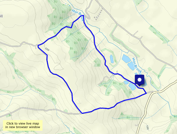
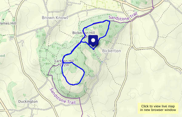
Sunday afternoon: we’re away from our usual haunts, up in the south-western corner of Cheshire, which unlike parts of the county, isn’t plain. These sandstone hills are not very high, but only a little elevation is needed for the extensive views in all directions – once we’re out of the woodland, that is. Away to the north-west, we can make out Liverpool and its cathedral (one of them), and there’s the reassuring outline of the Wrekin to the south. It’s good underfoot too – sandy paths and not much mud, despite recent rain. But it’s busy on Bickerton Hill! There are lots of people everywhere, especially on the main drag up from the car park to Kitty’s Rock and the hill fort at Maiden Castle. It’s not quiet here! We’ll come again, and explore more of the Sandstone Trail – on a school-term weekday…

Bickerton Hill NT

View OS map on Streetmap http://www.streetmap.co.uk/map.srf?X=349960&Y=353210&A=Y&Z=120