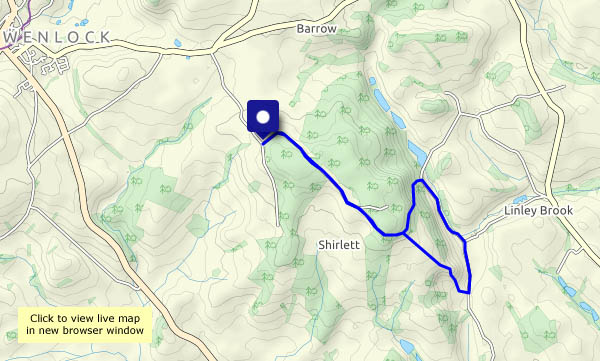
After a damp morning, the sky’s cleared and it’s a fine, bright and clear afternoon. There’s a cool breeze, but it definitely feels like spring up here
View OS map on Streetmap http://www.streetmap.co.uk/map.srf?X=355085&Y=298270&A=Y&Z=120
After a damp morning, the sky’s cleared and it’s a fine, bright and clear afternoon. There’s a cool breeze, but it definitely feels like spring up here
View OS map on Streetmap http://www.streetmap.co.uk/map.srf?X=355085&Y=298270&A=Y&Z=120
A variety of subjects for the camera, in familiar places…
View OS map on Streetmap http://www.streetmap.co.uk/map.srf?X=366240&Y=297950&A=Y&Z=120
Snow showers? It must be spring! It’s pretty cold too, with an icy breeze in the more exposed parts. Out of the wind, the sunshine is warm, and the shower’s only a few flakes in the wind. There are more around though – we’ve done well to avoid them. A pleasant walk (keep moving!) in the quiet countryside around Hurst Farm and Aldenham Park.
View OS map on Streetmap http://www.streetmap.co.uk/map?X=366910&Y=295745&A=Y&Z=120
There are old railways, the routes of old plateways and a former canal crowded into the land between the top of Coalbrookdale and Little Dawley. The canal was effectively replaced by the railway, the last traffic on which ended when the power station closed. Its track is still in place, unlike the plateways, last used in this area in the 1930s. Their former trackbeds provide walkers with interesting and quiet byways through this surprisingly rural part of south Telford.
View OS map on Streetmap http://www.streetmap.co.uk/map?X=367690&Y=305690&A=Y&Z=120
Quiet lanes and even quieter woodland in the little-known country below Wenlock Edge. Other than a cyclist or two on the road, and a distant family (complete with dog), there’s no-one else around – just the alpacas by the old mill, and lots of deer footprints in the woods.
View OS map on Streetmap http://www.streetmap.co.uk/map?X=361525&Y=303170&A=Y&Z=120
We start near Tigger’s Ickle Shop (see Holdgate and Rowe Lane) – and we’re there in the nick of time, for as we select one or two tasty-looking items, a horde of noisily-chattering locusts (thirty or more, all dressed as walkers) descends eagerly upon the roadside stall. Minutes later, we’re heading in the opposite direction (by choice) and it’s quiet along Rowe Lane, with good views to left and right from this minor ridge. Rowe Lane was once the main way along Corvedale, and a mile or so later, we’re following another old way – a narrow stream that pretends to be a footpath. Having survived the particularly muddy last few yards of this path (where our spirits are lifted by the call of a curlew), we’re back onto good surfaces, for the track past the remarkable moated farmhouse at Thonglands. A very pleasant wander in a quiet corner of the county.
View OS map on Streetmap http://www.streetmap.co.uk/map?X=354110&Y=288290&A=Y&Z=120
The skies have been pretty clear of clouds recently; today, there are feathers in the sky over Willey. We’re out in the morning, and it’s pleasantly warm – jackets not required. The world is turning green, and the clocks go forward at the weekend – whoopee!
View OS Map on Streetmap http://www.streetmap.co.uk/map.srf?X=367580&Y=297955&A=Y&Z=120
There’s lots of bustling in our hedgerows this afternoon (we’re not alarmed) – shortly after we’d seen and snapped the brimstone, we heard scurrying, and I glimpsed movement. (Was that a weasel, I wondered) Moments later my wife saw it. “Was that a weasel”. I guess it must have been. Some time after, hearing another rustle nearby, we stood stock-still for a little while – to see a small furry body scuttle rapidly out of sight. Mouse? Vole? It didn’t hang around! It’s that time of year, I suppose, when the local inhabitants are busily preparing for the coming season. Spring cleaning? Who knows!
View OS map on Streetmap http://www.streetmap.co.uk/map?X=361570&Y=299945&A=Y&Z=120
Four times – and (quite by chance) in chronological order. The Iron Bridge dates from MDCCLXXIX (or 1779), the Coalport bridge was built in 1818. Next in sequence I’m crossing the Jackfield Memorial Footbridge, dating from 1922. My last crossing is over the modern ‘Free Bridge’. It replaced an earlier free bridge in 1994 – ‘free’ as in toll-free, unlike the 1779 bridge where a toll was levied. They’re all free now, of course.
View OS map on Streetmap http://www.streetmap.co.uk/map?X=368420&Y=302750&A=Y&Z=120