The afternoon is wearing late – there’s only time for a short walk. We’ll have a wander around Wenlock…


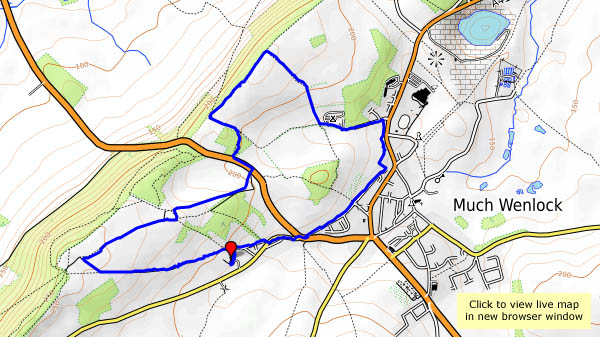 View OS map on Streetmap http://www.streetmap.co.uk/map.srf?X=361440&Y=300141&A=Y&Z=120

The afternoon is wearing late – there’s only time for a short walk. We’ll have a wander around Wenlock…
View OS map on Streetmap http://www.streetmap.co.uk/map.srf?X=361440&Y=300141&A=Y&Z=120
The clocks have gone back – it’ll be dark early, and we’re making the most of a fine sunny afternoon. Wenlock to Bannister’s Coppice will be a pleasant stroll – perhaps we’ll see some deer? We did – a sizeable herd, in the depths of the wood, just distant shapes moving quickly but quietly between the trees. No chance of a photograph. What we did achieve was a photographic record of a red kite, quite accidentally. I only saw it when checking through the photographs later – that speck in the sky has a pretty distinctive shape…


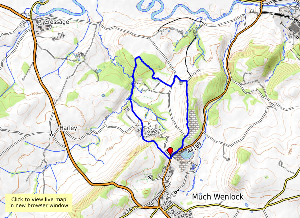
View OS map on Streetmap http://www.streetmap.co.uk/map.srf?X=362135&Y=302151&A=Y&Z=120
Friday 27 October – a bright sunny day, far too good for staying at home, so we’ve packed a picnic… It’s very busy in Church Stretton, but we soon lose the crowds – the Pike provides a quick way up onto the hill, at the top corner of the golf course. At this point, we attempted to follow the path clearly shown on the OS map, which is a mistake, as it doesn’t exist. The clear, easy-to-walk path is 100 yards to our left, higher up the hill. At least its quiet along here…
We take our lunch break by the pond, near the top of Mott’s Road, before heading to the summit, then returning to the car by Townbrook Valley. It’s a bit quieter down here – and finally, we time the tea room to perfection… A good day out!


View OS map on Streetmap http://www.streetmap.co.uk/map.srf?X=343320&Y=295091&A=Y&Z=120
It’s busy on the Stiperstones this afternoon – lots of black sheep, at least two red kites, a grouse, a good number of alpacas and several llamas. There were quite a few people too, in the more popular parts – something to do with it being half-term, and the weather fine, clear and sunny? Young parents and children, a largish party armed with pointy sticks and a large group of – were they schoolteachers? Our greatest fear was that they might arrive at the Bog before we did, and that it might be packed anyway. Our fears were unfounded – just a medium-sized group around one of the tables, and it seems one of us knew them all anyway, so that was OK. The tea and cakes were, as ever, excellent (and well-earned, of course).


View OS map on Streetmap http://www.streetmap.co.uk/map.srf?X=336375&Y=297956&A=Y&Z=120&ax=335475&ay=299701
The remains of the ancient iron furnaces at Bedlam were open to the elements until very recently – now they have a cover – a canopy with substantial steel supports. We’d better take a look. Afterwards, we’ll wander over the hill, and down Church Road, viewing the closed power station through the trees (there’s a common theme to this little walk…). At the top end of Coalbrookdale the viaduct no longer serves its purpose. The woodland path to the old railway station, now in the care of the Green Wood Centre, overlooks the iron works, soon to cease production. It’s been a quiet walk so far, but now we’re dodging the many visitors to Ironbridge as we walk beside the river back to the car. At least one thing is still thriving here.


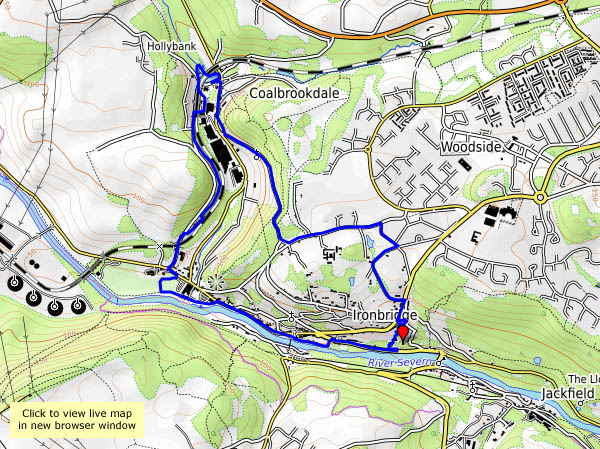
View OS map on Streetmap http://www.streetmap.co.uk/map.srf?X=367367&Y=304093&A=Y&Z=120
Keeping the legs well-stretched – a walk down to Ironbridge and back, to have a closer look at the work going on at Bedlam furnaces and the bridge itself. Tea and cake too!


Tuesday: We’re exploring in the southern part of the Clee hills – Magpie Hill and Titterstone Clee, and Clee Hill itself (Cleehill – all one word – is the village). The curiosities are many, not all easily explained. Who would think to name a place “Random”? Then there’s the three-forked pole – shropshirehistory.com quotes a map of 1571 which described it as a “A fforked pole neare to a place whence on old Stone Crosse stood formerly”. Those space-age mushrooms on Titterstone Clee (there was once a rocking or “teetering” stone) are not quite what one would expect, though, visible from miles around, they aren’t really unexpected. But those brick-built figures of eight – what were they for?


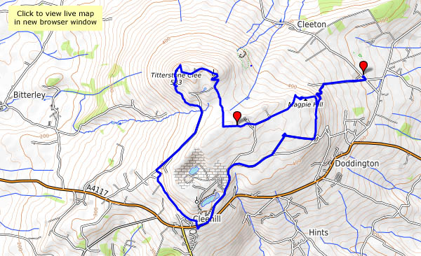
View OS map on Streetmap http://www.streetmap.co.uk/map.srf?X=360620&Y=276671&A=Y&Z=120
That’s all this little excursion was, on a grey and windy afternoon. Lots of bright autumn colours in the hedgerow leaves, but they’re blowing about in the wind, making photography difficult. Plenty of sloes though. Given that the little sour things were the main objective, with leg-stretching a close second, it was a successful trip…


Not just parasols (one of which looks more like a sombrero), though their size makes them rather obvious – there are all kinds of fungi up on Brown Clee at this time of year, from the mundane to the weird and wonderful. It’s a very pleasant afternoon to be out on the hill – barely a breeze at first, with a blue sky and white fluffy clouds. Later, the sunshine becomes rather watery, but it stays dry, and the light’s just right for those monster mushrooms as we return to the car.


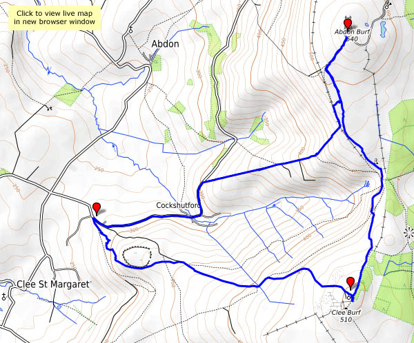
View OS map on Streetmap http://www.streetmap.co.uk/map.srf?X=358940&Y=285446&A=Y&Z=120
…is tremendous – a wide panorama taking in the Wrekin and Wenlock Edge, the Clee and Stretton hills, the Stiperstones and Breidden, the Berwyns and, in the far distance, mid-Wales peaks. Is that Cader Idris on the horizon? It’s far too good for a hill that needs no climbing – it must be very gently uphill from the car park, but we’re not going to have to stop to get our breath back…
There’s a little snack bar back at the car park, which closes about 5 minutes before we arrive back at the car. Next time perhaps?
Haughmond Hill (Forestry Commission)


View OS map on Streetmap http://www.streetmap.co.uk/map.srf?X=354250&Y=314018&A=Y&Z=120

