Narrow gauge heaven

Sragi No 1 and CSR 19 bustle along with a passenger train

It’s the Statfold June open day – and, as ever, there are narrow gauge steam locomotives everywhere. One on each end of the two trains on the new line, lots more on the old line – the freight has no fewer than four locomotives, two at each end. Haven’t attempted to count them – perhaps if I can’t get to sleep tonight (better than sheep…). A “Rail Diaries” page will appear in a day or two – in the meantime, here’s just one taster.

Two sunny afternoons

They’re too good to waste! Bright sunshine, fluffy clouds, not too warm – ideal for wandering.

Wednesday: To Benthall Edge and Hall (tea and cake)

Thursday: Long Mynd. A route we’ve done many times, starting from the Cardingmill valley and ascending via the Lightspout (hoardes of schoolchildren – it’s peak field trip season). Beyond the waterfall it’s quiet – just the sheep and the hill ponies to accompany us to Pole Bank. We return along the ridge to Townbrook Valley, a pleasant path to take us back to the start.

Map

View OS map on Streetmap http://www.streetmap.co.uk/map.srf?X=343005&Y=294546&A=Y&Z=120

Etruria – bones and boats

That’s Stoke-on-Trent, not Italy, though there’s a connection –  pottery. The Etruria Industrial Museum preserves, in working order, Jesse Shirley’s Bone and Flint Mill, for many years a supplier of finely ground calcined bone and flint (oddly enough) for the manufacture of Staffordshire china. Steam powered, the museum operates on a limited number of days each year – including this weekend, when there would be a gathering of working boats on the canal beside the works. Somewhere old – and for us, somewhere new, a most interesting little outing (and tea and cakes, but sadly not oatcakes – they’d all gone…).

Etruria Industrial Museum

Brown Clee from the phone box

We’ve done this one before (the phone box in question no longer contains a phone – instead, it’s now the “Little Red Book Stop”) – see “A clear day on Clee Hill” . It was clear this afternoon, warm when the sun shone – which wasn’t often, nor was it for long –  nevertheless, it’s a good place to be.

Map

View OS map on Streetmap http://www.streetmap.co.uk/map.srf?X=359005&Y=286906&A=Y&Z=120

Hay to Hampton

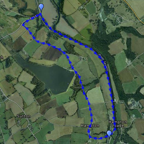
From Hay Bridge, near Eardington, to Hampton Loade, a pleasant path follows the Severn – though with riverside vegetation and a tall crop of oilseed rape, there’s not always much of a view. Banded demoiselles flop around like tiny world war 1 biplanes in an apparently clumsy manner, until one proves its aerobatic capabilities by snatching a passing fly and making lunch of it. We didn’t snatch anything, but the ice creams at Hampton Loade station were enjoyable on this increasingly warm afternoon, and the platform a pleasant spot to sit for a while watching the world go by. The latter happens in fits and starts – it’s busy when trains call, otherwise quiet (perhaps not quite Adlestrop).

Walking back to Hay Bridge, we follow a quiet way past Chelmarsh reservoir, where there are just a couple of boats out – not enough wind today.

Map

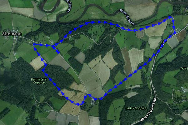
View OS map on Streetmap http://www.streetmap.co.uk/map.srf?X=373765&Y=287531&A=Y&Z=120

Sheinton Coppices

Wandering south of the Severn, through quiet woodlands and fields. The OS map defines several of the small woods as coppices, and one or two were still recognisable as such, though no recent work was obvious – unlike the extensive clearance that had been taking place at Traps Coppice. A small herd of wild deer grazed on the hillside just to the north of Farley Coppice – if they had seen us, they weren’t concerned. The rabbit saw us eventually…

Map
View OS map on Streetmap http://www.streetmap.co.uk/map.srf?X=362460&Y=303461&A=Y&Z=120