Fruit and nut

Mon 24 April: we’re heading north, towards an overnight stay in Glen Devon. We’re slightly ahead of schedule – let’s have a look at this pineapple thing… It’s quite startling, and definitely strange – a huge carved stone pineapple, at the head of a walled garden not far from the south bank of the Forth, a few miles east of Stirling. Other than the pineapple, and the walls (three of them), and a little pool, there’s nothing else and no-one else there. (There are further grounds to explore, but on this day of sunshine and snow showers, it’s too cold to hang around for long)

The Pineapple NT Scotland

Black Rhadley

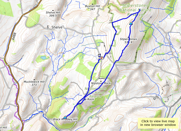
The beginning of April marks an eagerly-awaited turning point in the South Shropshire calendar – the Bog Centre opens up for the season. That fact (with its implied prospect of excellent cakes, scones etc.) was the clincher when I asked my friend where he thought we might go for today’s walk.

Before we can enjoy those refreshments, of course, we have to earn them, and we haven’t even had lunch yet. Black Rhadley, overlooking the river West Onny as it winds through the Linley Hall estates, should be a suitable spot. It was, too – extensive views in all directions, and wonderfully quiet – just the birds, and there’s that curlew again. Lunch over, we head northwards along the Stiperstones ridge, as far as the head of Perkins Beach, where we turn back toward The Bog for tea and Stiperscones.

View OS map in Streetmap http://www.streetmap.co.uk/map.srf?X=335620&Y=297406&A=Y&Z=120

A grey bank holiday

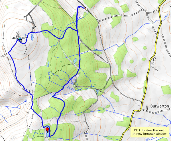
Best kind? After a rainy morning, the afternoon looked a little more promising, though there was never any sunshine, and we did feel the odd spot of rain. So there were no views to speak of, nor were there many people. A few at the YHA cafe at Coalport, perhaps, where we enjoyed a brief refreshment stop (tea and cake, of course), and one or two others beside the Severn as we headed back, but certainly not bank holiday crowds. Yes (answering my own question) – they probably are the best kind, when you don’t have to go to work in the morning.

Bright and breezy: Brown Clee

Cool, too, in the wind. The east side of the hill is in the lee, and the walk is very pleasant through the parkland, warm in the sunshine with views improving as we gain height. Boyne Water is twinkling as the breeze lifts wavelets; a little further on, we’re out on the ridge. Now we have extensive views to the west, but we’re in the wind, and we need to keep going. It buffets the camera as we stand at the highest point. Moments later, as we begin to descend, we’re sheltered and it’s a warm spring afternoon once more.

View OS map on Streetmap http://www.streetmap.co.uk/map.srf?X=359885&Y=285911&A=Y&Z=120

Unknown hills

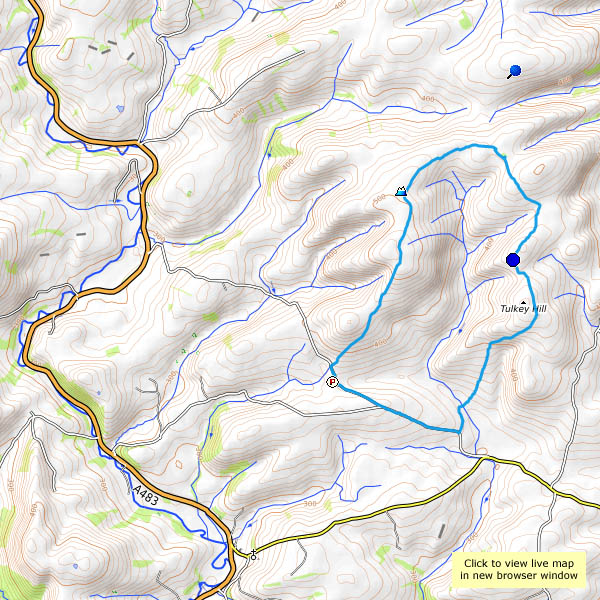
Can we find somewhere that will be quiet? With a clear blue sky and pleasantly-warm temperatures, the better-known destinations will be busy. But it’s quiet here. Really quiet! We’ve driven along the minor road between Llangunllo and Llanbadarn Fynydd, and parked at Moelfre City (which consists of two or three isolated farms). We’ve eaten our lunch, and walked back down the road for about a mile before taking the track into the hills. And we’ve seen no-one. Not a soul – until the chap turned up with a mower as we passed Cwmllechwedd Fawr. After that – no-one else, until we’ve completed the walk and driven homewards for several miles.

It’s quiet, not silent. We can hear larks (ascending, as they do), and occasional buzzards, and the odd sheep (aren’t they all?) makes its presence known, but that’s about it (there are one or two red kites too, never close enough for the camera). There’s a new wind farm up here, at Garreg Lwyd, just beyond the point where we turn back. If we listen carefully, we can just about hear the swish of the blades of the nearest turbine as they turn gracefully against the blue sky.

Our walk is taking us around the watershed of the Dildre brook. We pass the highest points of Tylcau, Newhouse and Warren hills on the outward walk, turn at Cae-glas Hill, and head back to the City via Tynybryniau Hill, Gors Lydan and Moelfre Hill. Gors Lydan is the highest point, at 528m (that’s 1,736′), but none of these hills have summits, in the sense of places worth visiting. I suspect the number of visitors they receive each year is in single figures – they’re unknown hills, and all the better for that on a day like today.
View OS map in Streetmap http://www.streetmap.co.uk/map.srf?X=313374&Y=276635&A=Y&Z=120

Edging along

Friday afternoon: a walk on the Wenlock edge. Starting from the car park by the Hughley turn, we’ll walk towards Wenlock along the very pleasant woodland path, below the edge, and return along the crest, above the woods and the old quarry workings. The weather’s getting warmer, and the butterflies are sunning themselves.

View OS map on Streetmap http://www.streetmap.co.uk/map.srf?X=359210&Y=298481&A=Y&Z=120