“We can have tea and cake at the youth hostel…” A walk down Pound Lane to Coalport, on a warm afternoon.


Just photos – no particular theme
“We can have tea and cake at the youth hostel…” A walk down Pound Lane to Coalport, on a warm afternoon.
A short wander along the Wenlock Edge in early July. The scenery is rather drab at this time of year, on a warm, still but grey afternoon – however, there are other things to point the camera at. The many butterflies are too busy to pause and pose; the floral colour is easy to deal with. It may have been a short walk, but we felt we’d earned our ice creams (not that ice cream in July needs any justification…).


")


")
View OS map on Streetmap http://www.streetmap.co.uk/map.srf?X=361490&Y=300316&A=Y&Z=120
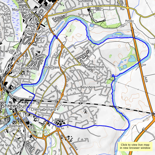
After yesterday’s walk in the hill country, we went for an almost-level walk this afternoon, following the Severn downstream from the weir to below Belvidere bridge. The river follows a looping course here, so that, though we’ve walked getting on for five miles along its bank, it’s only about a mile and a quarter back to the car when we leave the water’s edge. Starting from the abbey, we head for the footbridge and the weir. At first it’s fairly busy, but as we move away from the built-up area there are fewer people about, and it’s very pleasant and easy walking. We enjoy brief glimpses of a couple of kingfishers as we approach the railway bridge at Belvidere. We don’t see them again, though we do see two or three trains humming along. Our return from the river takes us past the Column, where Lord Hill surveys the scene, looking smart after a recent wash and brush-up.


View OS map on Streetmap http://www.streetmap.co.uk/map.srf?X=351360&Y=313231&A=Y&Z=120
If there’s a preponderance of pictures with blue skies below, it’s because we’ve not seen blue skies for a while. After the heat of the previous week, last week was cold, damp and thoroughly miserable. This afternoon’s break in the clouds demanded an outing (it’s raining again, on-and-off, as I write…). It wasn’t just sunny and warm, but the air was clear – the Brecon Beacons, our usual yardstick for clarity, stood out on the south-western horizon as we explored Clee Hill and Magpie Hill. Industry once thrived on these wind-swept grasslands, and quarrying continues to this day, though the associated railways are long-gone, their trackbeds providing good walking routes. Elsewhere there are the remains of small coal mines (what are those 8-shaped brick-built structures?), traces of aerial ropeways, a curious “three-forked pole”, a red kite, a curlew, skylarks, a farm called “Random”… There’s never a dull moment up here!


")


View OS map on Streetmap http://www.streetmap.co.uk/map.srf?X=360140&Y=276741&A=Y&Z=120
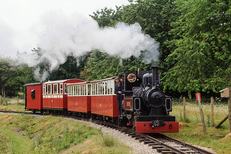
We’ve been to the Amerton Railway today, for their steam gala. We should have gone yesterday – we picked the wettest day for weeks. Despite the rain, which wasn’t always heavy, we had a most enjoyable afternoon. For more pictures etc. visit “A rainy day at Amerton” on Geoff’s Rail Diaries.
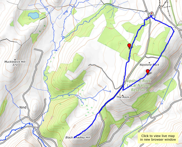
It’s the longest day of the year today – it has been one of the hottest too, though we managed to keep comfortable on a very pleasant short walk at the south end of the Stiperstones ridge, with a visit to the top of Black Rhadley. It was (relatively) cool in the woods, and on top there was a good breeze blowing. We celebrated with half a punnet of English strawberries (we’d eaten the other half at lunchtime!) – best strawberries I’ve had for many years too. There are other berries up here. The birds have obviously been eating something bilberry-coloured – but it will be a good few weeks before they’re ripe. In between the baby bilberries, we spotted interlopers, which I reckon were crowberries. Didn’t try them… We certainly wouldn’t have tried the fine fungus we’d found in the woods earlier. A common earthball with a stalk? Is there such a thing?
The tea / cold drink and cake at the Bog Centre were good, as ever.


View OS map on Streetmap http://www.streetmap.co.uk/map.srf?X=334995&Y=296626&A=Y&Z=120
It’s too warm! As we drove away from the Forestry Commission car park (Black Pool, not at all like Blackpool), the car said the air temperature was 26C. It touched 29.5C on the way home – it must have been cooler under those tall pines. That’s why we headed for High Vinnals this afternoon – we could be sure of a reasonable amount of shade on the (necessarily) gradual ascent. There was just enough of a breeze on top too, so that we could stop for a little while and enjoy a most extensive view of the Welsh hills. We returned to the start by the grassy Hanway Common (the sheep seem to like it). There’s a comfortable seat at the top, from which we watched a couple of buzzards – then two red kites swooped over our heads (from behind – hadn’t seen them coming). The bright sunshine picked out their colouring, but as (almost) ever, there wasn’t time to zoom and focus. Leaving the common at its foot, the path passes the eponymous Black Pool. It’s certainly an appropriate name…


View OS map on Streetmap http://www.streetmap.co.uk/map.srf?X=348535&Y=271700&A=Y&Z=120
When we walked in Bannister’s Coppice in late October, there were deer everywhere (see “Oh deer“). Will there be any today? More accurately, will we see any today? Yes, if we’re quiet and careful, though they’re shy at present – there’s a mother with a very young-looking fawn, which sneaks through the bracken and across our path, while we stand still and silent. We return by the track up from Seven Springs Farm, which I’ve realised is the route taken by a pre-railway age (1824) waggonway, from Gleedon Hill quarry to the Severn. Once again, there’s no-one else around.


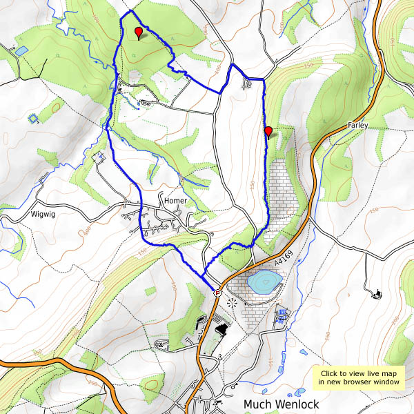
View OS map on Streetmap http://www.streetmap.co.uk/map.srf?X=362890&Y=302881&A=Y&Z=120
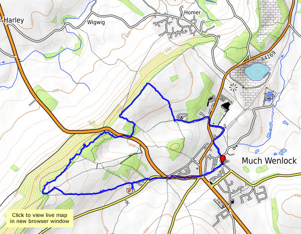
We’re walking from the National Trust car park at Presthope, through the fields to Easthope and back along the old railway track. There was a “halt” at Easthope, just by the bridge – but we never had a chance to ride on this line. It closed to passengers in the early 1950s; freight from Longville ended in 1964.


View OS map on Streetmap http://www.streetmap.co.uk/map.srf?X=357385&Y=296311&A=Y&Z=120
The sky may be uninspiring, but it’s a fresh-feeling afternoon, and the weather forecast thinks it should stay dry. A track follows the contours around the northern part of Brown Clee – we’ll join it at its northernmost point and follow it round to the west, then walk over the top of the hill and down the other side. We can then use the eastern arm of the track to get back to the start. A red kite is overhead briefly; sheep are everywhere, but there’s no-one else to be seen today. Do they know something we don’t, or is it the other way round?


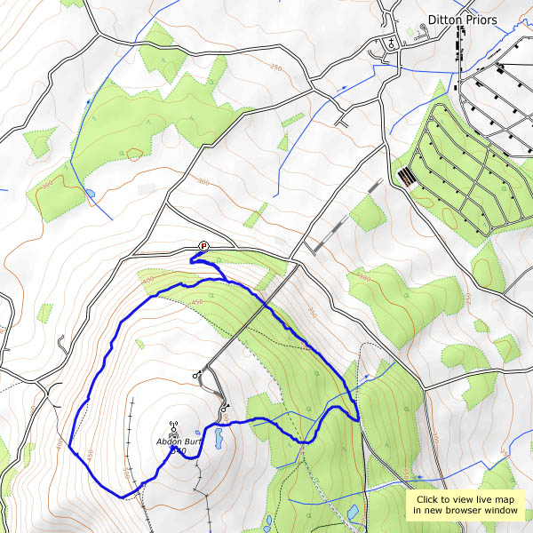
View OS map on Streetmap http://www.streetmap.co.uk/map.srf?X=359685&Y=286976&A=Y&Z=120
