A short leg-stretch, down Shirlett Lane to the crab-apple tree and back again


A short leg-stretch, down Shirlett Lane to the crab-apple tree and back again
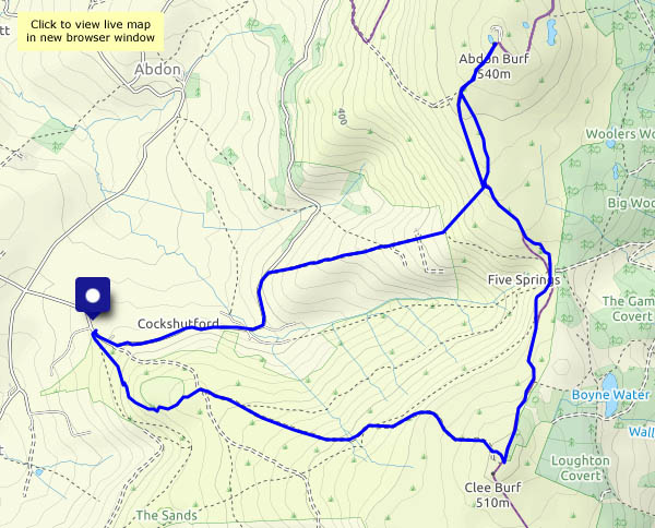
Thursday 22 October: there’s a stiff breeze from the north-west, and the air is cold, but we’ll soon warm up as we walk from Cockshutford, heading for the top of Brown Clee at Abdon Burf. Too cold to hang around! We’ll retrace our steps for a little way to continue along the ridge (though it’s hardly that) to the secondary summit at Clee Burf – and it’s all downhill from here, pausing only to record the presence of some splendid (though not fully-grown) parasol mushrooms below Nordy Bank.


")


View OS map on Streetmap http://www.streetmap.co.uk/map.srf?X=358970&Y=285485&A=Y&Z=120
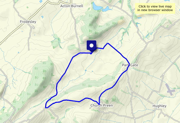
We’re walking from Langley Chapel to Church Preen and back. We walked this way in January, so we’ll do it anticlockwise this time. There are one or two showers about – just a few drops in the wind, but enough to provide a couple of rainbows. The wind is more significant – up on the ridge from Broome to Church Preen, it’s really blowing, but the sun is shining and the views are wonderful (when we can see over the hedge).
We’ve visited Langley Chapel before – for photos see https://geoffspages.blog/2016/03/25/langley-chapel/


View OS map on Streetmap http://www.streetmap.co.uk/map.srf?X=353720&Y=299215&A=Y&Z=120
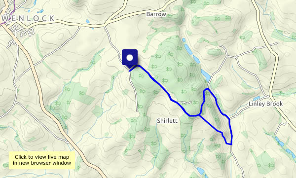
That’s the weather (nothing to do with what we used to call ‘coffee’) – no sunshine, hazy, a grey sky and flat lighting. It’s pleasant to be out, wandering across the fields from Barrow to Wyke and back, but there’s no drama in the landscape – even the autumn colours are subdued.


View OS map on Streetmap http://www.streetmap.co.uk/map.srf?X=365265&Y=301021&A=Y&Z=120
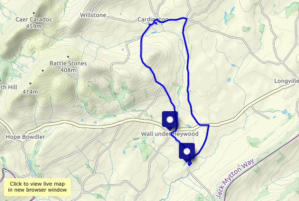
We’re exploring the lanes between the Wenlock Edge and the Stretton Hills. Although they’re barely two miles apart, Rushbury lies beneath the Edge, while Willstone Hill’s Battle Stones and Caer Caradoc define Cardington. They may be quiet, but the villages feel prosperous, and Cardington’s Royal Oak is the archetypal English pub (no, not today…). Walking anticlockwise from Wall-under-Heywood, we reach the highest point on our route as we pass – and we’d better visit – the Sharpstones, where rocks poke out of the hilltop pasture. From there it’s all downhill…


View OS map on Streetmap http://www.streetmap.co.uk/map.srf?X=351100&Y=293620&A=Y&Z=120
It’s a still, cold, grey afternoon – the only significant colours are those of the season, in leaves, berries and fungi.


")


View OS map on Streetmap http://www.streetmap.co.uk/map.srf?X=367420&Y=297950&A=Y&Z=120
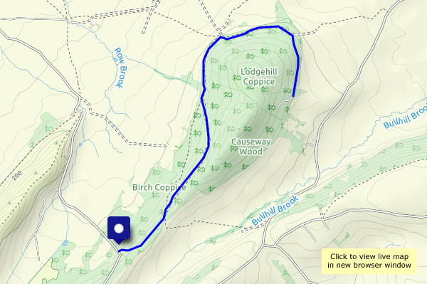
…in Birch Coppice and Causeway Wood, a forested hill between the Stretton hills and the Wenlock Edge. We hadn’t intended to come here today, but at the starting point for our planned walk, there were several horse boxes, and a quad-bike loaded with wicker hampers was just arriving. We’ll move on…
We’d been here five years ago (see ‘Birch Coppice‘), and resolved to revisit. Once again, our plans changed when we found the path ahead was deep in near-impenetrable mud. We’ll follow the forestry road and see where we get to. The road in question goes around perhaps ¾ of the hill, and given that this is access land, there could be a path completing the circuit*. When we arrived at the scene of serious-looking forestry operations (there were warning signs and several huge stacks of timber awaiting transport) we decided to retrace our steps, and try again another day.
* The aerial images on Google Maps seem to show such a path. Next time!


View OS map on Streetmap http://www.streetmap.co.uk/map.srf?X=351635&Y=298820&A=Y&Z=120
Like yesterday, we’re out in the morning – for the same reason. Rain’s forecast for the afternoon (once again, accurately). Some early mist is lingering, clearing only slowly, and there are some splendid sunbeams along the lane. No shortage of interesting fungi either – some old friends and some new surprises!


View OS map on Streetmap http://www.streetmap.co.uk/map.srf?X=366240&Y=297950&A=Y&Z=120
The forecast said it would rain this afternoon (it did!) so we’re out in the morning, following a route that wasn’t our first choice (but a road was closed – we’d forgotten). Partly on very quiet roads, and partly on even quieter field tracks, it’s an enjoyable amble in the autumn landscape.


View OS map on Streetmap http://www.streetmap.co.uk/map.srf?X=371200&Y=296615&A=Y&Z=120
Sounds great, doesn’t it? Catherton Common, then Silvington Common, but first, Cramer Gutter, appropriately the low point of a wander around this strange area to the north-east of Magpie Hill. Remains of old bell pits abound, and there are former squatters’ cottages everywhere. The paths are not always obvious, but the sheep seem to know where they’re going. Perfect for a cool, bright and sometimes sunny October afternoon!


")


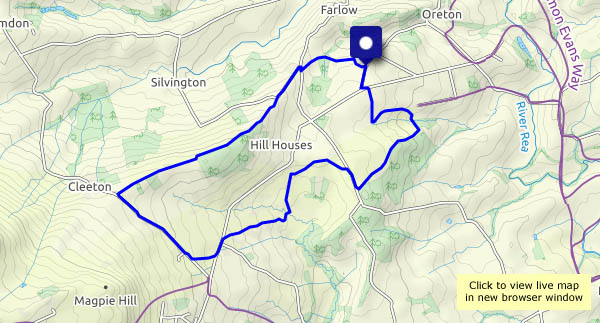
View OS map on Streetmap http://www.streetmap.co.uk/map.srf?X=363165&Y=278911&A=Y&Z=120
