
A short walk from the “coke hearth” at the top of Coalbrookdale. Like several others in this area, the dingle is a steep-sided little valley whose stream feeds the Severn. Below the coke hearth, it’s mostly culverted – higher up, it’s a jungle waterway. The path – a board-walk for much of its length – follows the stream fairly closely – away from the path, much of the woodland looks impenetrable (we’re not going to try!).
Our return takes us through Sunniside – and just beyond, there on the skyline are the most unlikely creatures – alpacas, ostriches (emus?) and reindeer. Are we still in Shropshire?


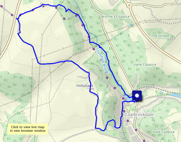
View OS map on Streetmap http://www.streetmap.co.uk/map.srf?X=366217&Y=305081&A=Y&Z=115

J > Wow, this brings back memories from when we lived in Shropshire. This is an area we know fairly well, and your photos and the map remind us of visiting the Abraham Darby home (Rose something or other), the Quaker burial ground, the Coalbrookdale Museum of Iron (absolutely fascinating, I could spend a lifetime in places like that). However we never explored this Dingle. IT must have been less appealing back in the days when the old blast furnaces were working nearby!