Misty Clee

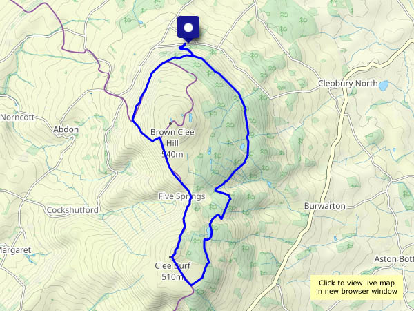
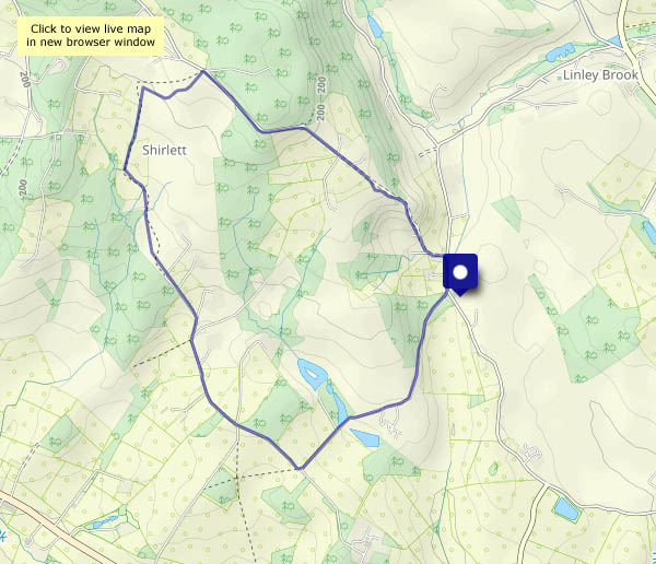
A circumambulation (i.e. we walked around a bit) on a day when the fog cleared, but the mist stayed. The sheep are basking in the very pleasant (again!) sunshine, and it’s certainly atmospheric up here on Brown Clee, though it would have been good to see just a little further – at times, we could barely make out the ridge of the Wenlock Edge.

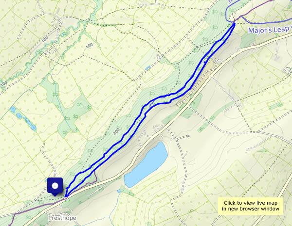
View OS map on Streetmap http://www.streetmap.co.uk/map?X=359285&Y=286330&A=Y&Z=120

Westwood

We start at Stretton Westwood, and head up a rough farm lane to Bourton Westwood Farm. Now we head south-west, passing Westwood Farm at Bourton Westwood to the southernmost point of this wander, a few hundred yards from Bourton… Heading back towards the start, we recross the ridge and descend past Westwood House. Hence the title.
Westwood notwithstanding, it’s a truly beautiful afternoon. No wind to speak of, a clear blue sky, cool air (I’m keeping my gloves on!) and warm sunshine. It’s rather hazy, making for atmospheric views from the Wenlock Edge. Tomorrow’s going to be fine and sunny too…

View OS map on Streetmap http://www.streetmap.co.uk/map?X=360325&Y=297755&A=Y&Z=120

Town and Country

Shrewsbury’s riverside, heading upstream (after a walk through the town itself) along a stretch that, though close to civilisation, feels much more rural. We return, after threading suburban streets, past the school and the boathouses, with views across the river to towers of St Chad’s and the market hall. A pleasant, interesting and varied wander.

View OS map on Streetmap http://www.streetmap.co.uk/map?X=348455&Y=312770&A=Y&Z=120


Round Hill, Shirlett and Hurst Farm

An enjoyable circular, making the most of the current dry conditions – the route passes through fields which can be rather soggy at this time of year. The land between Shirlett and Hannigan’s Farm feels particularly remote – no sign or sound of habitation. I don’t think it gets many visitors (and I’m not complaining!).

View OS map on Streetmap http://www.streetmap.co.uk/map?X=366520&Y=296945&A=Y&Z=120

Munslow skyscapes

Tuesday 7 February: There was a mist in Corvedale as we descended from the Rushbury road, but by the time we were parked and walking, it was merely a haze. The sky was clear blue, with just a tick of high, white feathery cloud – which gradually grew to provide with a remarkable skyscape as the sun neared the horizon. The deer were a bonus – we tried, but they weren’t for hanging around once they’d seen us…

View OS map on Streetmap http://www.streetmap.co.uk/map?X=350995&Y=287750&A=Y&Z=120

Croft Ambrey and Bircher

An old favourite… It does what favourites should – it’s a very enjoyable walk from start to finish. There’s woodland and open grassland, with wonderful views in most directions (though not all at the same time…). Below the hill fort at Croft Ambrey, the old Scots pines provide foreground interest to some of the most attractive scenery in this part of the world, where the Herefordshire hills meet the Welsh border country. To the south-west, the Black Mountains and the Brecon Beacons form a distant horizon, where Pen y Fan could be mistaken for a dormant volcano (it isn’t!). It’s another fine day too, the sunshine warm for a time. What more could one want?

View OS map on Streetmap http://www.streetmap.co.uk/map?X=345190&Y=266450&A=Y&Z=120

A long thin walk…

…on Wenlock Edge. It’s not very long – just under four miles. Thin? A glance at the map reveals all. Our return route parallels our outward route, but outwards we’re in the woods below the Edge, and returning we’re on the Edge – there are views! There’s barely any sunshine today – until the last few minutes when the sun lights the fields on the eastern Edge, with Brown Clee for a backdrop

View OS map on Streetmap http://www.streetmap.co.uk/map?X=359200&Y=298505&A=Y&Z=120