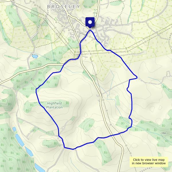
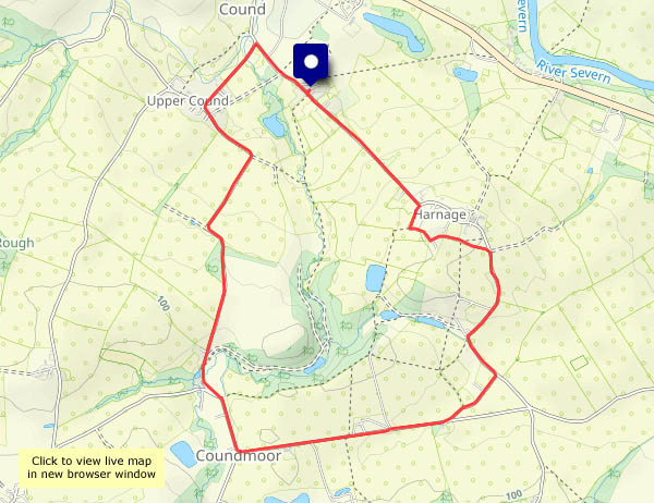
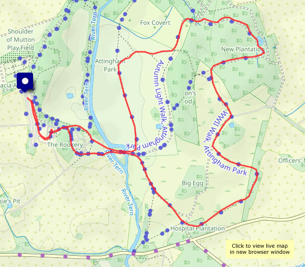
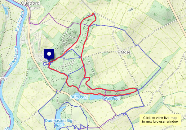
Homeward bound

Sunday 19 October: It rained. All day! We need to go to Portree, where I’m surplus to requirements. Coffee and cake (and a chapter from a book) in what used to be Aros will help to pass the time.

Monday 20 June: To Inverness – to return the hire car and board the train. It’s still raining on Skye, but the sun is out on the mainland and it’s a much better day. We need to grab a lunchtime bite, but nothing’s open along the Achnashellach – Achnasheen – Contin road. We’ll try Strathpeffer. There’s a cafe at the old railway station, but it’s closed too. However, the deli in the square serves us some delicious plum tart.
When the Kyle line was built (opening to Strome Ferry in 1870), the people of Strathpeffer didn’t want a railway, and the line had to take a difficult alternative route – a steep incline which caused the operators much trouble for many years. Meanwhile, Strathpeffer changed its mind, and in 1875 a short branch line opened, provided with the attractive station building which remains today. Strathpeffer would undoubtedly be a major contributor to local rail traffic if the Kyle line had taken that route. Sadly there wasn’t enough traffic to justify a separate branch line. It closed in 1946.

Post-oil: Cromarty: There’s time to kill before returning the car. Let’s drive around the Black Isle (it isn’t, though we cross bridges to enter and leave it!) to Cromarty. There’s an attractive little harbour there, in the throes of restoration/renovation. The Cromarty Firth is an eye-opener  – it appears to be an elephants’ graveyard for redundant oil rigs. The air is clear and the sunshine strong – until it slips behind shower clouds. We’d better be on our way now.
The Black Isle Bar’s pizzas are excellent: the beer’s pretty good too. We’ll need little else before our train arrives at Crewe (5.30 this morning, and already it feels like yesterday!). We’re home.

Stacks and caves of Balmaqueen

Mostly, the caves are unseen (a boat could be useful!) but from the Balmaqueen clifftops the stacks are an impressive feature, despite being just a small part of the extensive seascape and landscape views. Tomorrow’s going to be rainy, and the day after, we’re heading for home. A good one to end this trip’s outdoor explorations.

View OS map on Streetmap http://www.streetmap.co.uk/map?X=144270&Y=874503&A=Y&Z=120

Bornesketaig’s cave of gold

There’s silver in the greenery beside the road – it must have been misty in the early hour – and below the Ru Bornesketaig clifftop, there’s an Uamh Oir – a Gold Cave! It’s a well-hidden sea cave, and most of the time it’s inaccessible. Today the tide is really low – perhaps I should go and check? Perhaps 30 years ago, when the tide was exceptionally low, I managed to get into the cave. Not a great place to be – a wet and slippery floor – and there was no sign of any gold, so there certainly wouldn’t be any today. I’ll enjoy the view and keep going!

View OS map on Streetmap http://www.streetmap.co.uk/map?X=137815&Y=870870&A=Y&Z=120

Unhurried Uig

Thursday 16 October: As we drove down into Uig, the ferry was just departing with the 14.10 sailing to Lochmaddy – the puff of exhaust smoke from its funnel told the story. Soon after arrival from Tarbert some 50 minutes earlier, there would have been a flurry of activity as numerous cars, camper vans, lorries and other vehicles drove away, and the pier would then have been busy as the ferry loaded for its next crossing. Now it’s quiet in Uig, until the ferry returns in around 4 hours. The weather’s quiet too. It’s a small-scale shopping trip, but while we’re down here, we may as well enjoy a leg-stretch.

View OS map on Streetmap http://www.streetmap.co.uk/map?X=139181&Y=863762&A=Y&Z=115


Peaceful Portree

Wednesday 15 October: the summer is long past, but the centre of Skye’s ‘capital’ Portree is busy with tourists. That’s where I find myself, and I need to hang around for about 90 minutes on this cloudy but still afternoon. If I walk down to the end of Bayfield Road, I can continue around ‘The Lump’ – that should be quiet. It was, of course, but the photos may convey a false impression of the Portree that the visitors see…

View OS map on Streetmap http://www.streetmap.co.uk/map?X=148237&Y=843453&A=Y&Z=115

Chestnuts and toadstools

Perhaps Chestnut Coppice should be renamed Toadstool Wood? There are certainly lots of chestnuts – we left with our pockets full – but there’s also a fine crop of all kinds of fungi. Mushrooms? Toadstools? I’m no judge, I just enjoy finding them, in all their different shapes and sizes, ranging from single isolated specimens to large family groups. And I’d much rather leave them for everyone else to enjoy.
The fallen chestnuts are in a different category. We’ll roast them and enjoy eating them – and rest assured, there are plenty left for the squirrels and other nibblers of nuts…

View OS map on Streetmap http://www.streetmap.co.uk/map?X=372065&Y=296465&A=Y&Z=120

Sunny Mynd

Monday 6 October: What a beautiful afternoon! It would be a crime not to be out on the hills, though we can hardly call this Long Mynd wander a hill walk. We’ve parked the car at about 1530′, and the highest point, Pole Bank, is 1680′. A good leg stretch though, through the rich colours of the autumnal moorland. Returning to the start, we realise we’ve had the best of the sunshine – clouds are starting to gather – but it’s been really pleasant out on these hills

View OS map on Streetmap http://www.streetmap.co.uk/map?X=342385&Y=295030&A=Y&Z=120