…on Round Hill and down Ned’s Lane. It’s really very pleasant in this open woodland on a warm afternoon.


View OS map on Streetmap http://www.streetmap.co.uk/map.srf?X=367107&Y=297480&A=Y&Z=115

Short walks with photos and a Google map.
…on Round Hill and down Ned’s Lane. It’s really very pleasant in this open woodland on a warm afternoon.
View OS map on Streetmap http://www.streetmap.co.uk/map.srf?X=367107&Y=297480&A=Y&Z=115
Down through Chestnut Coppice to the riverbank – then along the bank as far as Bridgnorth golf course. We may be beside the river, but for much of the distance we can’t see it for trees, bushes and invasive knotweed. We return to Chestnut Coppice along the old railway track. A very enjoyable leg-stretch on a fine summer’s day.


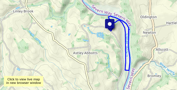
View OS map on Streetmap http://www.streetmap.co.uk/map.srf?X=371970&Y=296515&A=Y&Z=120
We walked this way in February (see “Tugford and Broncroft Castle“), for similar reasons – we’ve had a drop in rain in the last few days, and the paths can be rather sticky. These are very quiet lanes – very little traffic, and little else to disturb the peace. The similarity between these two walks ends there – Corvedale in late June is very different to Corvedale in winter.


View OS map on Streetmap https://www.streetmap.co.uk/map.srf?X=354785&Y=287186&A=Y&Z=120
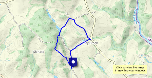
19 June: After a couple of rainy days, it looks as though the evening should stay dry. The paths we’ve trodden in recent weeks will be very muddy – we’ll have a wander along the quiet lanes around Willey and The Smithies.


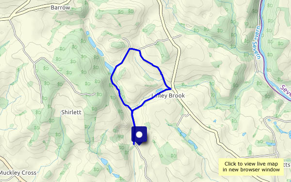
View OS map on Streetmap http://www.streetmap.co.uk/map.srf?X=367420&Y=297950&A=Y&Z=120
We walked this way at the end of May – today we’re retracing our steps. Last night’s rain has left the air humid – it feels quite warm in the sunshine, and there’s a chance (once again) of thundery showers. Under the trees (no shortage of them up here) it’s cooler, and very pleasant for a leisurely stroll.


View OS map on Streetmap http://www.streetmap.co.uk/map.srf?X=366090&Y=298085&A=Y&Z=120
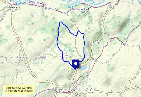
The other road at Shirlett: a short walk down the lane and through the woods to the redundant trig. point on Hawthorn Bank, and a fine view to the Clee hills.


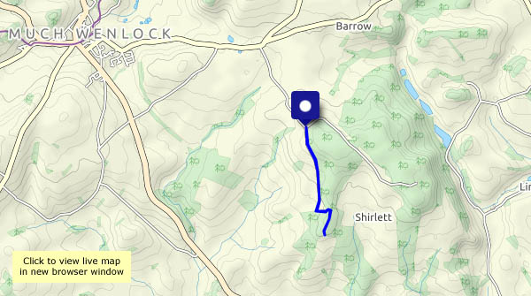
View OS map on Streetmap http://www.streetmap.co.uk/map.srf?X=365200&Y=297975&A=Y&Z=120
The heavy clouds threaten rain, and one or two spots appear on the windscreen as we drive the couple of miles to our parking place. They continue to threaten as we walk, but no more spots. The fields could do with more than a few spots – tomorrow perhaps?


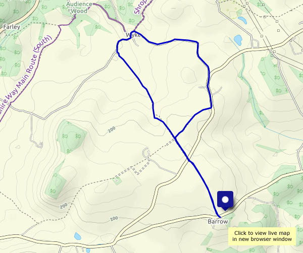
View OS map on Streetmap http://www.streetmap.co.uk/map.srf?X=365265&Y=301021&A=Y&Z=120
A walk around the mosses… It’s a peat bog, and just a few hundred years ago it was a raised bog, which has since collapsed as a result of drainage and peat-cutting. There are paths and tracks on and across the bog, but it’s not wise to stray from acknowledged routes – there are some very wet places, not all of them obvious. We’re walking around the perimeter, more or less, before exploring some of the waymarked routes into the bog. Within that perimeter it’s a different world – very quiet, very few people around (we passed just one other person walking, in eight miles). There’s the distinctive call of a curlew, and the tick-tick of chats – is that a whinchat there? – reminds us we’re not completely alone. There are views to faint distant hills, but the near and middle horizon is a flat one, interspersed with the odd tree, and forests around the periphery. It feels rather strange, on setting off home, to drive back into reality.
Natural England: Shropshire’s National Nature Reserves


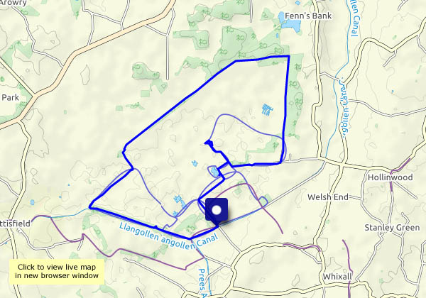
View OS map on Streetmap http://www.streetmap.co.uk/map.srf?X=349280&Y=336720&A=Y&Z=120
“Perhaps we’ll see some deer”… Yes, we did – a couple trotted past some distance away, There were squirrels too, by the dozen. Apart from the squirrels, and blackbirds frantically rustling in the undergrowth, it’s really quiet here, and very pleasant too – it feels as though the world outside has been left behind.


View OS map on Streetmap http://www.streetmap.co.uk/map.srf?X=361935&Y=302200&A=Y&Z=120
We’ve walked this route several times, with a difference. It’s been a good standby in winter and/or very wet weather, a pleasant stroll around quiet lanes. Today’s difference is the inclusion of the track up behind Round Hill, and back down Ned’s Lane to get to Willey (a route that can be seriously muddy in poor weather). It’s a Sunday, and there are one or two other people about, on Round Hill and near Willey Lower Pool – after that, we’ve got the place to ourselves.


View OS map on Streetmap http://www.streetmap.co.uk/map.srf?X=367105&Y=297810&A=Y&Z=120
