The Munslow Edge

A path across the fields from Munslow to Aston Munslow ends this walk, which takes us to one of the highest points on the Wenlock Edge, overlooking (if there weren’t so many trees) the well-hidden hamlet of Middlehope. From Munslow Common, a little further on, it’s a long descent back to Munslow and that field path. The sky is blue sky, there’s no wind and no-one else about – apart from a friendly farmer who stops his tractor for a chat. Another perfect January day!

View OS map on Streetmap http://www.streetmap.co.uk/map?X=351295&Y=287750&A=Y&Z=120

A day on the Mynd

A perfect January day – sunshine from a clear blue sky and a light breeze. The view from our lunch table  – the Packet Stone – is extensive, with ridge after ridge gradually fading into the haze. And (despite all the cars in the Carding Mill valley) there’s no-one else in sight or sound! It can’t get much better than this. It’s a shame to have to come back down to earth, but the light’s fading rapidly as we get back to the car. We’ve made the most of it!

View OS map on Streetmap http://www.streetmap.co.uk/map?X=342960&Y=292530&A=Y&Z=120

Battle Stones and Caradoc

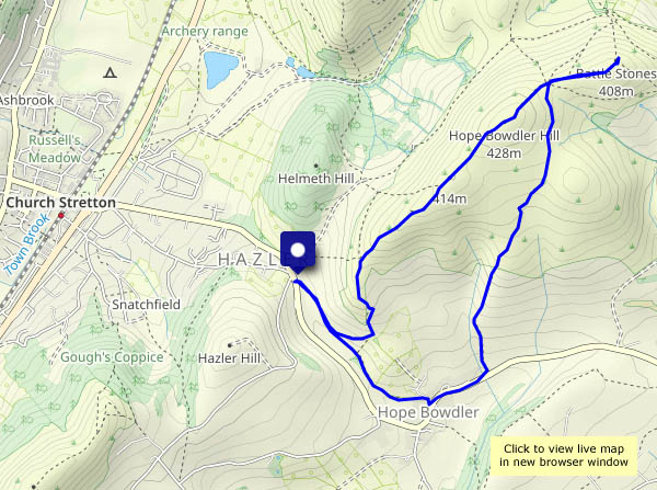
Wednesday 5 January: there’s a thin layer of snow at home – the hills should be good today? Yes, they were, a great day to be out on Willstone Hill and Caer Caradoc, but there’s no snow. We’re well prepared for the cold and frosty weather, and the uphill stretches keep us warm. A patch of thicker cloud towards the end of the afternoon  brings somewhat gloomier conditions for a time – and a few snowflakes – but without a doubt we’ve chosen a good day for this most enjoyable outing.

View OS map on Streetmap http://www.streetmap.co.uk/map?X=348665&Y=295130&A=Y&Z=120

Walking home from Wenlock

It rained heavily last night – anything away from a surfaced road or track will be seriously muddy. So, having been dropped off in Wenlock’s Barrow Street, I’m walking down beside the main road towards Buildwas, then up the narrow (grass in the middle) lane to Wyke. Just past Newhouse Farm, the road has become a canal – deep water for perhaps 50-60 yards. After a false start, the verge sees me past, but it’s touch and go. My usual companion would have fallen in. After that, the lane from Wyke to Posenhall is pleasant but lacking in excitement…

View OS map on Streetmap http://www.streetmap.co.uk/map?X=364815&Y=301065&A=Y&Z=120