December days

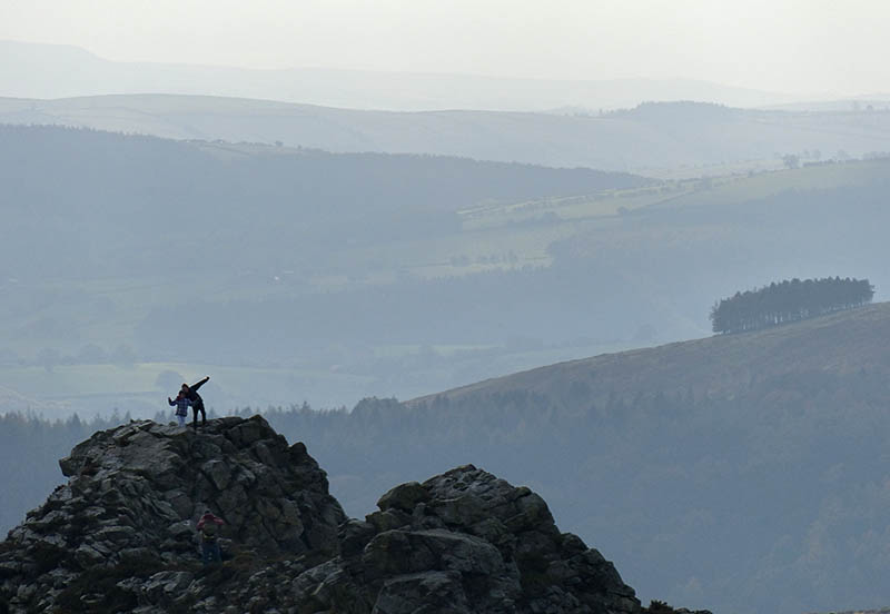
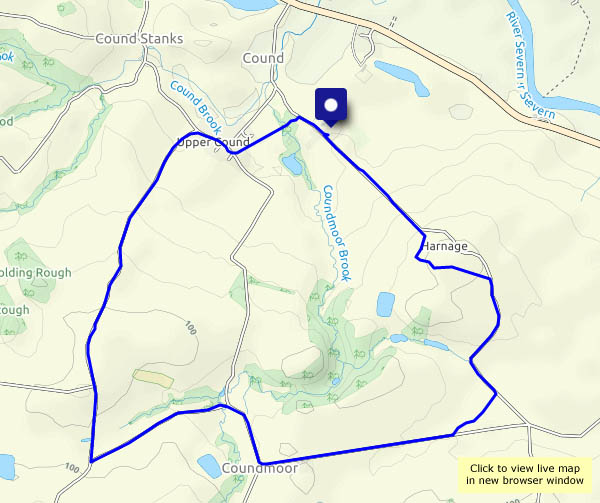
First day of December – and first day of (meteorological) winter. They’re short, but when they’re dry and sunny, it’s good to be out. It’s a familiar route for us – out past Hurst Farm pools, down through the field (a significant part of which came home on our boots) to Shore Pool, and back up the estate road past Aldenham Park. Most enjoyable!

View OS map on Streetmap https://www.streetmap.co.uk/map.srf?X=366995&Y=295721&A=Y&Z=120


There’s no-one here!

We’ve had lunch, the rain has stopped and the sky has cleared, so we’re taking a stroll from Ironbridge to the top of Coalbrookdale and back. It’s a pleasant afternoon – mild, bright and mostly dry (it’s trying to rain when we get back to the car). But where are all the people? There’s no-one else on the bridge, the Wharfage is deserted, Coalbrookdale’s quiet. Most unusual!

View OS map on Streetmap https://www.streetmap.co.uk/map.srf?X=366895&Y=304151&A=Y&Z=120

Stiperstones strolling

It has to be a stroll – the path along the ridge is far too rough for any speed. Slow progress is essential if the view is to be appreciated without broken bones… The distant views are wonderful, in all directions; closer, there are other items of interest – a red kite, toadstools (just a few), a fine hairy coo – and the alpacas… It’s a great day to be up here – fine and clear, bright and cool (and breezy).  Nevertheless, it’s good to get back to the Bog too – the cakes are splendid. What an enjoyable day!

View OS map on Streetmap http://www.streetmap.co.uk/map.srf?X=336175&Y=298046&A=Y&Z=120

A Cound Circular

It’s a slightly-extended version of a walk we did earlier in the year, and for the same reasons. There’s been a lot of rain in the last couple of days; now the sky’s mostly clear blue, and we need to make the most of it, but we’ll have to stay on hard roads and tracks unless we want to get seriously bogged down. It’s a very pleasant leg-stretch, and as the afternoon wears on, the sun gets noticeable lower, spotlighting the landscape and leaving deep shadows.

We left the car at Cound Guildhall, where there’s a charity box for parking and a charity bookshop too: St Peters Charity Bookshop

View OS map on Streetmap http://www.streetmap.co.uk/map.srf?X=355585&Y=303886&A=Y&Z=120

Via Random

We’ve left the car at Cleehill village, and we’re heading for the spooky remains of industry on Magpie Hill. It’s a grey day, and the air’s cold – it’s also clear, with views extending to the Brecon Beacons. Recent rains mean that, away from good surfaces, there’s no shortage of mud, so today we’re mostly on hard-surfaced tracks across this remote hill country. The outward route takes us past the curiously-named Lower Random Farm, on what was once a mineral wagonway, disused for more than a century. Inevitably, the sun breaks through when we’re in the car heading homewards; unexpectedly, it’s raining (again!) as we near home.

View OS map on Streetmap http://www.streetmap.co.uk/map.srf?X=360620&Y=276546&A=Y&Z=120