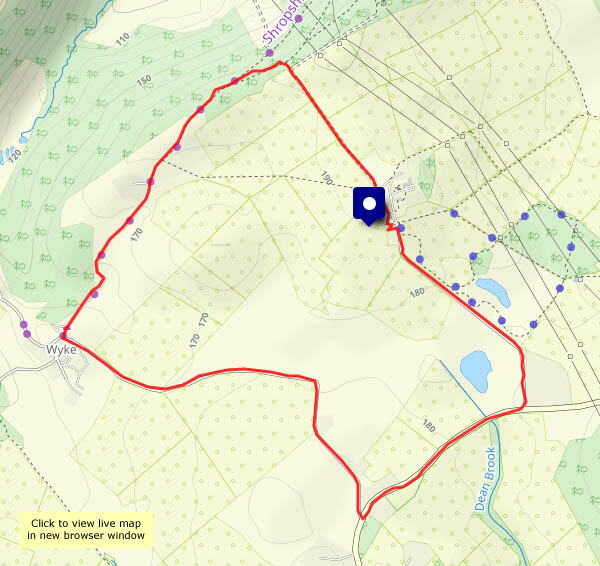
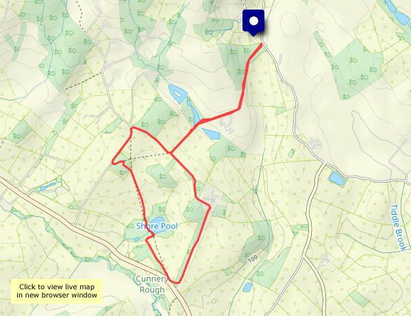
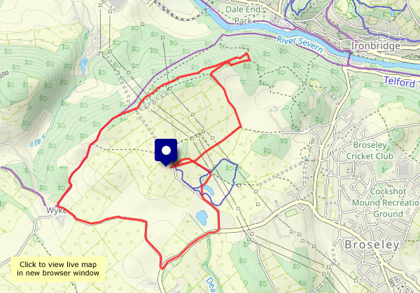
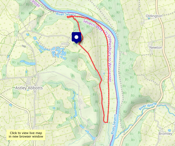
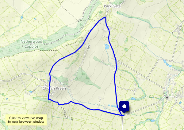
One more week…

…and it will be spring, by the Met Office’s definition. It certainly felt springlike when I set out. There will be rain later – there’s been a lot of it recently. The fields are completely sodden, and refuse to accept any more water, so instead it’s running off down the roads. Despite the wetness, the signs of spring are everywhere – hawthorns leaves are brilliant green in the hedgerows, there are primroses and periwinkles (garden escapees?) and the blackthorn blossom is starting to appear.

View OS map in Streetmap http://www.streetmap.co.uk/map.srf?X=367470&Y=298250&A=Y&Z=120

There and back again

Almost two weeks ago, I travelled on the sleeper from Crewe to Inverness, where I boarded the normal service train to Kyle of Lochalsh and Skye. This morning I arrived home again, after an “interesting” return trip – a departure from Inverness delayed by 194 minutes. Nevertheless I was home just an hour later than if it had left on time. The full story will possibly appear on “Geoff’s Rail Diaries” in due course; meanwhile, here are a couple of tasters.

Bornesketaig

Monday 19 February: A last Skye leg-stretch, grabbing a couple of hours between lunch and the onset of rain… There’s a stiff breeze raising the waves down by the slip at Camus Mor, and I won’t go too near the cliff edge, but there’s some brightness for a time, and the rain held off. The first drops are falling as I drive away.

View OS map on Streetmap http://www.streetmap.co.uk/map?X=137830&Y=870875&A=Y&Z=120

A tale of three ferries…

Monday 19 February: …or four? A week ago, we saw the Pentland Ferries catamaran Alfred arriving at Uig pier (see A stranger at Uig). A little digging on the Calmac website clarified the position. The usual ferry, Hebrides, which we’d seen at the pier a couple of days earlier, had gone for its scheduled overhaul. Another Calmac ferry, Clansman, should have taken over but its own overhaul is over-running… So, today, Hebridean Isles came to the rescue. It was the regular vessel – a familiar shape and sight – on the Uig routes from the late ’80s until the bigger Hebrides took over. It seems to be providing a Lochboisdale – Uig service in lieu of the Lochmaddy and Tarbert routes for the time being. So – here’s a reminder of Hebrides and Alfred, and today’s arrival from Lochboisdale. (No photos of Clansman, for obvious reasons).

Going over to the other side…

Sunday 18 February: Sometimes the weather in Staffin, on the east coast of Trotternish (and not quite 7 miles away, as the golden eagle flies), is very different from that on the west. The Met Office thought it would be different too – I left in murky mist, under heavy cloud, and enjoyed bright sunshine for much of my walk. The basic route is quite short (and we’ve done it many times), but today I lengthened it by walking to the end of the line of cliffs above the slip (which may explain the unlikely route shown below), for an aerial view of familiar places.

View OS map on Streetmap http://www.streetmap.co.uk/map?X=149025&Y=867956&A=Y&Z=120

Heribusta

Thursday 15 February: A rainy day. It was heavy before lunch, but the afternoon looked better. Not sunny, still damp, not actually raining… The ground is sodden, and there’s running water everywhere – I’ll stay on surfaced roads. The minor road from Kilmuir village hall leads up into the hills, through the curiously-named settlement of Heribusta, looping back to the main road not far from the cemetery where Flora (“Over the sea to Skye”) Macdonald lies. Nothing passes me – no cars, no-one on foot (a golden eagle, forced down from higher ground by the mist, cruises past briefly). The main road back to the village hall (A855, single track with passing places) isn’t much busier – a couple of cars and a van perhaps. An enjoyable outing!

View OS map on Streetmap http://www.streetmap.co.uk/map?X=139435&Y=870985&A=Y&Z=120

An Uig paper round

Saturday 17 February: Need a leg-stretch, and the weatherman says it will rain this afternoon. We need to go down to Uig for today’s paper – perhaps we can end our walk at the shop. The papers should be in by then – they don’t get here until late morning (many years ago, I had a paper round. I was hopeless – usually half-asleep, I pedalled around on autopilot. Rarely did my last delivery coincide with the last paper in my bag. I might have been more successful if the papers arrived at noon)

The jelly-ear fungus was a welcome find, on some scruffy elder bushes beside the Idrigill road. There was another very substantial crop a few yards further back, but the thicket of dead brambles looked impenetrable and rather scratchy…

View OS map on Streetmap http://www.streetmap.co.uk/map?X=139050&Y=863942&A=Y&Z=115

Coast to coast…

Friday 16 February: Easy! The east and west coasts of Skye’s Trotternish peninsula are about a mile and a half apart here, almost at the northern tip. This is my October walk ‘Walking in reverse – the Skye Trail‘ – in reverse! Makes a great circular route, even if that means walking along the road (very quiet at this time of year) – and it’s a perfect afternoon. Bright sunshine, blue sky, just the slightest breath of wind, almost no-one else around – what more could one ask?

View OS map on Streetmap http://www.streetmap.co.uk/map?X=142254&Y=875148&A=Y&Z=120

Balmaqueen – filling the gap

Tuesday 13 February: it didn’t really need filling – I’ve walked along this spectacular stretch of coastline several times. Last October, I walked the northernmost part of the Skye Trail (in reverse) between its start at the Shulista road end and Port Gobhlaig. Last month I walked the stretch between the old radar station at Balmaqueen and Flodigarry. Today I’m filling the gap.

Don’t be misled by the photos. Yes, beautiful blue sky and white fluffy clouds; one or two showers about, though not where I am. But there’s a cold, strong and buffeting westerly wind, trying to hurl me off the clifftops. I’m keeping well back from the edge today…

View OS map on Streetmap http://www.streetmap.co.uk/map?X=144334&Y=874324&A=Y&Z=120

Hinnisdal woodland

Wednesday 14 February: a quiet wander along the Hinnisdal forest road, on a calm and grey afternoon. Yesterday afternoon I was nearly being blown off my feet – today there’s barely a breath of wind. As with other wooded parts of the island, the trees are accompanied by moss and lichen, and despite the trees, there are some fine views out to sea and up the glen.

View OS map on Streetmap http://streetmap.co.uk/map?X=140500&Y=857500&A=Y&Z=120