
Wednesday 20 November: It’s icy cold out, but also dry and sunny, under a clear blue sky. To stay indoors would be unforgiveable! So we’re enjoying a short (and fairly slow) walk on the Hope Bowdler hills – over the main ridge to the Battle Stones, and back across the moor. It’s wonderful up here – the snow has drifted a little, carving some interesting shapes; it’s deep in places. The (invisible) path isn’t always easy, as we step in and out of the (deep!) few footprints left by others, but it’s fun! And there’s no-one else about – just one young woman descending with a dog, in the first half-mile. After that, the hills are ours for the afternoon!


")

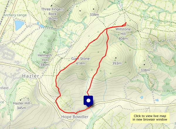
View OS map on Streetmap http://www.streetmap.co.uk/map?X=348115&Y=293760&A=Y&Z=120


")


")


")


")


")
")


")


")


")

