23 May 2009: a warm spring evening at Cressage, Shropshire
23 May 2012: having fun in France – the Somme Bay railway, the cliff lift at Le Treport and the Somme at St Valery. Lots more photos on the blog – see “Sunshine“, and on Geoff’s Rail Diaries – “Rails around the Somme Bay”
Category: Photography
Just photos – no particular theme
It’s still windy!
Three days ago, we chose a route which would provide some shade – today, we’ll retrace our steps – in reverse – for a different perspective and some shelter from the strong westerly winds… Once again, it’s an enjoyable little outing.
View OS map on Streetmap http://www.streetmap.co.uk/map.srf?X=367107&Y=297480&A=Y&Z=115
Lilleshall and the Somme
22 May 2005: a visit to Lilleshall Abbey, between Telford and Newport. We were the only people there.
I mentioned our 2012 French trip a couple of days ago (it was covered pretty fully on the blog at the time). On 22 May 2012, we visited the Cité Souterraine at Naours. For more on our visit to this amazing place, visit “The underground city” (the most visited page on the blog).
Later that day, as the sun went down, we walked beside the Somme, from our gîte at Saigneville, in a lovely quiet corner of Picardy.
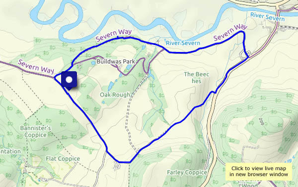
Buildwas Park
Not a walk in the park! It’s an easy wander around (outside?) the perimeter of this estate, apart from a short stretch along a main road, and other than the numerous drivers on that 1/3 mile, we saw no-one else. No shortage of squirrels in the woods, though, and almost continuous birdsong… Most enjoyable!
View OS map on Streetmap http://www.streetmap.co.uk/map.srf?X=362890&Y=303355&A=Y&Z=120
At sixes and sevens
That’s 2006 and 2007… Thirteen years ago, on this day, we visited the red kite feeding station at Gigrin Farm near Rhayader in mid-Wales – what a spectacle! (It would have been better, photographically, if the sun had shone…) These are native kites, the offspring of a very small number of survivors from the original population. Today, we regularly see birds from the Welsh population in Shropshire.
On 20 May 2006, we were very nearly in mid-Wales. We’d planned a walk over Hergest Ridge, from the Herefordshire border town of Kington. It would have led us to lunch just across the border. The forecast suggested there might be one or two showers. We were rained off! A heavy, fine, penetrating rain which, among other things, would have soon soaked into our cameras. The significance of this day is that one of the photos appeared on the very first page of this blog, just over a week later (see “The new blog“) Yes, we’ve been going 14 years.

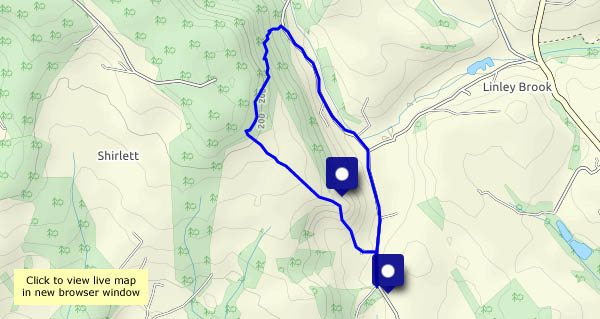
Round Hill
A very short (2.3 miles) and pleasantly shady walk – it’s warm and sunny! – up the leafy track past Round Hill to the Shirlett plateau, and down again through the forested hillside. Is that rustling a blackbird? No, it’s a small deer, perhaps 2-3 metres away, fairly well hidden – so no photos – in undergrowth beyond the fence. It’s sensed our presence, and is gone – no hurry, but it’s soon out of sight. We return to the car along the quiet road through the Smithies. Everyone else (perhaps half-a-dozen) is riding a bicycle. Have we missed something?
View OS map on Streetmap http://www.streetmap.co.uk/map.srf?X=367107&Y=297480&A=Y&Z=115
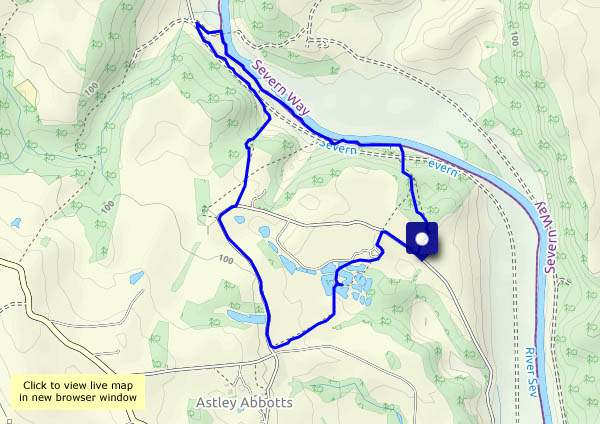
Summer?
Down by the riverside… It certainly felt like summer – the plentiful shady stretches were very welcome on this pleasant wander down to the river Severn, a couple of miles north of Bridgnorth. Out of the valley, along the quiet road and past the landscaped fishing pools, the light breeze was just what we needed.
View OS map on Streetmap http://www.streetmap.co.uk/map.srf?X=370940&Y=297505&A=Y&Z=120
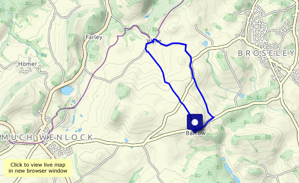
The yellow fields of Wyke
A pleasant amble from Barrow to Wyke and back, through leafy lanes, along quiet roads and past dazzling yellow fields. The sky is grey, but it feels as though the sun is shining when the oilseed rape is in flower. And there’s no-one else here – what more could one ask?
View OS map on Streetmap http://www.streetmap.co.uk/map.srf?X=365225&Y=301215&A=Y&Z=120