Just look at the weather! Rain last night, more forecast for this evening. Between, leaden skies, but at least it’s dry. The distance is hazy – we’ll concentrate on what’s close by. The spring display is over, replaced by summer’s foliage, and in the sloes and blackberry flowers are reminders that autumn will come – but not just yet…
Category: Photography
Just photos – no particular theme
Barrow to Wyke
The heavy clouds threaten rain, and one or two spots appear on the windscreen as we drive the couple of miles to our parking place. They continue to threaten as we walk, but no more spots. The fields could do with more than a few spots – tomorrow perhaps?
View OS map on Streetmap http://www.streetmap.co.uk/map.srf?X=365265&Y=301021&A=Y&Z=120
Whixall and Fenn’s
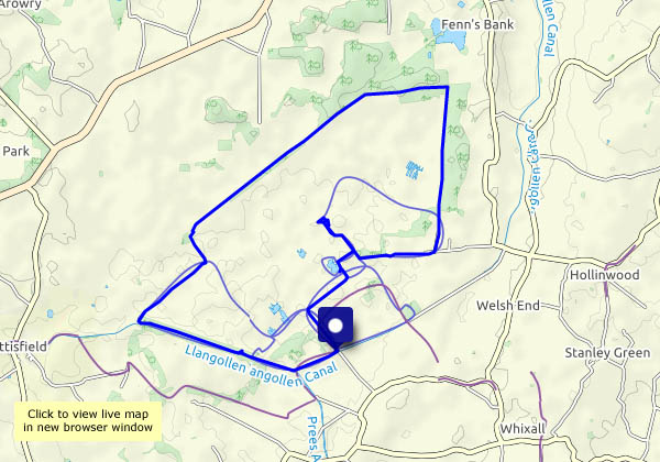
A walk around the mosses… It’s a peat bog, and just a few hundred years ago it was a raised bog, which has since collapsed as a result of drainage and peat-cutting. There are paths and tracks on and across the bog, but it’s not wise to stray from acknowledged routes – there are some very wet places, not all of them obvious. We’re walking around the perimeter, more or less, before exploring some of the waymarked routes into the bog. Within that perimeter it’s a different world – very quiet, very few people around (we passed just one other person walking, in eight miles). There’s the distinctive call of a curlew, and the tick-tick of chats – is that a whinchat there? – reminds us we’re not completely alone. There are views to faint distant hills, but the near and middle horizon is a flat one, interspersed with the odd tree, and forests around the periphery. It feels rather strange, on setting off home, to drive back into reality.
Natural England: Shropshire’s National Nature Reserves
View OS map on Streetmap http://www.streetmap.co.uk/map.srf?X=349280&Y=336720&A=Y&Z=120
To Bannister’s Coppice
“Perhaps we’ll see some deer”… Yes, we did – a couple trotted past some distance away, There were squirrels too, by the dozen. Apart from the squirrels, and blackbirds frantically rustling in the undergrowth, it’s really quiet here, and very pleasant too – it feels as though the world outside has been left behind.
View OS map on Streetmap http://www.streetmap.co.uk/map.srf?X=361935&Y=302200&A=Y&Z=120
Ned’s Lane, Willey and The Smithies
We’ve walked this route several times, with a difference. It’s been a good standby in winter and/or very wet weather, a pleasant stroll around quiet lanes. Today’s difference is the inclusion of the track up behind Round Hill, and back down Ned’s Lane to get to Willey (a route that can be seriously muddy in poor weather). It’s a Sunday, and there are one or two other people about, on Round Hill and near Willey Lower Pool – after that, we’ve got the place to ourselves.
View OS map on Streetmap http://www.streetmap.co.uk/map.srf?X=367105&Y=297810&A=Y&Z=120
Change in the weather
We didn’t get out for a leg-stretch yesterday! The weather has changed, and though it wasn’t really wet enough for the garden and the fields, it wouldn’t have been much fun. Today’s a little better – it should stay dry during the first part of the afternoon (we won’t be seeking the shade though). We’ll walk along to the end of Red Lane and back – see what’s new, and what else has changed…
Severn Valley Railshade
It’s certainly shady on the old Severn Valley trackbed, just a few miles north of Bridgnorth. The riverside footpath, which we follow for our return, isn’t quite so shady, but it’s very pleasant beside the quiet waters, and Chestnut Coppice is an enjoyable stroll in both directions.
It looks as though this long spell of fine weather is about to end – rain is forecast for tomorrow…
View OS map on Streetmap http://www.streetmap.co.uk/map.srf?X=371505&Y=297675&A=Y&Z=115
Shady ways
Back to Ned’s Lane and Round Hill! It’s a short leg-stretch, but very pleasant. The path up the hill on the edge of the woodland has a far-away feel to it, and the shade under those tall trees is most welcome.
As we drive the couple of miles to our starting point, a red kite swoops low over the road. We’re losing count of the number we’ve seen close to home in the last few weeks.
View OS map on Streetmap http://www.streetmap.co.uk/map.srf?X=367107&Y=297480&A=Y&Z=115
Clee woodlands
We’re walking on the tame side of Brown Clee – the woodlands on the north-eastern edge of the hill. Once again, the shade is welcome, though there’s a bit more cloud today. The greater part of this route is not over-popular – as we guessed, most of the other people we saw (perhaps a dozen?) were on the short stretch between the picnic field and the summit. For much of the time, we had the place to ourselves.
View OS map on Streetmap http://www.streetmap.co.uk/map.srf?X=360025&Y=286850&A=Y&Z=120


