Horseshoe Falls

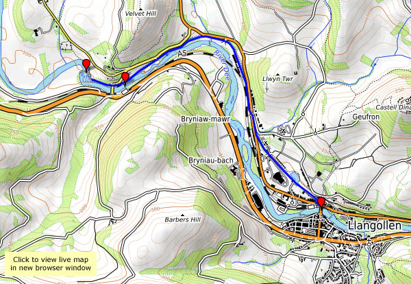
Fri. 12 May: Llangollen: a pleasant walk beside the canal to the recently-restored chain bridge at Berwyn, and the Horseshoe Falls on the Dee. On my first visit here, over 40 years ago, the falls came as a disappointment. After seeing down through the trees to the rushing waters of the Dee, tumbling over the rocky river bed, we came to the curving weir. “Is that it?”. It’s there to provide a feed for the canal, which flows like a clear stream down to Llangollen, and it’s well worth a visit, whatever its origin.

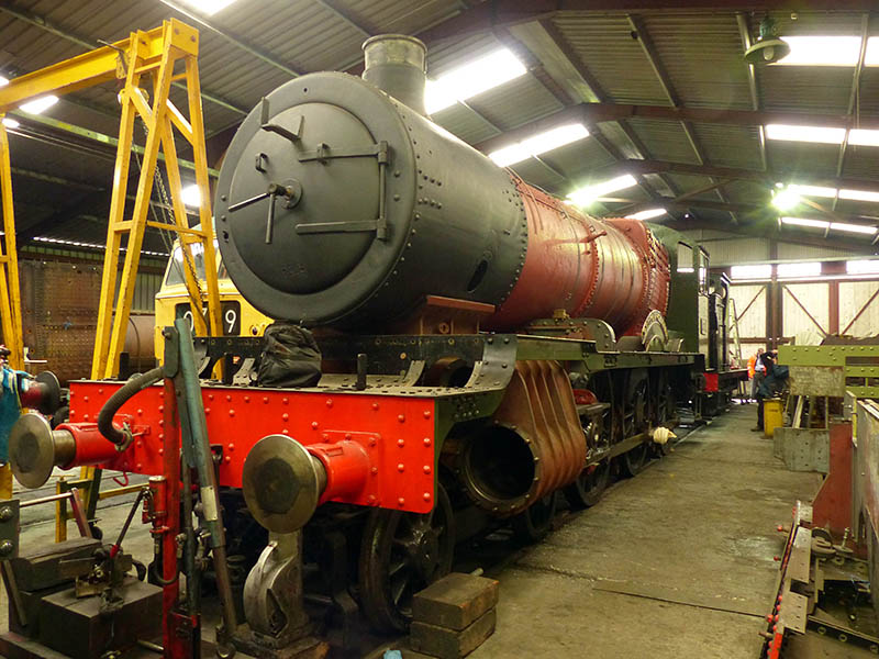
Why did we do it? See previous post “Future Steam

View OS map on Streetmap http://www.streetmap.co.uk/map.srf?X=320446&Y=342859&A=Y&Z=120

Future steam

6880 “Betton Grange”

On 12 May, I joined a group visiting the locomotive works at Llangollen – where no fewer than four new-build steam locomotives are under construction – a GWR “Grange” 4-6-0, a GWR 47xx 2-8-0, an LMS unrebuilt “Patriot” 4-6-0, and an LNER B17 4-6-0. Fascinating stuff! For more on this trip, go to “New Build” on Geoff’s Rail Diaries

Quiet flows the Severn

Weds. 10 May: we’re out for a leg stretch, on a perfect May afternoon. It’s warm too – perhaps we could cast a clout or two. I’ve never been sure whether the saying relates to the month or the May blossom of the hawthorn, which is truly “out”. We’re walking down the lane to Lower Severn Hall – there we’ll cut across to the river, and walk back along the bank as far as the Apley bridge, then return along the old railway track and up through the woods. There are one or two other people about, but it’s certainly quiet beside the Severn here.

View OS map on Streetmap http://www.streetmap.co.uk/map.srf?X=371365&Y=296926&A=Y&Z=120

Uig and the Fairy Glen

Fri. 5 May: tomorrow, we’re heading for home. This afternoon, we’ll take a leisurely stroll around Uig – a walk up the road to the Fairy Glen, then, ending as we started, a wander down by Uig pier. The contrast between the cold grey weather of last Wednesday and this afternoon’s bright sunshine couldn’t be greater. There was only one cloud in our sky today (the thought of the M6 perhaps?).

Evening light

Weds 3 May: it’s a fine bright evening, clear but cold. We’re spending a few minutes down at Camas Mor, where there’s a little sailing boat with red sails (I know, we should have stayed until sunset) and the light’s catching the scattered houses of Bornesketaig. Later that evening, the sunset is spectacular, and after the sun’s gone down, there’s a sun pillar over the Harris hills.

Dun Beag

Weds. 3 May: A drive to a less-familiar part of the island, and a visit to Dun Beag. It’s a broch – or the remains thereof – with its circular hollow wall, and interesting cells and stairways within that wall. It’s in the care of Historic Scotland, who say “These stone roundhouses… …date from about 1,900 – 2,300 years ago…  Dun Beag’s location may be a deliberate statement about social status and control of land – set on a steep slope, above the cultivated land and with a commanding view of the surrounding countryside”. Whatever the reason, the view is tremendous, from the high Cuillins, through the sweep of Loch Bracadale, to the lonely Macleod’s Tables. Quite a place!

Dun Beag broch Historic Scotland

Rubha na h-Aiseig again

Tues. 2 May: we’ve walked this way several times before, but it’s always an enjoyable outing. From the tiny Port Gobhlaig, a faint path follows the top of low cliffs, with stacks and inlets and an excellent view to the coast and hills to the south. After a little while, what seems to be an ancient path descends steeply to the grassy foreshore, fringed by rocks, pools and camels (just their humps). Eventually, one can go no further. There’s evidence of settlement here, the remains of perhaps three “black” houses by the shore – is this where a ferry (to Trodday, just a mile off shore) once departed? It’s a pleasant, and exceptionally quiet spot – there’s no-one else here – a good place to find a comfortable rock seat and gaze across the water. Eventually, we return the way we’ve come, more-or-less, which is no hardship given the views of the cliffs and Trotternish ridge ahead.


View OS map on Streetmap http://www.streetmap.co.uk/map.srf?X=144015&Y=875895&A=Y&Z=120

Back to Rubha Hunish

Mon. 1st May: I’m on my own again, heading for Skye’s northernmost tip – Rubha Hunish. The path down the cliff face, between Meall Tuath and Meall Deas, puts many casual wanderers off. They’ve already reached a spectacular viewpoint, but the promontory below the cliffs is somewhere special. A cruise liner passes as I descend carefully: I’d much rather be where I am than where they are. There’s a great feeling of freedom on Rubha Hunish – I’d feel trapped inside that thing…

View OS map on Streetmap http://www.streetmap.co.uk/map.srf?X=141460&Y=875564&A=Y&Z=120