It’s cold, dry and bright – might even get some sunshine! Once again, our walk to Wyke.


View OS map on Streetmap http://www.streetmap.co.uk/map.srf?X=365265&Y=301021&A=Y&Z=120

It’s cold, dry and bright – might even get some sunshine! Once again, our walk to Wyke.
View OS map on Streetmap http://www.streetmap.co.uk/map.srf?X=365265&Y=301021&A=Y&Z=120
That wasn’t the intention (honest!) – just a good leg-stretch on a fine, cold and breezy day. The pub is roughly half-way around this 10-mile circuit – a pint of home-brew and a pork pie (in the garden) being just the thing to propel us home again!


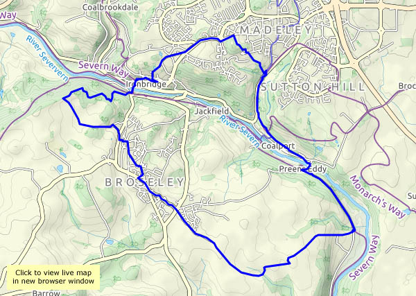
View OS map on Streetmap http://www.streetmap.co.uk/map.srf?X=368500&Y=302240&A=Y&Z=120
We were trying to spot the most likely dry spell in the weather forecasts, but we didn’t quite get it right… A passing shower makes us glad the trees are still in leaf while we shelter. It’s early evening, and sunset is approaching rapidly.


View OS map on Streetmap http://www.streetmap.co.uk/map.srf?X=366070&Y=298060&A=Y&Z=120
The harvest has taken the barley that was growing in these fields. The land has been ploughed, harrowed and re-sown – and next year’s wheat or barley (hard to tell at this stage) is starting to come up. There’s the green sheen of spring in this early autumn landscape! In the hedgerows, the season is more obvious.


View OS map on Streetmap https://www.streetmap.co.uk/map.srf?X=367540&Y=298191&A=Y&Z=120
Friday 18 September: later that day – a walk to Belhaven’s “bridge to nowhere” and along the cliff path to Dunbar harbour


")


View OS map on Streetmap http://www.streetmap.co.uk/map.srf?X=367147&Y=679110&A=Y&Z=115
Friday 18 September: a short walk with the family in the John Muir Country Park, through the Hedderwick Hill plantation to the shore at Hedderwick sands. It’s all very pleasant on this fine sunny day.

")


View OS map on Streetmap http://www.streetmap.co.uk/map.srf?X=364534&Y=679067&A=Y&Z=115
We walked this way two months ago, trying some new (to us) paths on the Wenlock Edge, just a couple of miles from Much Wenlock, We’re extending the route a little today, which adds distance but not much more interest. It’s a hazy day; despite the clear blue sky and sunshine, July’s colours are long gone, and the autumn leaves are still mostly ahead of us. Nevertheless, it’s good to be out – infinitely more enjoyable than long drives down busy motorways…


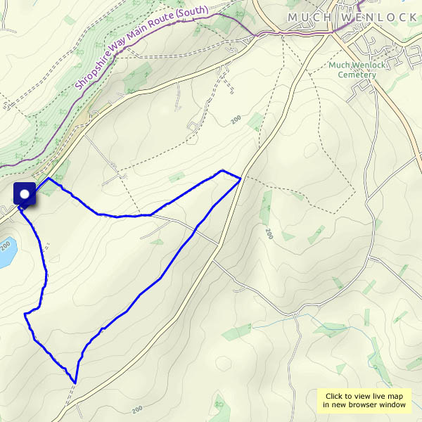 View OS map on Streetmap http://www.streetmap.co.uk/map.srf?X=360205&Y=297700&A=Y&Z=120
Thursday 17 September: I could do with a leg-stretch after the long drive, and I’m surplus to requirements for an hour or so – I’ll take a short walk down to the harbour, then along the coastal path for a little way. The light is warming as I wander – is that a Scottish Ayers Rock down there?

")


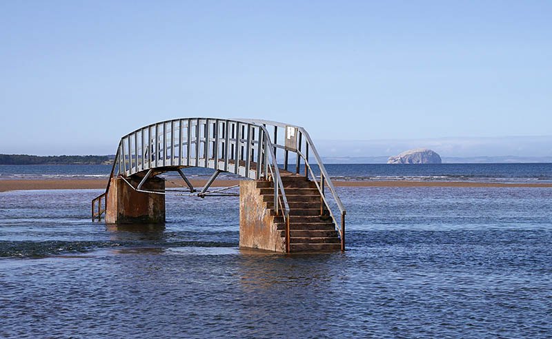 Landmarks local to Dunbar, where we’ve been for a few days: the bridge at Belhaven is useful when the tide is out… In the distance (about 6.5 miles / 10km) is the Bass Rock, home to an astonishing number of gannets.
We arrived home this afternoon, after a drive of over 300 miles, so that will have to do for now. More photos tomorrow.
A few months ago, the colour was in the many spring flowers, backed by the bright blossom of blackthorn, then hawthorn. On this grey and gloomy afternoon, we’ll focus on the sloes, hips, haws and other berries. the offspring of that springtime display.

")


