
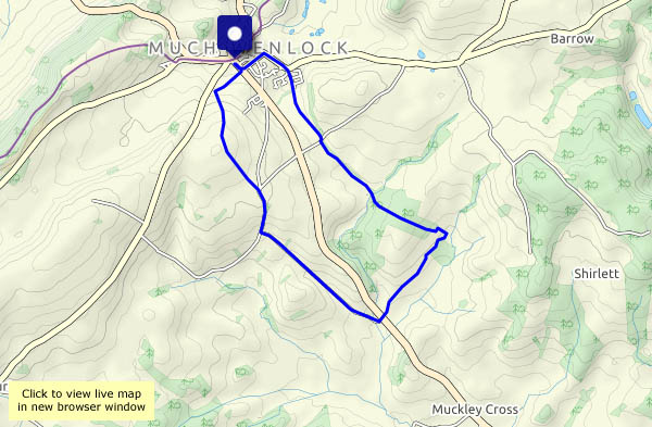
…from Much Wenlock, through leafy lanes and orchards to this hamlet at the end of a very minor road. As well as the road, which we would need to use to continue our wanderings, three public footpaths meet at Atterley (the one we’re on and two others) – but there seems to be no obvious connection between the paths and the road, and the rights of way on the OS map don’t correspond with the signing around the settlement. A kind and helpful young lady pointed us in the right direction – “you’re not the first I’ve had to help”, or words to that effect…
Heading back, a long straight lane takes us to towards Callaughton, then we head across the fields (with the oilseed rape towering above us) and down another leafy lane to return to Wenlock. An interesting and most enjoyable walk!
")


View OS map on Streetmap http://www.streetmap.co.uk/map.srf?X=362765&Y=298325&A=Y&Z=120
