Perkley

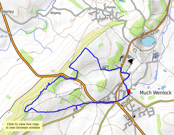
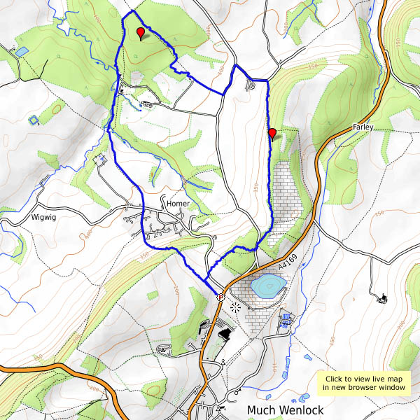
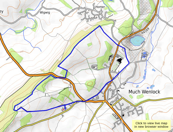
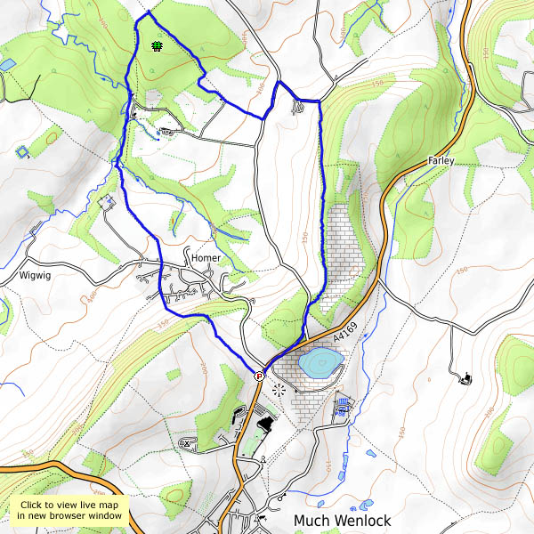
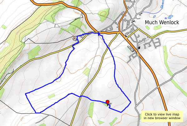
A short wander at the northern end of the Wenlock Edge, on a grey but warm and humid afternoon. The blackberries are ripening nicely at present – perhaps we’ll pick a few. That hedge near the end of the walk was well-covered last September… Yes, and it probably will be this September – today there are banks of very unripe berries. Earlier on the walk, we’d passed by some nicely ripe ones (checked, of course, by sampling), but we’d have to carry them with us, so we’ll keep going… It was inevitable, wasn’t it?

View OS map on Streetmap http://www.streetmap.co.uk/map.srf?X=361420&Y=298936&A=Y&Z=120

July on the Edge

A short wander along the Wenlock Edge in early July. The scenery is rather drab at this time of year, on a warm, still but grey afternoon – however, there are other things to point the camera at. The many butterflies are too busy to pause and pose; the floral colour is easy to deal with. It may have been a short walk, but we felt we’d earned our ice creams (not that ice cream in July needs any justification…).

View OS map on Streetmap http://www.streetmap.co.uk/map.srf?X=361490&Y=300316&A=Y&Z=120

Bannister’s Coppice and the waggonway

When we walked in Bannister’s Coppice in late October, there were deer everywhere (see “Oh deer“). Will there be any today? More accurately, will we see any today? Yes, if we’re quiet and careful, though they’re shy at present – there’s a mother with a very young-looking fawn, which sneaks through the bracken and across our path, while we stand still and silent. We return by the track up from Seven Springs Farm, which I’ve realised is the route taken by a pre-railway age (1824) waggonway, from Gleedon Hill quarry to the Severn. Once again, there’s no-one else around.

View OS map on Streetmap http://www.streetmap.co.uk/map.srf?X=362890&Y=302881&A=Y&Z=120

Last of the Early Purple

Weds. 24 May: the month seems to have passed by rather quickly. We’ve usually been up to the Wenlock Edge by now, to see how the orchids are doing. But we’ve left it late – they’re not doing, they’re done, more-or-less. There are usually lots on the hillside amongst the bluebells, which are history now, though there are still one or two orchid stragglers – late early purple, perhaps. Orchids or not, it’s a perfect May afternoon.

View OS map on Streetmap http://www.streetmap.co.uk/map.srf?X=361490&Y=300371&A=Y&Z=120

Walking back from Wenlock

It’s become a good standby – bus to Much Wenlock, walk back. We might have gone further afield, but the weather forecast wasn’t great (so, inevitably, the weather was better than we expected). Spring flowers are beginning to appear in the hedgerows, there are spring lambs in the fields, and it’s warmer than it’s been for a while. There’s only one downside – the tea room at Benthall Hall isn’t open on Mondays…

View OS map on Streetmap http://www.streetmap.co.uk/map.srf?X=364940&Y=301386&A=Y&Z=120

Shirlett: a Christmas leg-stretch

25 December: a day when we get out, weather permitting, for a walk and a breath of fresh air. On this Christmas Day, there’s no shortage of the latter – quite a stiff breeze, though the route we’re following will be sheltered. It’s certainly not cold – 13C according to the Met Office. It’ll soon be dark though – better get back to the car, and head for home and Christmas tea (featuring, among other things, a rather fine locally hand-built pork pie). Merry Christmas everyone!

We were here (Streetmap):  http://www.streetmap.co.uk/map.srf?X=365980&Y=298106&A=Y&Z=120


Back to Bannister’s

We walked to Bannister’s Coppice in the autumn, on a beautiful golden day; today’s dull and colourless, but I need a leg-stretch. Perhaps, like last time, I’ll see deer? Perhaps not. If nothing else, I can check the existence of a footpath, not shown on the OS map, which will avoid muddy fields on the return leg. Yes, it’s there, winding through the trees – the views are better too, looking back along the Wenlock Edge, with the village of Homer prominent in the middle distance. By now the afternoon is getting late – the light’s gone. Time for home.

map

View OS map on Streetmap http://www.streetmap.co.uk/map.srf?X=362505&Y=302021&A=Y&Z=120

Oh deer!

Wenlock to Bannister’s Coppice – out via Homer, back past Farley Hill and along the old railway track. The morning’s fog has cleared to hazy sunshine – it’s an afternoon to be out and about. The air is almost still, and though the woodlands are carpeted with the fallen, the trees are still well-covered with leaves, in widely varying shades of red and gold. There are usually deer about in these woods – today we enjoy no fewer than five sightings. In Bannister’s Coppice there are two, then two more, then a family of five, then a group of perhaps ten, out from the edge of the wood, tempted by the turnips in the field. Later, another two trot away from us on Farley Hill. These fallow deer are shy, often only partly visible for brief moments through the trees (and almost impossible to photograph). The turnip thieves are a real bonus, making this last day of October a little bit special.

View OS map on Streetmap http://www.streetmap.co.uk/map.srf?X=362115&Y=302131&A=Y&Z=120