High Vinnals and Richard’s Castle

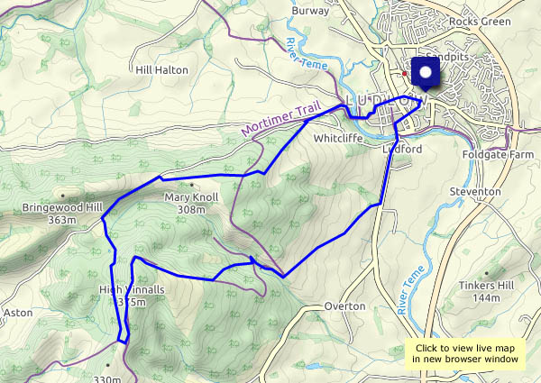
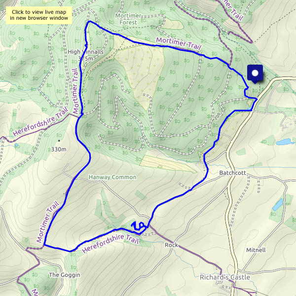
It’s a beautiful spring day, perfect for a picnic lunch on Climbing Jack Common… We’re walking from the Black Pool car park near Ludlow, up to the top of High Vinnals. The air is cold but clear – those are the Brecon Beacons, more than 40 miles distant on the southern horizon. Heading downhill now,  we cross the top of Hanway Common and look down on the Goggin (who wouldn’t?) before descending to what’s left of Richard’s Castle. It’s defended, or tended, by a pair of goats, currently basking atop the highest remaining wall. The church nearby has a separate bell tower,  The village of the same name is perhaps 3/4 of a mile way. A curious settlement – mostly in Herefordshire, its village hall is in Shropshire.

View OS map on Streetmap http://www.streetmap.co.uk/map.srf?X=348480&Y=271266&A=Y&Z=120

In Mortimer Forest

We’re walking from Ludlow into the hilly forest to the south-west, a route which takes us into Herefordshire, via the delightfully-named Sunnydingle Cottage to a summit at High Vinnals. 375m (1230 feet) is no great height, but the view is tremendous. That is, it would be, if it wasn’t for the showers of light rain here and there (no, the weather isn’t being as friendly as we’d expected). We return past Mary Knoll House, slithering downwards on the slippery clay, back to very welcome tea and cake, just right for the journey home.

View OS map on Streetmap http://www.streetmap.co.uk/map.srf?X=349560&Y=273526&A=Y&Z=120

Mary Knoll – 40 years later

We’ve walked many times in the woodlands to the south-west of Ludlow – this walk was probably our first. Today we retraced our steps, visiting Mary Knoll Valley for the first time in 40 years. The valley, with its pleasant but well-hidden little stream, cuts deeply through the land. Near its head, there’s a herd of deer, and beyond Mary Knoll itself, there are woodpeckers hammering away in the trees. Earlier, as we drove towards Ludlow, we’d passed a pair of red kites, wheeling in the warming air. Oddly, this walk seemed shorter than it was in 1976, though the trees have grown, and Ludford weir has been tidied up. How will it all look in 2056? (Will we care?)

Photo note: it was a dull, slightly murky day in 1976, so I used a roll of FP4 (monochrome) film – which I reversal-processed for black-and-white slides. I was rather pleased with the results, though I never tried it again…


View OS map on Streetmap http://www.streetmap.co.uk/map.srf?X=349675&Y=273336&A=Y&Z=120