The Bannister’s Round

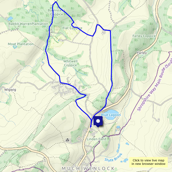
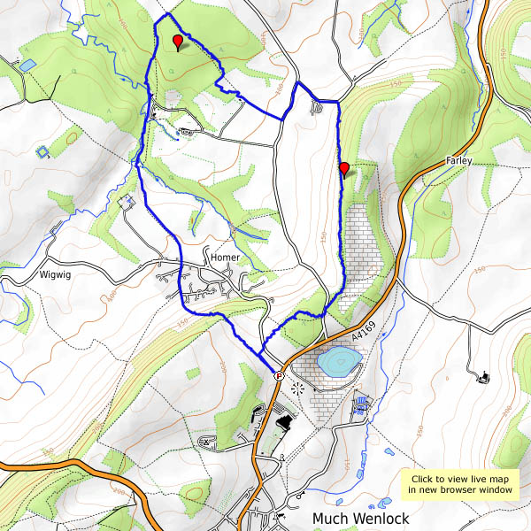
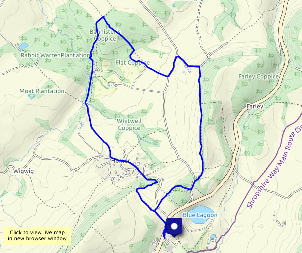
It’s become a favourite – a very enjoyable circular route from Much Wenlock, down through Traps Coppice and into Bannister’s Coppice, then beside Sheinton Brook and back up through Homer. There was a chance of rain earlier in the afternoon – this route is mostly in attractive woodland, but in the event we didn’t need shelter. By the time we’d topped the edge above Homer, the day had changed for the better.

View OS map on Streetmap http://streetmap.co.uk/map.srf?X=362175&Y=301916&A=Y&Z=120

Bannister’s and Traps

Saturday 23 February: A walk from Wenlock, on a fine dry afternoon. It’s almost “fine sunny afternoon”, but an approaching weak weather front takes the sunshine away (it didn’t get far – there was clear blue sky not too many miles to the east). The woods are quiet – there’s no wind. In Bannister’s Coppice, a rustling to our left reveals a herd of deer, perhaps 20 or more, well-hidden and impossible to photograph. There aren’t any deer in Traps Coppice today – just hundreds of pheasants, whose likely life expectancy is probably very short…

View OS map on Streetmap http://www.streetmap.co.uk/map.srf?X=362175&Y=301916&A=Y&Z=120

Bannister’s Coppice and the waggonway

When we walked in Bannister’s Coppice in late October, there were deer everywhere (see “Oh deer“). Will there be any today? More accurately, will we see any today? Yes, if we’re quiet and careful, though they’re shy at present – there’s a mother with a very young-looking fawn, which sneaks through the bracken and across our path, while we stand still and silent. We return by the track up from Seven Springs Farm, which I’ve realised is the route taken by a pre-railway age (1824) waggonway, from Gleedon Hill quarry to the Severn. Once again, there’s no-one else around.

View OS map on Streetmap http://www.streetmap.co.uk/map.srf?X=362890&Y=302881&A=Y&Z=120