The Munslows – an afternoon on the Edge

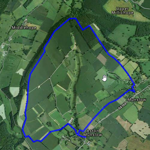
One we’ve done many times – park at Aston Munslow, then follow field tracks and, in places, sunken and/or hidden ways, along the second of the Wenlock Edges. It’s higher here than the generally more obvious first edge, to the north-west, topping out at 324m – about 1063ft. There are autumn leaves, toadstools, blackberries (still), crazy pheasants, and fine views to the Clee hills and Mortimer Forest. The last downhill stretch into Munslow is particularly deep and well hidden; the surface is, in places, the rock of the Wenlock Edge.

Map

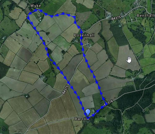
View OS map on Streetmap http://www.streetmap.co.uk/map.srf?X=351160&Y=287706&A=Y&Z=120

On the Edge in October

That’s the Wenlock Edge, of course. It’s a dry, bright and still afternoon, with just a “very small chance of a shower”. There are one or two possible candidates, but nothing near enough to worry us. Once again, there are all kinds of autumnal things in the hedgerows, and it’s always fun to find fungi…


Map

View OS map on Streetmap http://www.streetmap.co.uk/map.srf?X=361535&Y=300526&A=Y&Z=120

Autumn on the Stiperstones

It didn’t feel too autumnal – warm sunshine from a mostly-clear blue sky. The air was fairly cool, but with little wind, it was a great afternoon for these hills. I would say “lonely hills”, but they weren’t lonely today. There were two coaches in the Bog car park. There were quite a few people about on the main Stiperstones ridge, past the Devil’s Chair, but far fewer on the lower lane, and the southern ridge by Nipstone and The Rock. In the woods there are toadstools galore! – including a huge colony (at least 50 specimens) of “Flying Eric” (the psychoactive mushroom more commonly, but perhaps not more appropriately, known as fly agaric – which they were until my then-young nephew misheard or misremembered…).

Sadly, the Bog Centre was packed – the coaches were still there – no tea and cake after this walk.

(We’ve done this walk before – last time we did it anticlockwise, as shown on the map. Today we walked clockwise, for the views to the south-west from the ridge)

Map

View OS map on Streetmap http://www.streetmap.co.uk/map.srf?X=336435&Y=298026&A=Y&Z=120

Back to Homer, and Wigwig, and Harley

We walked this route earlier in the year – anticlockwise. Today we’ll walk it clockwise – the views will be different… The path through the deciduous woodland of Bannister’s Coppice is a most pleasant, descending to the former mill, whose race can still be traced beside the path. Alongside the lane from Homer to Harley there are distracting blackberries (and the odd damson). Returning past Belswardyne Hall the views are extensive on this fine last afternoon of September.

Map

View OS map on Streetmap http://www.streetmap.co.uk/map.srf?X=361005&Y=302661&A=Y&Z=120

A walk to Coalport

We’ve done it many times. It’s a pleasant afternoon, even if it is rather overcast. There’s not quite as much colour in the hedgerows as there was a month or two ago, but the butterflies are more cooperative. The peacock was on the path, wings closed. I reached down to him and he crawled onto my hand, to join us for a few yards (he would have stayed, I suspect, but we thought he’d be better off in the bushes). As usual, there’s tea and cakes to be had at Coalport…