April on the Edge

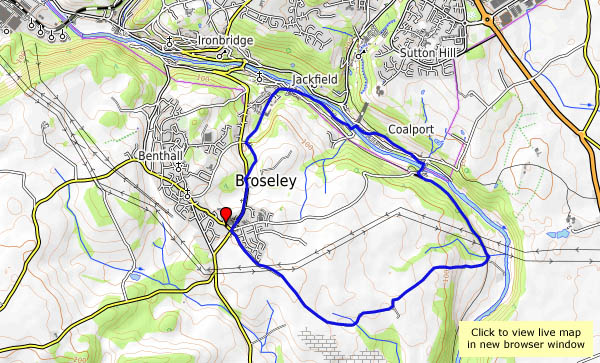
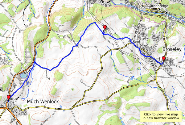
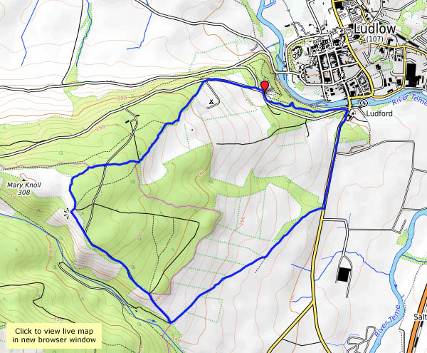
Friday 20th April: It’s too good for indoor chores. Lots of other people had the same idea – the little NT car park was full – though we only saw three others as we walked these quiet fields and woods. Little more than a week ago, it seemed spring would never come, but there’s no doubt now.

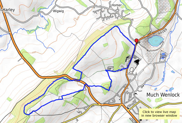
View OS map on Streetmap http://www.streetmap.co.uk/map.srf?X=361345&Y=300046&A=Y&Z=120

Spring at last

After lunch, the clouds cleared (as forecast) and instead of rain, warm sunshine fell on Shropshire’s sodden fields. We’d better make the most of it, it may not last… The no 18 bus to Much Wenlock gets us started, on a route which we’ve chosen in the hope of avoiding the worst of the mud (by avoiding field paths, a policy that nearly caught us out on the very quiet road near Wyke). Leaving Benthall Edge (last gasp of the Wenlock Edge) we find ourselves at Benthall Hall, where it’s warm enough to sit outside, in shirt sleeves, for tea and cakes… Suitably refuelled, it’s not far home now.

Benthall Hall NT

View OS map on Streetmap http://www.streetmap.co.uk/map.srf?X=365085&Y=301511&A=Y&Z=120

Corbet Wood and Clive

There’s a low sandstone ridge north of Shrewsbury, with attractive woodlands and interesting paved and bedrock tracks. The stone here has been quarried for many years – signs warn walkers to “beware of old quarries”… We’ll follow the lower-level paths from the car park at Corbet Wood, past Grinshill to Clive, then return via the highest point, which is a fine rocky viewpoint for the hills to the south, but hardly what one would call a summit (192m, or about 630ft above sea level). It’s a pleasant walk on an afternoon when, despite the grey skies, there’s spring in the air.

View OS map on Streetmap http://www.streetmap.co.uk/map.srf?X=352040&Y=323791&A=Y&Z=120

Bog, Black Ditch and Black Rhadley

There’s barely a cloud in the blue sky – it’s a day that’s too good to waste. We’re off to The Bog, for a walk along the southern ridge of the Stiperstones to Black Rhadley, and when we get back, the Bog Centre is open for tea and cakes. What more could one ask? That was intended to be a rhetorical question, but I’ll answer it anyway: “peace and quiet” – and yes, we had that too. Despite the weather being unusually good, we saw hardly anyone else on our walk, the shooters at the range were quieter than normal and even the dogs in the kennels failed to disturb the calm (there must have been others about – the cakes had nearly all gone!).

Bog Visitor Centre

View OS map on Streetmap http://www.streetmap.co.uk/map.srf?X=335045&Y=296846&A=Y&Z=120

Into the woods

A short walk from Ludlow. We’ve parked facing the well-known view of the town, with the castle and church prominent against the backdrop of Titterstone Clee. A cloud is casting deep shade over the castle, though the rest of the town is floodlit. Perhaps on our return?

Our walk takes us a short way along the old A49, then up to the woodland past Hucksbarn and Starvecrow. There are some fine views on this clear afternoon – until we enter the woods, by which time the cloud has thickened and the sunshine gone. There are thick plantations of conifers at first, but as we descend towards Ludlow the woodland becomes more varied and interesting.

View OS map on Streetmap http://www.streetmap.co.uk/map.srf?X=350060&Y=273470&A=Y&Z=120

Not yet…

Mid-March – any signs of spring? Very few – just a couple of hawthorns with a few buds opening (and possibly wishing they hadn’t), otherwise, the trees are still very bare. We’re walking to Benthall Hall, returning past the bluebell wood. Their green shoots are coming up, but we’re several weeks away from the flowers. At least the days are getting longer – it will get warmer.

View OS map on Streetmap http://www.streetmap.co.uk/map.srf?X=365865&Y=302501&A=Y&Z=120

Nesscliffe and The Cliffe

The road through Nesscliffe village is much quieter since the A5 bypass opened, though up on the hill the traffic noise from that bypass is somewhat intrusive. As we wander on around this little group of low sandstone hills, away from the road, the sound fades. It’s quiet here – although the afternoon is dry, it’s grey and gloomy, and there are few others about. Nesscliffe Hill is wooded, with few viewpoints; The Cliffe is more open, and though of insignificant height (157 metres – that’s 515 feet) the views are extensive. That is, they would be, on a clear day…

View OS map on Streetmap http://www.streetmap.co.uk/map.srf?X=339110&Y=320151&A=Y&Z=120


Rain, hail and snowdrops

We needed to call into the shops in Ironbridge – “We could walk down, have lunch and walk back the long way”. We did! It’s not warm, but we soon warm up, and it feels pleasant after last week’s Siberian snowfall. There’s a possibility of showers, apparently, maybe of hail or snow – and yes, there’s hail (which bounces off) and a little rain (which doesn’t). After the rain, the skies clear – to reveal more shower clouds approaching. We’d better not hang around.


View OS map on Streetmap http://www.streetmap.co.uk/map.srf?X=368730&Y=301831&A=Y&Z=120

Coalport cakes

They were an unexpected bonus – we hadn’t realised the hostel cafe was open, and despite the cold, there was enough sunshine and shelter for us to sit outside. Other than the café, a couple of lambs and some catkins, there are few signs of spring. We’ve got some cold weather to get through before things warm up.

opentopomap.jpg

View OS map on Streetmap http://www.streetmap.co.uk/map.srf?X=369350&Y=301556&A=Y&Z=120