No fairies…

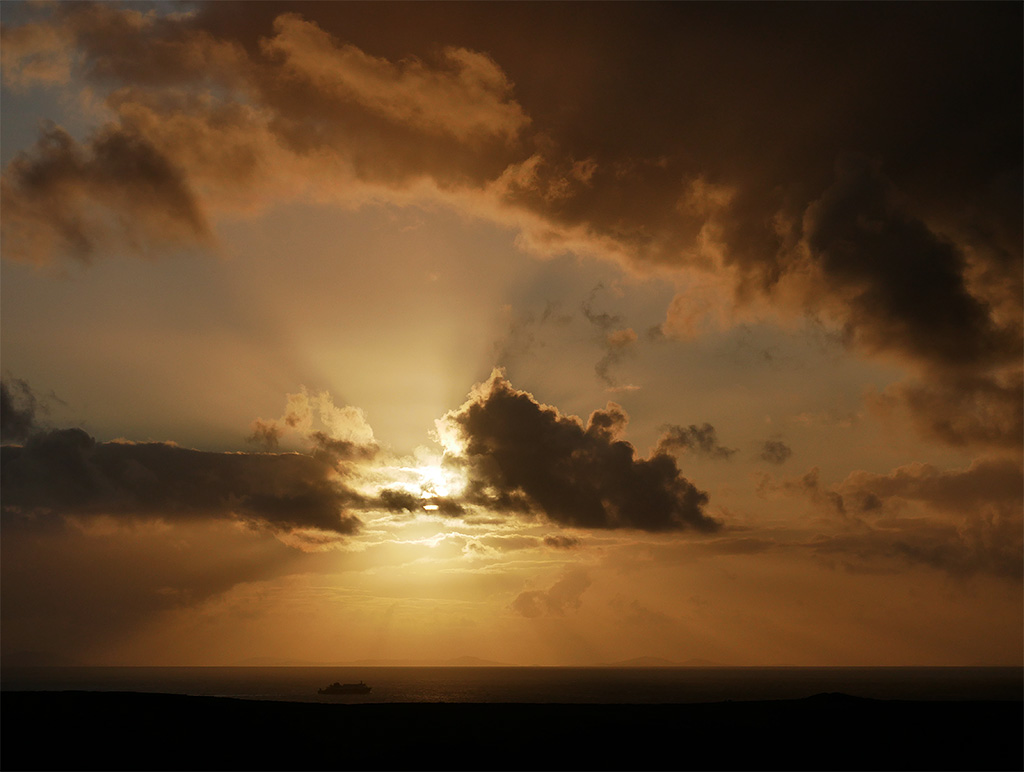
…the visitors have frightened them all away! Friday: a walk up to the Fairy Glen near Uig – with the emphasis on “walk”. The first time we visited this curious and fascinating landscape in miniature, we had the place to ourselves. That was perhaps getting on for 40 years ago – now it’s firmly on the tourist to-do list (remember to pack the selfie stick!). Driving up there is not to be recommended – parking is limited and potentially boggy, and then there are the adventure minibuses to contend with. But between the passing cars it’s quiet and a pleasant walk – and much easier to take in the scenery and the ambience.

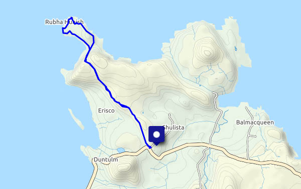
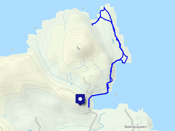
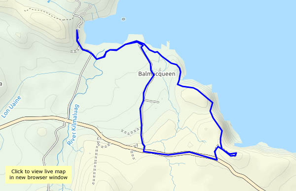
View OS map on Streetmap http://www.streetmap.co.uk/map.srf?X=140635&Y=863337&A=Y&Z=120

Loch Dunvegan

Not a day for walking – instead, we’re driving round to Dunvegan, for a change of scene and a look at the seals. There’s still some showery rain over the hills as we look over the loch from the east side, but it’s getting brighter by the minute, and when we explore the little dead-end road beside the western shore, sunshine predominates.

View OS map on Streetmap http://www.streetmap.co.uk/map.srf?X=124569&Y=848830&A=Y&Z=120

Staffin shore and skyescapes

Wednesday: it’s misty and damp here, on the western side of Trotternish (as seems to happen fairly often), but just a few miles away, at Staffin on the eastern shoreline, it’s much clearer, with the odd sunny spell. There are showers about, but we seem to escape them. We walk over the hill from Staffin to the slip and the beach (beware of minibus tours!), then along to the rocks, before heading back over the hill to the car, to drive around the coast to the fog and gloom.

View OS map on Streetmap http://www.streetmap.co.uk/map.srf?X=149128&Y=867796&A=Y&Z=115


Balmacquien – stacks and caves

Tuesday: Port Gobhlaig. We’ve walked many times from here, following the shoreline northwards to Rubha na h-Aiseig. Today we’re starting from the same parking place, around the other side of the bay and up onto the cliffs, above a wonderful selection of stacks and the odd cave or two, to end at the old RAF radar station high above Bagh nan Gunnaichean. Returning, we follow the main (single track) road as far as the Balmacquien lane, which takes us back to that little white house out on the point, from where we retrace our steps to the start. What a spectacular stretch of coastline!

View OS map on Streetmap http://www.streetmap.co.uk/map.srf?X=144210&Y=874345&A=Y&Z=120

The far north

Rubha Hunish: the northernmost tip of Skye. We could see it yesterday, over to the west. It’s a fine morning, and if I get there soon, I should be able to park the car without trouble. Without a doubt, it’s the only way to beat the hordes. The walk to the cliff tops (Meall Tuath and Meall Deas) overlooking the Hunish peninsula is becoming popular, but not all visitors are prepared to take the precipitous route down the cliff face. The peninsula itself is wonderful – gentle grassy slopes 50′ – 100′ above the sea, with superb coastal architecture along the east side – stacks, an arch – fine views and the sound of nesting seabirds. The views, admittedly, could be clearer – it’s been hazy all week, and we’ve barely seen the outer isles. But it’s great here – just me, the gulls, a few gannets, cormorants and – was that a golden eagle?

As I approach the cliffs for the scramble back up, there are one or two figures on the headland, by the bothy, and as I make my way back along the path, I meet an eclectic cross-section of humanity. Some respond to my greeting; others look straight through me. Did I fall off the cliff and perish? Am I a ghost?

View OS map on Streetmap http://www.streetmap.co.uk/map.srf?X=141529&Y=875608&A=Y&Z=120

Staffin strolling

We’ve driven here from Uig, over the bealach – past the car park for the horribly busy path to the Quiraing. There must be 70-80 cars crammed into every available space (apart from that taken by the burger van). I believe, along with several other destinations on Skye, that’s it’s become firmly lodged on the “World Top 50 Selfies” list… (what a shame!)

We squeeze past people struggling to park, and find ourselves in Staffin, for the very gentle walk over the hill and down to the shore south of the slip. Coming back up the well-engineered ancient path is slightly less gentle, but we can manage. Other than a few excessively loud voices at the slip, it’s really quiet – the only other person we’ve seen close by is a fisherman. On a fine, sunny, warm (for April) afternoon, Staffin’s shore is a great place to be.

View OS map on Streetmap http://www.streetmap.co.uk/map.srf?X=149198&Y=868006&A=Y&Z=120