A walk down to Ironbridge and back, on a grey day – didn’t take many photos… Here are seven of the best / least bad.


")
View OS map on Streetmap http://www.streetmap.co.uk/map?X=367447&Y=303282&A=Y&Z=115

A walk down to Ironbridge and back, on a grey day – didn’t take many photos… Here are seven of the best / least bad.
View OS map on Streetmap http://www.streetmap.co.uk/map?X=367447&Y=303282&A=Y&Z=115
South Shropshire uplands… They may be at the mole end of the hill scale, but on an afternoon like this, they’re great for fresh air and (despite the haze) wonderful views. The latter can be extensive, but ‘atmospheric’ is a better way to describe them today.


View OS map on Streetmap http://www.streetmap.co.uk/map?X=347750&Y=293585&A=Y&Z=120
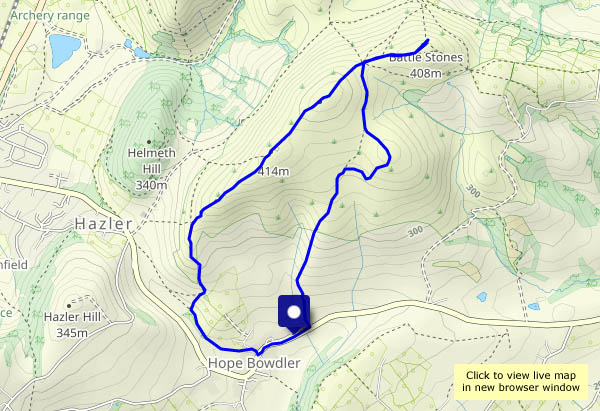
I don’t think anything disappears in mysterious circumstances up here, though it’s seriously deep country – who knows what happens in these parts? It’s a pleasant walk on a mild November afternoon, despite the lack of sunshine, and there’s still plenty of autumn colour.


View OS map on Streetmap http://www.streetmap.co.uk/map.srf?X=353520&Y=295320&A=Y&Z=120
We did well to find a dry(ish) spell today! We needed to call in Bridgnorth High Street – we might as well make it a mini-exploration.


A bright autumn afternoon, on the very quiet lanes in this attractive part of the county. It’s warm in the infrequent sunshine, but the air’s cold so we’ll keep moving. There’s plenty to see – a couple of red kites, two herons (one doing aerobatics!), an escaped heifer making off down the road at Holdgate (did it really enter the field behind the church, closing the gate behind it?), the usual uninterested sheep and a smattering of assorted mushrooms and toadstools. And cakes from Tigger’s Ickle Shop too! What more could one want?


View OS map on Streetmap http://www.streetmap.co.uk/map?X=356005&Y=289605&A=Y&Z=120
A wander around familiar lanes, starting from the village hall at Willey. There’s plenty to see at this time of year, though much of it will be gone in another few weeks.


View OS map in Streetmap http://www.streetmap.co.uk/map.srf?X=367470&Y=298250&A=Y&Z=120
As a hill, it’s barely there – the highest point is only about 170m (less than 600ft) above sea level. As a viewpoint for the south Shropshire hills, especially those around Church Stretton, it’s a grandstand! The grassy and almost level top is popular with dog-walkers, but down past the venison farm and along the unsurfaced track through Exfords Green, it’s much quieter. Returning by the pine-topped hill towards Lyth Bank, the views are opening out a little towards the west, to the Breidden hills and the Berwyns beyond.


")


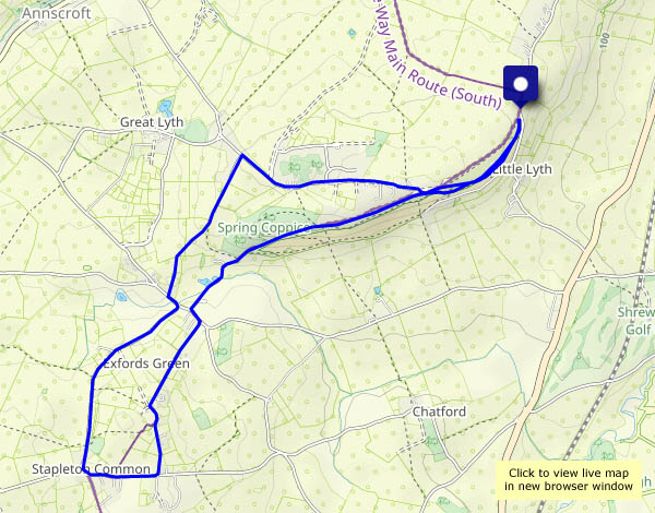
View OS map on Streetmap http://www.streetmap.co.uk/map?X=346580&Y=306275&A=Y&Z=120
Not so many years ago, people lived in caves along this part of the Severn Valley. There’s at least one house in Bridgnorth that has a quite significant cave behind a more conventional exterior. These cave dwellings, between the old railway track and the river, haven’t been used for many years – except by the sheep, who probably find them quite cosy on cold wet days.


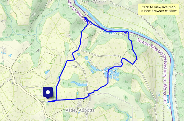
View OS map on Streetmap http://www.streetmap.co.uk/map?X=371405&Y=296985&A=Y&Z=120
A fine, sunny day – perfect for a walk on high ground, with extensive views in all directions… In other words, the Long Mynd’s Portway (approximately), from Robin Hood’s Butts to the Pole Cottage pools. Many others have similar ideas – I’ve never seen the top so crowded (“crowded” is a relative term up here…). Some people are trying to place their small dog on the trig point, so that he can appreciate the view. On the path, some walkers pretend we’re not there as they pass by, carefully avoiding any eye contact. Just smile and say “Hello”, folks! Only yards from Pole Bank, no-one else is interested in those reedy pools behind Pole Cottage, where there’s some welcome peace and quiet. Retracing our steps, a grouse calls out as he flies low over the moor – “go back, go back, go back”. Yes, that’s what we’re doing!


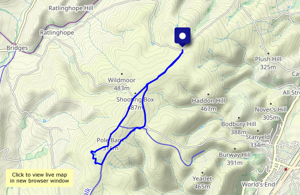
View OS map on Streetmap http://www.streetmap.co.uk/map?X=342420&Y=295110&A=Y&Z=120
Coalbrookdale too! It’s going to rain in the early afternoon – we’ll try to make the most of some brightness before lunch.


View OS map on Streetmap http://www.streetmap.co.uk/map?X=367310&Y=303895&A=Y&Z=120
