Enjoying some intermittent late-morning sunshine, with a walk down the lane to the top of the bank (and back). It’s a good place to pause and contemplate the view to the east, aided by a little chocolate…


Just photos – no particular theme
Enjoying some intermittent late-morning sunshine, with a walk down the lane to the top of the bank (and back). It’s a good place to pause and contemplate the view to the east, aided by a little chocolate…
… there’s colour in the woods, and there’s a splendid bank of toadstools beside the path back up the hill.


")


View OS map on Streetmap http://www.streetmap.co.uk/map?X=367572&Y=302235&A=Y&Z=120
Along Ned’s Lane, pale particles are sifting down through the trees. I should say from the trees… Larch needles, doing what they do in autumn, covering the path with a snow-like coating. Elsewhere, there are still plenty of toadstools, though most of the ‘Flying Erics’ are well past their best, and the puffballs have puffed!


View OS map on Streetmap http://www.streetmap.co.uk/map.srf?X=366240&Y=297950&A=Y&Z=120
We ate out on Tuesday – outside the Tea Emporium in Ironbridge. The ambience for today’s lunch was on a different plane – nearly 1500ft above sea level, beside Boyne Water on Brown Clee. A bit draughty perhaps, and just a plain wooden plank to sit on, but much superior views – a great place to dine! A little later, we’re enjoying our second lunch (a fine tradition is developing in these parts…) – biscuits on the bench near the Five Springs. With the Brecon Beacons in view, 55 miles to the south-west, and Cader Idris (57 miles) peeping over the Long Mynd, the views are even better.


View OS map on Streetmap http://www.streetmap.co.uk/map?X=360095&Y=285830&A=Y&Z=120
When the sun shines at this time of year, it’s low and directional, restoring a dimension that’s lost in flat summer lighting. It brings out the colour too, and there’s no shortage of autumnal shades in the quiet country below the Wenlock Edge


View OS map on Streetmap http://www.streetmap.co.uk/map?X=354710&Y=298445&A=Y&Z=120
“We could walk from Bedlam, over to Coalbrookdale, then back through Ironbridge – pick up some tea at the Emporium”. Good idea, and we’ll go this morning – it will be cloudier after lunch, with showers. The timing was good too – it’s just lunchtime as we arrive in the Square. The bacon baps weren’t on the plan, but they were rather good…


View OS map on Streetmap http://www.streetmap.co.uk/map?X=367220&Y=304157&A=Y&Z=120
It’s a regular destination – in the season we can have tea and cakes at the youth hostel. Out of season, we can use their benches for our chocolate stop. The forecast thinks it should stay dry, but as we reach the plateau on our way back, we can see there are one or two little showers around…


View OS map on Streetmap http://www.streetmap.co.uk/map?X=369015&Y=301605&A=Y&Z=120
Strong winds and blustery showers – we could get soaked! Let’s risk it! Apart from a few drops in the wind (followed by a rainbow) it stayed dry, and with mostly bright skies and interesting clouds, it’s a very enjoyable little outing.


View OS map on Streetmap http://www.streetmap.co.uk/map?X=367662&Y=298184&A=Y&Z=120
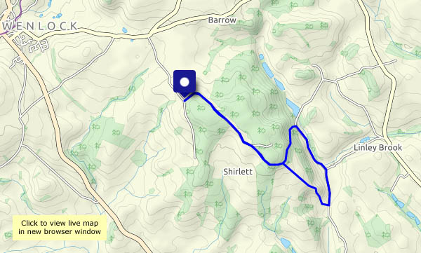
Properly known as fly agaric, it was a nephew’s apt malapropism many years ago. A couple of them caught our eyes as we walked along Shirlett Lane – they were duly recorded by the camera. It’s an out-and-back walk, but “things look different in the other direction”. They certainly did. The Reeves’s pheasant was perhaps rather overdressed for these parts. He was around on the outward walk, hard to see in the undergrowth, but determined to pose for us on our return. A little further on, there are the two Erics – and beyond them (we hadn’t noticed them earlier) dozens more, in amongst the trees beside the lane. Despite being past their best, they brighten up a dull morning.


View OS map on Streetmap http://www.streetmap.co.uk/map.srf?X=365660&Y=298545&A=Y&Z=120
We’ve walked down to Ironbridge, where the rails of the level crossing remind us of what has gone. Half a mile or so along the trackbed, we’re on that curious viaduct-that-isn’t, looking down on the Severn. Soon, we can go no further, and have to take to the hillside for the pull up through the woods to Benthall Hall. There are lots of distractions along the way…


View OS map on Streetmap http://www.streetmap.co.uk/map?X=366292&Y=303217&A=Y&Z=115
