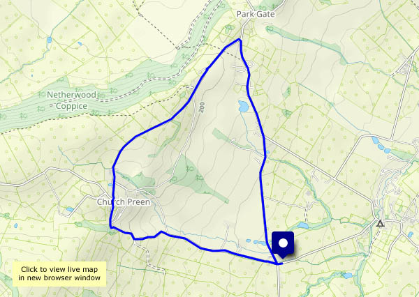
Toadstools in the woods

It’s possible I’m describing mushrooms (edible) as toadstools (not!) – but even if they were edible, I wouldn’t want to risk it (Russian roulette!) and, more to the point, would rather leave them growing there for everyone to see and enjoy. It’s a grey afternoon at Attingham, but pleasant nevertheless. Sunshine would have been good but would be wasted in the woods.

Attingham Park NT

View OS map on Streetmap http://www.streetmap.co.uk/map?X=354940&Y=310040&A=Y&Z=120

Fungi, hops and berries

Could brew a few pints with the hops around Willey! Pick a hop flower and rub it between your fingers to release that delicious scent. The fungi are beginning to emerge after the recent rain – two beautiful giant puffballs amongst others, and the various fruits and berries are still around in colourful profusion (I think the blackberries are past their best – the devil’s in them from next Wednesday!)

View OS map in Streetmap http://www.streetmap.co.uk/map.srf?X=367470&Y=298250&A=Y&Z=120

Cave-dwellers

Kinver Edge and the rock houses. We’re at the southern end of that thin extension of Staffordshire sandwiched between Shropshire and the county of West Midlands – Kinver, with its wonderful rock houses and wooded sandstone ridge. The houses are in the care of the National trust (see link below), and well worth an exploration. The Edge, also NT, is a popular place for a leg-stretch – deservedly so, with its well-waymarked maze of sandy tracks, and particularly attractive on this sunny afternoon.

Kinver Edge & the Rock Houses NT

View OS map on Streetmap http://www.streetmap.co.uk/map?X=383220&Y=282885&A=Y&Z=120

Up to Plaish

It’s a hilltop hamlet with a hall. After yesterday’s heavy rain, we’re staying on the (very quiet) surfaced lanes for this walk in Apedale, from the crossroads at Day House, towards Longville then up (it’s no great height, but a gentle pull for the last half-mile) to Plaish. A glance at the hall, a chocolate stop at the field gate – then back down to the start, beside the gurgling little brook, hidden amongst the trees.

View OS map on Streetmap http://www.streetmap.co.uk/map.srf?X=353520&Y=295320&A=Y&Z=120

A Haughmond wander

Another fine afternoon (it can’t last!) – Haughmond Hill could be pleasant. It’s barely worth calling a hill, at 153m above sea level, but the view from the southern edge of the woodland is extensive, a sweeping panorama of significantly higher ground – the Wrekin, the Clee hills, the Stretton hills, the Stiperstones, and away to the west and over the border, the Berwyns. Away from the edge, in the forest, there’s a more limited view, but there’s lots of foreground interest – interesting fungi galore, and a fine crop of tiny sweet wild damsons…

Forestry England: Haughmond Hill

View OS map on Streetmap http://www.streetmap.co.uk/map?X=354525&Y=313810&A=Y&Z=120

The Harton triangle

Dodgy part of the county… No, I’m not aware of a tendency for unexplained disappearances around here, though it is rather quiet (spooky, I suspect, after dark), and very pleasant too beneath the wooded Wenlock Edge. One or two cars passed on the wider lane from Ticklerton to Harton, but the other two sides of the triangle, Harton – Eaton – Ticklerton (see the map below), were almost deserted. We paused to look at the birds at Newhall farm – “come in and have a closer look”, said the friendly lady on her way to feed them. The eagle owl promptly hid when it saw us, but peeped out briefly to see if we were still there. Peacocks, of course, are not so shy…

View OS map on Streetmap  http://streetmap.co.uk/map?X=367550&Y=301475&A=Y&Z=120

Autumn’s great!

The last month or so of summer can be drab – tired greens in the trees and few flowers. Now, half-way through September, the seasonal shades are developing rapidly. It’s much wetter (we needed it) and generally cooler, though when we set out this afternoon, after the rain had almost cleared, it felt warm. The recent wet weather, as well as supplying much-needed moisture to the forests, fields and rivers, has encouraged the fungi. They’re there all the time, of course, unseen in the earth and rotting wood, but now making themselves visible (though not overly obvious). I’ve no idea what most of them are, but it’s fun to find all these strange shapes and forms in the Shirlett verges and woodland fringes.

View OS map on Streetmap http://www.streetmap.co.uk/map?X=365790&Y=298180&A=Y&Z=120

Wyke, the edge and the hall

Tuesday 16 September: Benthall Hall to Wyke, and back by Benthall Edge. It’s all very autumnal now, though the colours of the leaves have a little way to go yet. We’re enjoying a wander around familiar places (no less pleasant for that), but finding the unexpected too. Spotting three deer scampering through the trees (no chance of a photo, sadly) is not unusual, but I don’t think we’ve ever seen quinoa – if that’s what it is – growing locally.

View OS map on Streetmap http://www.streetmap.co.uk/map?X=365765&Y=302600&A=Y&Z=120

We might get wet…

There are some heavy showers around, but if we time it carefully (and if the Met Office’s map is reasonably reliable) it could stay dry for long enough to walk around the Willey lanes. It was raining when we left home, and soon after we left the car, we had to shelter under the trees (who needs an umbrella around here?) for five minutes…

…and then it was dry, with some bright sunshine and great cloudy skyscapes. It can’t last though, and on the five-minute drive home, the rain begins again.

View OS map on Streetmap http://www.streetmap.co.uk/map?X=367515&Y=298310&A=Y&Z=120