A Hinnisdal dozen

…on a remarkable day of mist and sunshine. The former burned away during the morning, but lingered over the sea for the whole day. Plenty of the latter in the forested Glen Hinnisdal, with spiders’ webs highlighted by droplets from the mist and a fine crop of fly agarics just waiting (in a dark little recess of the forest) to be snapped.
More to come on the misty conditions elsewhere, but that’s enough for today…

View OS map on Streetmap http://www.streetmap.co.uk/map?X=140415&Y=857548&A=Y&Z=115

Ferry Point once more

Thursday 19 September: Rubha na h-Aiseig – Skye’s far north again, just a couple of miles east of Rubha Hunish and perhaps two hundred yards further south – another favourite outing. There are some pleasing similarities to yesterday’s walk – not least the fact that there’s no-one else there. An interesting negotiation of a cliff-top route leads to a zig-zag way down (not remotely as exposed or tricky as Rubha Hunish) to the scrubby sheep pastures, where a faint path leads to the northernmost tip. Rubha na h-Aiseig translates as “Ferry Point”: there are remains of former “black houses” tucked in behind a stony shore – was there once a ferry across to the island of Trodday, about a mile offshore?

View OS map on Streetmap http://www.streetmap.co.uk/map?X=143954&Y=875863&A=Y&Z=120

Return to Rubha Hunish

Wednesday 18 September: It’s the northernmost tip of Skye, accessible only by a very steep and exposed “path” down the cliff face. Lots of people park at the end of the Shulista road and walk along the excellent path to the cliff top, look down and decide to visit the ex-coastguard bothy on top of Meall Tuath instead.  I’ve been to the bothy three times this year, on longer walks where the visit to Rubha Hunish would be too much for a short outing. Today I’m descending! It’s barely a mile from the cliff top to the tip of the island, but a full two hours have elapsed by the time I’m back at the top (I’d have been walking in total darkness on my January and February visits). Skye’s roads are very busy with visitors, but for those two hours, I have the little Hunish peninsula to myself – paradise! That monster cruise liner can hold over 4,000 passengers. I know where I’d rather be on this beautiful sunny day!

View OS map on Streetmap http://www.streetmap.co.uk/map?X=141439&Y=875598&A=Y&Z=120

Flying things

Comer and Mose – a walk through the woods and along the very quiet lane past the farm. There are butterflies, there’s a small dragonfly (a common darter, I believe) and, at the other end of the scale, a family of swans in Wall Pool. The NT car park is busy, but beyond a 15 minutes radius from the car, there’s no-one else around.

View OS map on Streetmap http://www.streetmap.co.uk/map?X=375070&Y=289900&A=Y&Z=120

Hobbits and men: Stourport

The Prancing Pony at Bree had separate facilities for the differently-sized peoples of Middle Earth. Stourport basin is a bit like that. It connects the narrowboat canals of the West Midlands with the Severn and, well above the river, also provides facilities for medium-sized riverboats (which cannot, of course, travel any further up the waterway along the canals). Between the river and the basin are two sets of locks – full-width barge locks for the riverboats, and hobbit-sized for the narrowboats. It’s a fascinating place.

Cheek-by-jowl with the canal-age calm of the basin, overlooked by the elegant Georgian buildings of Stourport, is a brash, noisy, colourful funfair (it’s probably much noisier at the weekend), and the high street shops, particularly those nearer the river, appear to cater for its visitors – especially the hungier ones. The contrast between the shopfronts and the floors above is almost as great as that between the basin and the funfair. I’ll say it again – it’s a fascinating place!

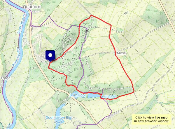
View OS map on Streetmap http://www.streetmap.co.uk/map?X=380903&Y=271058&A=Y&Z=115

Lasp gasp…

… of summer? It’s certainly warm today, in the mid-2os, though it probably won’t last. Sunny too – it would be a crime to stay indoors. Away from the car park, there’s hardly anyone else about, and I don’t think the path from Posenhall to Arlescott has been walked much recently – it’s almost blocked by scratchy brambles and stinging nettles (I can still feel them in my left hand). The blackberries beyond that short stretch make it all worthwhile – several brief stops for refreshment…

View OS map on Streetmap http://www.streetmap.co.uk/map?X=365360&Y=301865&A=Y&Z=120