
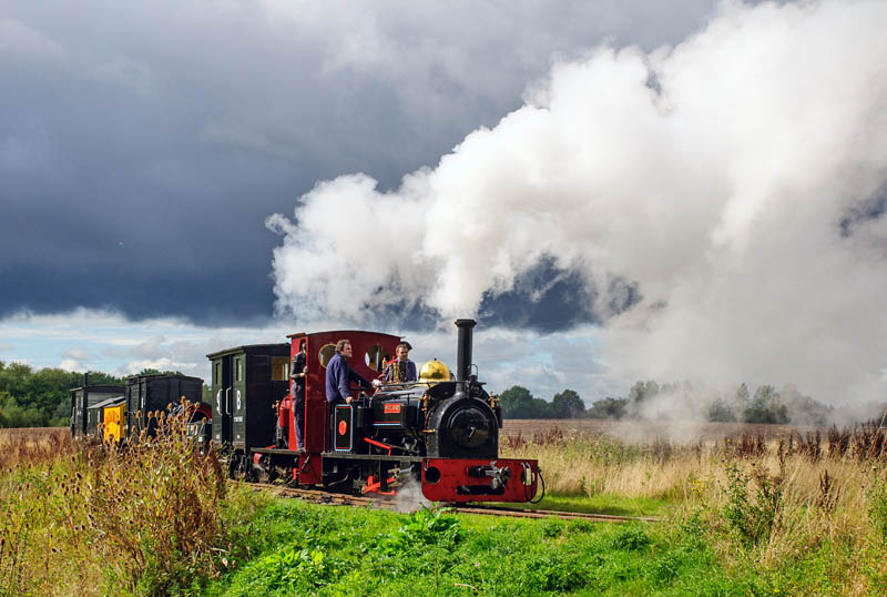
 Been to Statfold today. The overnight night rain cleared, but there was plenty of cloud around, making for some threatening skies and, just occasionally, dramatic lighting. Here’s a sample – eventually, there will be several more pictures on Geoff’s Rail Diaries (when I’ve done the Waverley photos…).
Author: geoffspages
More from Threlkeld
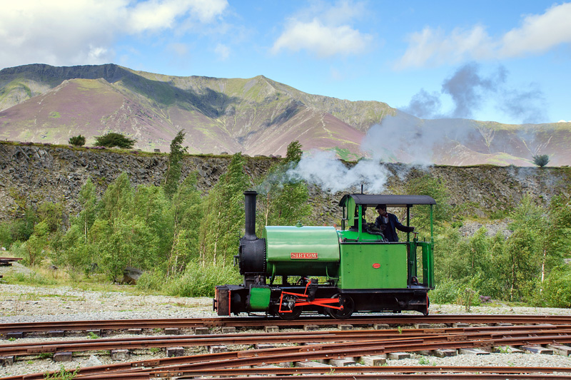 Just published to Geoff’s Rail Diaries – “Sir Tom” – an illustrated account of our visit to Threlkeld quarry (just over two weeks ago – there’s a bit of a backlog to work through…)
First train to Tweedbank
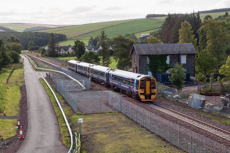
 Sunday 6th September: the 9.11am from Waverley, the first public train to Galashiels for more than 46 years (and the first public train ever to Tweedbank). Yes, I made it – and what a pleasant trip it was too, on this fine sunny morning.
Next stop Hawick?
Return to Fountainhall
Today, trains have been running on the reconstructed part of the Waverley route, between Edinburgh and Tweedbank, a couple of miles south of Galashiels. Part of the celebration of the reopening, they were for Golden Ticket holders – local people including numerous school children. No such tickets for Geoff’s Pages. Having travelled on the last day (see “Last Day of the Waverley Route” on Geoff’s Rail Diaries), we’ll be doing our best to travel on the first public train from Edinburgh Waverley tomorrow morning; today we’ll have a photographic day out.
 A Rail Diaries page will follow before too long. In the meantime, here’s a photo which provides a link between the last day and the first day. Our special train, in January ’69, called at Fountainhall for a photo stop. The station there has not been reopened – there will be no more returns (or singles) to Fountainhall. The platforms have gone, as have the level crossing and signalbox – but that house, immediately beyond the crossing, is still there…
Scorrybreac Circuit
Portree – a deservedly popular walk along the shore past the Black Rock towards the Bile (a raised beach, apparently), then over the hill on a steep but very pleasant path, to return to the car past the Cuillin Hills hotel. Wild flowers abound beside the path; beyond, the fish farm resembles giant lily pads.
Scorrybreac Circuit on Walkhighlands


Glen Uig
Or is it Glen Conon? That’s the river; the OS map labels the north side as “Glen Conon”, as does the road sign for its road. The southern side? The sign points to Sheadar and Balnaknock, but it’s best know as the road to the Fairy Glen. We walked both roads (it’s very wet off-road at present), with the aim of following their continuations, as rough tracks, a little way up onto the moor. In both cases we were thwarted – by awkwardly-placed stepping stones on the south side, and a morass at the gate on the north side.
The Fairy Glen is, almost literally, crawling with tourists, struggling to top Castle Ewen. Away from the fairies, these are very quiet ways. There are fine views of three substantial waterfalls to the north (the first of which was a possible objective if we’d been able to cross the morass). Both roads leave Uig by steep hills, with wonderful zig-zags, and from the top there’s a fine prospect of Uig bay, and the ferry for the outer isles.
Sheader, Balnaknock and the Fairy Glen


Glen Conon


Later in the day
It’s looking brighter – is the weather changing? Perhaps not, but at least it’s dry enough for a leg-stretch.


Heavy showers
Not a day from straying far from the car – the showers are heavy, frequent and unpredictable. Some of these were taken from inside the car. After all, it’s important to keep raindrops off the lens…


Wet!
It’s just the weather for playing with a 10-stop ND filter – even if the wind does buffet the tripod, and raindrops on the lens don’t improve the picture…


Sir Tom
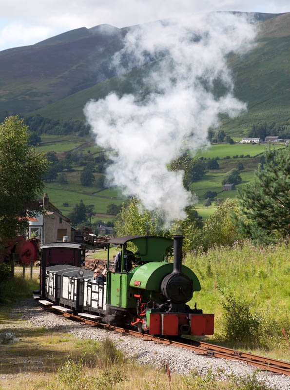 We looked in at Threlkeld Quarry this afternoon – for a ride into the old workings behind Bagnall 0-4-0ST “Sir Tom”. There will be a “Rail Diaries” page in due course; in the meantime, here’s a taster…
Threlkeld Quarry and Mining Museum
