…with the camera. If we’re lucky (we were!), it won’t rain on us. It’s quiet this evening, hardly anyone else about.


…with the camera. If we’re lucky (we were!), it won’t rain on us. It’s quiet this evening, hardly anyone else about.
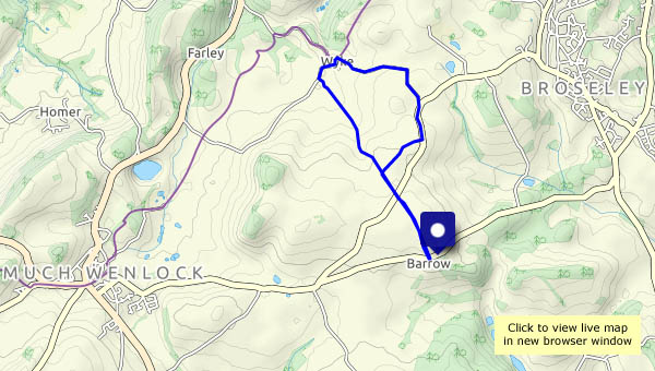
Ned’s Lane, Willey and Linley Brook – four quiet miles on a quiet afternoon. The cuckoo pint berries are prominent low in the hedges near Lower Pool, and the pure white of the convolvulus catches the eye in the higher reaches of Bould Lane and beyond.


View OS map on Streetmap http://www.streetmap.co.uk/map.srf?X=367490&Y=297955&A=Y&Z=120
Arranging a day’s walking: “where shall we go?” “I’ve got somewhere in mind…” Yes, a day on the Long Mynd. Haven’t been up there for ages.
Carding Mill Valley is horribly busy, but five minutes later we’ve left it all behind, and we’re enjoying a mostly-quiet and easy, if somewhat indirect ascent to the ridge. Predictably, from the top of Mott’s Road to the highest point at Pole Bank, there are others about (but only a very small proportion of those in the valley make it this far). Leaving Pole bank is to leave the crowds (I exaggerate. There were three others there), and our descent, by the Yearlet / Ashlet ridge, is comfortably quiet. A very enjoyable outing (but we won’t be hurrying back to Carding Mill Valley just yet…)


")


View OS map on Streetmap http://www.streetmap.co.uk/map.srf?X=344030&Y=295120&A=Y&Z=120
We’re exploring today – quiet farm tracks which we’ve not trodden before, and paths through fields of ripe wheat. If the weather holds, they will very soon be stubble. As well as the usual enjoyable views, there are hundreds of butterflies, most of which are nervous, but one or two pose obligingly for the camera.


 skipper")


View OS map on Streetmap http://www.streetmap.co.uk/map.srf?X=360205&Y=297700&A=Y&Z=120
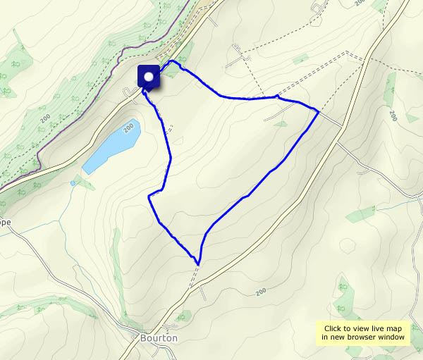
We walked this way little more than two weeks ago, when the weather had been damp. Today’s dry and sunny – quite different. That sums up the route too – each short stretch is quite different from the others. We start beside, and through, fields of ripe wheat. The next field is sheepy, then there’s the leafy way to Barrow and its ancient little church. A march down the road is unavoidable, before we leave it for pine woods, to walk past Wildwoods and up the sunken lane, then descend beside the estate wall to Willey. Willey is certainly “different”, medieval in appearance. Next, a very quiet narrow road leads us to Lower Pool, then up Ned’s Lane we go, to finish along Shirlett Lane, with its wooded stretches and some open views to Brown Clee and the Wrekin. Most enjoyable – never a dull moment!


View OS map on Streetmap http://streetmap.co.uk/map.srf?X=366190&Y=298996&A=Y&Z=120
It was an enjoyable afternoon wander, though the photography was somewhat limited. I’d remembered the camera, but its battery and memory card were still in the charger and card reader at home. Spare battery? It was flat. Spare memory card? In the other camera bag. I’ll have to use the phone camera. As expected, there were few other people around, and those we met were all on the old railway track or the riverside path.


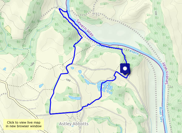
View OS map on Streetmap http://www.streetmap.co.uk/map.srf?X=370980&Y=297385&A=Y&Z=120
We’re sitting in the chocolate seat, enjoying a couple of minutes rest. “Look, there’s a rabbit” “No, it’s a hare!” Inevitably, he’s long gone by the time the camera is pointing in the right direction. Some of the butterflies are more obliging, and there are electric-blue damselflies on a branch in Shore Pool. A few poppies in the wheat catch the eye – as does a huge toast-coloured toadstool. An enjoyable afternoon outing!


")


View OS map on Streetmap http://www.streetmap.co.uk/map.srf?X=366905&Y=295705&A=Y&Z=120
… in the distance. The Wrekin, Brown Clee and Titterstone Clee – all are in view (from time to time) as we wander along the lane at Shirlett. Last time, we walked in a misty drizzle, and had to focus on things close at hand. The walnuts, the cherries and the cattle (and many trees!) are still here, and there’s an interesting but scruffy-looking toadstool beside the road. And it’s quiet – really quiet. As we pause at the top of Ned’s Lane, before heading back, there’s one small bird singing, a little way off. Not another sound!


A day on Brown Clee: the weather’s not great – gloomy, cold and just the occasional spot of drizzle – but it’s good to be out on Shropshire’s highest hill. Not a giant, Brown Clee is nevertheless a good viewpoint, and today the air is clear despite the gloom. Higher hills in Wales form a wonderful western panorama – and that summit away in the far south-west must be Carmarthen Fan, a full 100 km distant (just over 62 miles, but it sounds more impressive in metric). Our outward route has taken us along the estate road, then up the steep track to a bench beside Boyne Water. Later, after crossing the summit ridge, we drop down to the hillside terrace, with its views of Corvedale and the Wenlock Edge. A most enjoyable circuit!


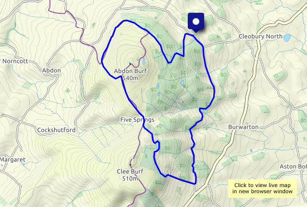
View OS map on Streetmap http://www.streetmap.co.uk/map.srf?X=359765&Y=285845&A=Y&Z=120
There are poppies in the cornfields, and butterflies galore (they’re rather restless today). The sky is blue, with lots of wispy clouds, and though the sunshine is warm, the air is pleasant. It’s a perfect afternoon for a walk to Wyke.


View OS map on Streetmap http://www.streetmap.co.uk/map.srf?X=365265&Y=301021&A=Y&Z=120
