The far north

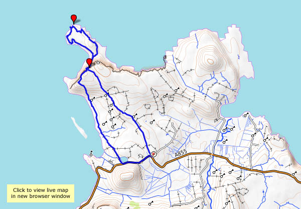
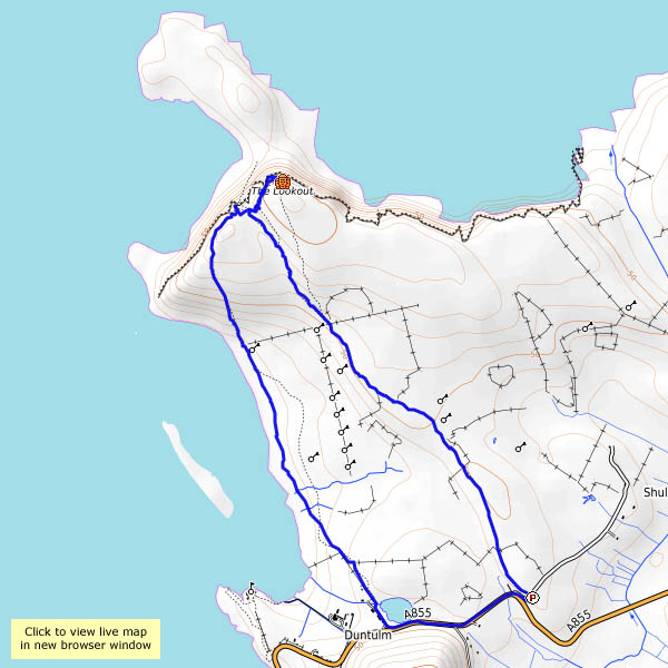
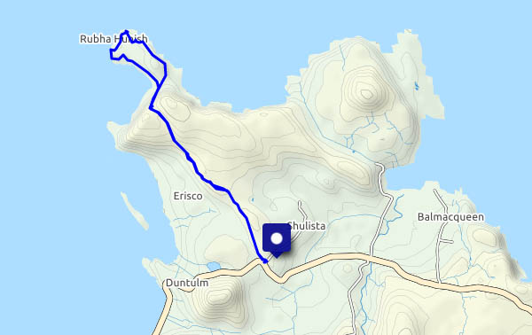
Rubha Hunish: the northernmost tip of Skye. We could see it yesterday, over to the west. It’s a fine morning, and if I get there soon, I should be able to park the car without trouble. Without a doubt, it’s the only way to beat the hordes. The walk to the cliff tops (Meall Tuath and Meall Deas) overlooking the Hunish peninsula is becoming popular, but not all visitors are prepared to take the precipitous route down the cliff face. The peninsula itself is wonderful – gentle grassy slopes 50′ – 100′ above the sea, with superb coastal architecture along the east side – stacks, an arch – fine views and the sound of nesting seabirds. The views, admittedly, could be clearer – it’s been hazy all week, and we’ve barely seen the outer isles. But it’s great here – just me, the gulls, a few gannets, cormorants and – was that a golden eagle?

As I approach the cliffs for the scramble back up, there are one or two figures on the headland, by the bothy, and as I make my way back along the path, I meet an eclectic cross-section of humanity. Some respond to my greeting; others look straight through me. Did I fall off the cliff and perish? Am I a ghost?

View OS map on Streetmap http://www.streetmap.co.uk/map.srf?X=141529&Y=875608&A=Y&Z=120

Back to Rubha Hunish

Mon. 1st May: I’m on my own again, heading for Skye’s northernmost tip – Rubha Hunish. The path down the cliff face, between Meall Tuath and Meall Deas, puts many casual wanderers off. They’ve already reached a spectacular viewpoint, but the promontory below the cliffs is somewhere special. A cruise liner passes as I descend carefully: I’d much rather be where I am than where they are. There’s a great feeling of freedom on Rubha Hunish – I’d feel trapped inside that thing…

View OS map on Streetmap http://www.streetmap.co.uk/map.srf?X=141460&Y=875564&A=Y&Z=120

North and south hills

28 November: Meall Tuath and Meall Deas are the rocky hills (or possibly “lumps”) which overlook Rubha Hunish, Skye’s northern tip. I was here in the summer, scrambling down the cliff-face to reach that grass-topped rocky tongue of land. Today, we’ll be content to take in the vista from these superb viewpoints. On Meall Tuath, there’s a former coastguard lookout, now equipped as a mountain bothy – could be a great place to spend a short midsummer night, but not in late November. Once again, we’re on our own out here – apart from the sheep and the seabirds – and golden eagles. There were two or three above us as we parked the car, gone by the time we were out – but then, as we made our way along the path, there was another. A grab shot will have to suffice for illustration – they may be big, but they’re hard to find in the viewfinder on maximum zoom, and they don’t exactly pose. A great sight on our last day out up here – soon we’ll be heading south, with fingers crossed for weather and traffic…

map

View OS map on Streetmap http://www.streetmap.co.uk/map.srf?X=141484&Y=875643&A=Y&Z=120

Alone on Rubha Hunish

28 August: Last time I was here, there were others about. This time, I paid my visit to Skye’s northernmost tip before lunch, and had the little rock-rimmed peninsula to myself – and the gulls, and the cormorants. Wonderful! I’m on my own because my usual companion on these little outings would be quite unable to manage the very steep rocky path down the cliff between Meall Tuath and Meall Deas – it needs a good head for heights. After a most enjoyable hour or so, I’m on my way back, and now there are others on their way down. They’ll enjoy their visit, I’m sure, but being alone on Rubha Hunish feels a little bit special…


View OS map on Streetmap http://www.streetmap.co.uk/map.srf?X=141425&Y=875535&A=Y&Z=120