Skateraw and Barns Ness

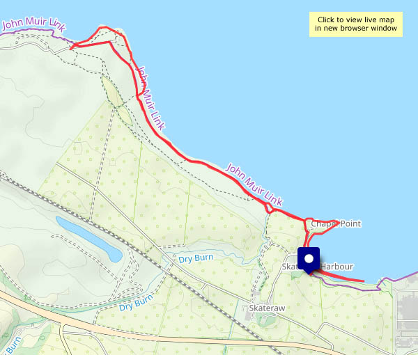
Wednesday 6 August: a walk along the shore. Skateraw lime kiln is just a few yards along the rock slab shore from the Torness nuclear power station, a prominent landmark on the coast of East Lothian. A couple of miles to the north-west is another highly visible landmark, the lighthouse at Barns Ness. Dating from the turn of the 20th century, it was deactivated twenty years ago, and is now in use as holiday accomodation. The shore path is very pleasant, with fine views to sea and plenty of white waves – most enjoyable for an afternoon stroll.

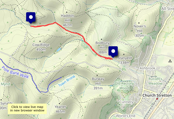
View OS map on Streetmap http://www.streetmap.co.uk/map?X=373167&Y=676267&A=Y&Z=120

The riverbank and Colemore Green

The sunshine is rather warm this afternoon. Some shade would be good: there’s not a lot of it along the riverside path, but it’s very pleasant down by the river, though we’re not alone. There are people in inflatable rubber boats making their way downstream, and there are ducks and geese in the water. There’s the odd cyclist (I probably mean “the occasional cyclist”) on the old railway track, where it’s shady and cool in the deep rock cutting. There’s no-one else on the path back up to Colemore Green – this is a quiet corner of the world.

View OS map on Streetmap http://www.streetmap.co.uk/map?X=371620&Y=296675&A=Y&Z=120

Not Hurst Farm and Aldenham

There were cows in the field (bullocks, I realised later), and one of us wouldn’t enjoy that part of the walk, especially as we’d have to pass them in both directions, at the start and end of our outing. So, without moving the car, we’ll turn through 180° and do the Round Hill / Ned’s Lane / Smithies walk (very pleasant it is too, on this warm afternoon).

View OS map on Streetmap http://www.streetmap.co.uk/map?X=367105&Y=297455&A=Y&Z=120

Toothwort and lungwort

Last week we were admiring the tree lungwort at Uig. We’re back in Shropshire, which isn’t a temperate rain forest, but beside the lane around Willey, there’s a more colourful plant, unrelated but also known as lungwort. Further back along the lane, we’ve spotted some toothwort, a curious parasitic plant. It’s not pretty!
The weather down here has been drier recently – the fields and lane are not quite so soggy as they were just a couple of weeks ago. Not complaining!

View OS map on Streetmap http://www.streetmap.co.uk/map?X=367515&Y=298310&A=Y&Z=120

Staring Sheep

We went to the local amateur dramatics group’s pantomime a few weeks ago. The undoubted star of the show (sorry, Nick!) was Lampard the staring sheep. Brilliant! Of course, since that evening, almost every sheep we’ve seen reasonably close at hand has done just that – stared blankly. Today, beside the Hurst Farm lane, they thought we might be auctioning for next year’s production.

Sheep notwithstanding, it’s a beautiful morning to be out and about. Saturday will be the first of March, the beginning of the Met. Office’s spring. The air temperature’s not so sure about that, but the sun is noticeably much higher in the sky than when we walked this way in mid-January. It’s a great time of year!

View OS map on Streetmap http://www.streetmap.co.uk/map?X=366690&Y=296355&A=Y&Z=120

Sunny Salop

Thursday 6 February: A clear blue sky! What a difference a day makes. Yesterday (Fri 7th) was cold, grey and windy, and that’s the forecast for the next week. Oh dear!.
The county was, for a few years, called “Salop” (I think it reverted to Shropshire after a visit by a party of French schoolchildren, who couldn’t help giggling). The town was Salop too, to railwaymen – a useful shorthand. A van destined for a Shrewsbury siding would usually be chalked-up for “Salop”.  Anyway, Thursday was a great day for a wander around our county town (whatever it’s called) with the camera – but don’t be deceived by the sunshine – it was cold in the shade…

View OS map on Streetmap http://www.streetmap.co.uk/map?X=349282&Y=312460&A=Y&Z=115


Falling water

The sight and the sound! No, it’s not raining – it’s the water running off the Long Mynd, down into the Carding Mill valley. There hasn’t been a lot of rain recently – but there’s enough water soaked into the upland mosses to maintain a steady flow. We were going to Church Stretton anyway (Entertaining Elephants), and the weather (bright, some sunshine) was better than the forecast (dull, overcast). Would have been a shame to waste it! Up to the waterfall and back is just right for a short walk* – with the sight and sound of falling water every step of the way.
The local robins are neither shy nor modest – in fact they’re real posers! I’m not complaining…
* about 2.5 miles – and 670ft of ascent

View OS map on Streetmap http://www.streetmap.co.uk/map?X=343857&Y=294785&A=Y&Z=115